Regional Archives
 Many institutions in the Pacific northwest have tools to provide access to, enable the interoperability of, analyze, discover, and make use of environmental information. Here are just a few of the growing list...
![]() PISCO provides access to the ecological and oceanographic data collected by the Partnership for Interdisciplinary Studies of Coastal Oceans through a web-based portal and data-specific applications. PISCO researchers collect biological, chemical, and physical data about ocean ecosystems in the nearshore portions of the California Current Large Marine Ecosystem.
PISCO provides access to the ecological and oceanographic data collected by the Partnership for Interdisciplinary Studies of Coastal Oceans through a web-based portal and data-specific applications. PISCO researchers collect biological, chemical, and physical data about ocean ecosystems in the nearshore portions of the California Current Large Marine Ecosystem.
 The OrCOOS website facilitates the access to of a wide variety of near real-time ocean observing and modeling systems. Examples of the source platforms that OrCOOS data products are derrived from include moorings, undersea autonomous vehicles, a land-based surface current mapping and wave detection radar array, and “nowcast” and “forecast” fields of sea surface currents and temperature derived from an ocean circulation model.
 The West Coast Habitat Portal is a component of the Pacific Coast Ocean Observing System (PaCOOS) and serves up a variety of important marine datasets from a network of data providers including NOAA Fisheries National Marine Fisheries Service, NOAA National Marine Sanctuaries Program, Pacific States Marine Fisheries Comission as well as Oregon State University's Active Tectonics and Seafloor Mapping Lab.
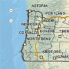 The Oregon Spatial Data Library (OSDL) provides public access to reliable and up-to-date spatial data. Currently the OSDL contains several hundred data sets, including all of the statewide framework data available for Oregon. These data sets can serve as base data for a variety of applications to support research, business and public services.
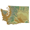 The Washington State Geospatial Clearinghouse is a node on the NSDI national network of spatial information servers. The Clearinghouse provides a single point of access to geospatial information across Washington. The goal is to make access to spatial information technologies more efficient.
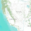 The California Geoportal provides easy and convenient ways to discover and share california geospatial data resources. It makes geographic data more accessible to the public by establishing key partnerships with federal state and regional agencies, counties, cities, tribal nations, academia and the private sector.
![]() The ODFW Data Clearinghouse houses natural resource information, including reports, data files, databases, GIS files, maps and pictures from natural resource projects; especially those funded by the Oregon Watershed Enhancement Board, from Oregon Watershed Councils, and from Oregon Plan partners.
The ODFW Data Clearinghouse houses natural resource information, including reports, data files, databases, GIS files, maps and pictures from natural resource projects; especially those funded by the Oregon Watershed Enhancement Board, from Oregon Watershed Councils, and from Oregon Plan partners.