-
Search

- Federal Archives
Federal Archives
 Many federal agencies have tools to provide access to, enable the interoperability of, analyze, discover, and make use of environmental information. Portals, Geoportals, Clearinghouses and Registries are flavors of these types of tools. Most of these tools enable simple text search, multiple data access links, federated search, search by time period, search by location, browse by keyword access to a variety of important NOAA and other federal data archives.
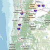
 Ocean.data.gov is the National Ocean Council’s portal for data, information, and tools to support people engaged in planning for the future of the ocean, our coasts, and the Great Lakes. The goal is to be a one-stop hub to support planners and to provide useful information to the public by making Federal data resources available for the coastal and marine spatial planning process.
 The USGS Core Science Clearinghouse contains metadata records describing datasets largely focused on wildlife biology, ecology, environmental science, temperature, geospatial data layers documenting land cover and stewardship (ownership and management), and more. The clearinghouse provides visualizations of the data to illustrate where data are collected, and the types of data contained in the system.
 The National Oceanographic Data Center, National Coastal Data Development Center (NCDDC) and NOAA Central Library, are integrated to provide access to the world's most comprehensive sources of marine environmental data and information. NODC maintains and updates a national ocean archive with environmental data and produces products and research from these data which help monitor global environmental changes.
 National Climatic Data Center (NCDC) is the world's largest active archive of weather data. NCDC produces numerous climate publications and responds to data requests from all over the world. NCDC operates the World Data Center for Meteorology and the World Data Center for Paleoclimatology.
 The National Geophysical Data Center (NGDC) is one of three NOAA National Data Centers. NGDC provides stewardship, products and services for geophysical data describing the solid earth, marine, and solar-terrestrial environment, as well as earth observations from space. NGDC's data holdings currently contain more than 400 digital and analog databases, some of which are very large, and the center works closely with contributors of scientific data to prepare documented, reliable data sets.
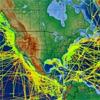
 With more than 90 percent of the world's ocean still unmapped and unexplored, the need for ocean exploration has never been more critical. NOAA's Office of Ocean Exploration and Research (OER) provides a unique capability to discover and investigate new ocean areas and phenomena and to conduct the basic research required to capitalize on discoveries. This information can be used to bring new understanding and benefits to research, management, policy, and the public.

The National Ocean Service (NOS) Data Explorer Geoportal application provides centralized access to distributed NOS geospatial data, tools, applications and services. This Web mapping application allows users to search and access geospatial data via the NOS master catalog of FGDC metadata.
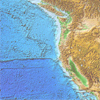
 The Ocean and Coastal Mapping Inventory is designed to increase the efficiency of the nation's ocean and coastal mapping activities. It offers a clearinghouse for data and interpretive information, and a registry of completed and projected elevation mapping activities. The web-based data portal helps users discover and access to elevation data from across multiple federal agencies (NOAA, USGS, USACE).