About the Neptune State Park Rocky Shore Area
Description
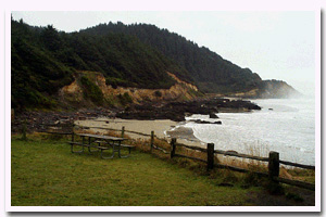
An extensive basalt rock bench and intertidal habitat area just south of Cape Perpetua fronting the entire length of Neptune State Park. Neptune State Park is located off US 101, approximately 4 miles south of the city of Yachats in Lane County, Oregon. |
|
Designation
 Neptune State Park Research Reserve. The research reserve includes “all rocky areas, tide pools, and sand beaches situated between extreme high tide and extreme low tide lying between the northerly and southerly boundaries of the northern parcel of Neptune State Park.” This designation includes the “Strawberry Hill” area but not Bob Creek since it is in the southern parcel of Neptune State Park. Neptune State Park Research Reserve. The research reserve includes “all rocky areas, tide pools, and sand beaches situated between extreme high tide and extreme low tide lying between the northerly and southerly boundaries of the northern parcel of Neptune State Park.” This designation includes the “Strawberry Hill” area but not Bob Creek since it is in the southern parcel of Neptune State Park. |
| |
|
|
Key Resources
Intertidal communities; some seabird nesting on nearby cliff sites. |
|
What can you do here?
Primarily sightseeing and fishing from shore with some tidepooling, pickinicking and beachcombing. Neptune State Park is designated a research reserve, therefore, collection of intertidal shellfish and invertebrates is limited (see current ODFW fishing regulations for a list of species and exact boundaries), except by scientific permit. |
Getting to the Rocky shore at Neptune State Park
Highway 101 runs very close to the shore along this stretch of coast. There is a short access trail to the shore from Neptune State Park and from a highway pullout area. A narrow and winding highway and seasonally heavy traffic create safety concerns at entrances to pullouts and waysides. There are two day-use areas that both provide access to the intertidal areas to the north and south of Cummings Creek. The access to the south of Cummings Creek is via a short wooden staircase from the parking area. The access to the north at Gwynn Creek is via a short, relatively easy gravel access trail. This trail gets slightly more difficult near the bottom where it becomes necessary to cross some cobbles before reaching the beach. Although Cummings Creek moves rather quickly during some times of the year, it is passable with waterproof footwear. The small highway pullout to the north of the Gwynn Creek day-use area provides very limited parking space (1-2 cars).
 Public Access Option 1 for Neptune State Park Rocky Shore Public Access Option 1 for Neptune State Park Rocky Shore
Public Access Option 2 for Neptune State Park Rocky Shore
Who Owns this Site?
Submerged and submersible (intertidal) lands: Division of State Lands; beach and upland areas: Oregon Parks and Recreation Department. |
|
Who Manages this Site?
  Oregon Parks and Recreation Department (OPRD) manages several waysides in the area as part of Neptune State Scenic Viewpoint, which is part of the central coast (Area 3) Management Area, and the Beachside Management Unit. The beaches and rocky shores of Oregon are part of Oregon’s Ocean Shore Recreation Area, which is managed by the OPRD. ODFW manages the site
as a Research Reserve. Oregon Parks and Recreation Department (OPRD) manages several waysides in the area as part of Neptune State Scenic Viewpoint, which is part of the central coast (Area 3) Management Area, and the Beachside Management Unit. The beaches and rocky shores of Oregon are part of Oregon’s Ocean Shore Recreation Area, which is managed by the OPRD. ODFW manages the site
as a Research Reserve. |
|
Data for the Neptune State Park Rocky Shore
[6 Records Listed]
Neptune State Park Rocky Shore GIS Data |
Data Layer |
Source |
Scale |
Year |
Download |
|
ODFW |
100,000 |
2008 |
|
|
ODFW |
24,000 |
2010 |
|
|
ODFW |
24,000 |
2010 |
|
|
ODFW |
24,000 |
2010 |
|
|
ODFW |
24,000 |
2010 |
|
|
ODFW |
24,000 |
2010 |
|
[6 Records Listed]
Information compiled by Laurel Hillmann, NOAA Coastal Management Fellow, OPRD |