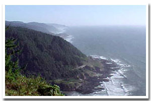
Here identified as the Heceta littoral cell, this sandy 10.5 mile segment of Oregon's coastal shoreline extends from mileage Cape Perpetua to Heceta Head. It is associated with the no major river mouth(s) and accompanying estuary.
The Heceta sandy shore lies within Lane County and makes up the shoreline fronting the communities of . It consists of Bluff Backed and Dune Backed shoreline. Of this shoreline approximately 0% is urban and 42.9% is park. An unknown percentage of this stretch of sandy shoreline is hardened with shore protection structures. Predominant land uses include those typical of ruralsettings.
Chronic coastal hazards for the Heceta sandy shore include ocean flooding and erosion and landsliding and sloughing. Catastrophic hazards include earthquakes, and the groundshaking, subsidence, landsliding, liquefaction, and tsunami that accompany them.
Key recreational facilities and cultural features include: Cape Perpetua Campground, Cummins Creek Wilderness and the Cape Perpetua Visitor Center, Heceta Lighthouse, and the Winchester Bay Marina. |