About the Rocky & Coal Points Rocky Shore Area
Description
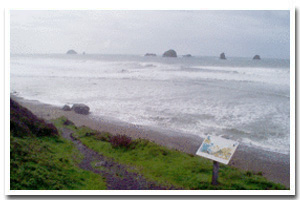
This isolated section of the coast is located approximately four miles south of Port Orford, in Curry County, Oregon and runs between Rocky and Coal Points. |
|
Designation
The beaches and rocky shores of Oregon are part of Oregon’s Ocean Shore Recreation Area and the offshore rocks and islands are part of the Oregon Islands National Wildlife Refuge. |
| |
|
|
Key Resources
Relatively undisturbed intertidal habitat, subtidal habitat and kelp beds. Also, several seabird species, including Harlequin Ducks (a federal species of concern and a state listed sensitive species) have been known to use the area. |
|
What can you do here?
Typical uses within this area include hiking, sightseeing, tidepooling, beachcombing, intertidal harvest (primarily clams), and fishing from shore. |
Getting to the Rocky shore at Rocky & Coal Points
Access is possible via several highway turnouts and scenic overlooks along HWY 101, just north of Humbug Mountain State Park (which is located approximately 6 miles south of Port Orford) including one at both Rocky and Coal Points.
 Public Access Option 1 for Rocky & Coal Points Rocky Shore Public Access Option 1 for Rocky & Coal Points Rocky Shore
Who Owns this Site?
Submerged and submersible rocks: Division of State Lands; offshore rocks above Mean High Water: U.S. Fish and Wildlife Service. Much of the upland is part of Humbug Mountain State Park, owned by Oregon Parks and Recreation Department (including both Rocky and Coal Points). |
|
Who Manages this Site?
  Much of the upland is part of Humbug Mountain State Park, which is part of Oregon Parks and Recreation Department’s Area 4 and the Cape Blanco Management Unit. Oregon Parks and Recreation Department manages the ocean shore recreation area. Much of the upland is part of Humbug Mountain State Park, which is part of Oregon Parks and Recreation Department’s Area 4 and the Cape Blanco Management Unit. Oregon Parks and Recreation Department manages the ocean shore recreation area. |
|
Data for the Rocky & Coal Points Rocky Shore
[1 Records Listed]
Rocky & Coal Points Rocky Shore GIS Data |
Data Layer |
Source |
Scale |
Year |
Download |
|
ODOT |
6,000 |
1967 |
|
[1 Records Listed]
Information compiled by Laurel Hillmann, NOAA Coastal Management Fellow, OPRD |