About the Cannon Beach Haystack Rock Rocky Shore Area
Description
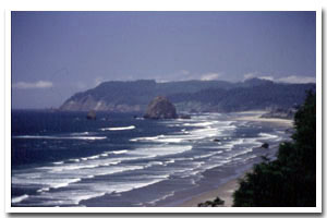
0.4 miles of intertidal habitat and offshore rocks at Cannon Beach in Clatsop County, Oregon. |
|
Designation
 Marine Garden. Haystack Rock Marine Garden encompasses “all rocky areas, tide pools, and sand beaches situated between extreme high tide and extreme low tide lying within a 300 yard radius of the base of Haystack Rock, located at Cannon Beach, Clatsop County.” Marine Garden. Haystack Rock Marine Garden encompasses “all rocky areas, tide pools, and sand beaches situated between extreme high tide and extreme low tide lying within a 300 yard radius of the base of Haystack Rock, located at Cannon Beach, Clatsop County.” |
| |
|
|
Key Resources
Very accessible intertidal habitat; 3 seabird colonies with over 2,000 birds total (including the second largest tufted puffin nesting colony in the state). |
|
What can you do here?
Typical activities include tidepooling, sightseeing, and education/interpretation. Haystack Rock Awareness Group (HRAP) is a wonderful educational resource for school groups and the general public as they offer seasonal interpretive programs to thousands of visitors every year. The area is closed to the taking of any marine invertebrates (except single mussels may be taken for bait). |
Educational Opportunities
Haystack Rock Awareness Group (HRAP) is a wonderful educational resource for school groups and the general public. This local non-profit group offers free seasonal (during most daytime low tides) interpretive programs, which may include touch tanks, microscopes for viewing specimens and interpretive walks.
Getting to the Rocky shore at Cannon Beach Haystack Rock
Multiple, open access from the beachfront in the City of Cannon Beach. The most prominent access in Cannon Beach proper is from the entrance near the “Haystack Rock Public Parking” lot off the main road, Hemlock Street. From the parking lot it is an easy (2-3 block) walk along city sidewalks onto the beach. From the signed entrance to the beach area, it is a level walk along the beach (approximately 5-10 minutes) on sand to Haystack Rock. Access is also available from Tolovana Beach State Recreation Site on the south end of Cannon Beach. From there, one can either simply view the rock (there are pay-per-use telescopes) or access the beach and walk. This is a slightly longer walk than from the public parking lot.
 Public Access Option 1 for Cannon Beach Haystack Rock Rocky Shore Public Access Option 1 for Cannon Beach Haystack Rock Rocky Shore
Public Access Option 2 for Cannon Beach Haystack Rock Rocky Shore
Who Owns this Site?
Submerged and intertidal lands: Division of State Lands; offshore rocks above Mean High Water (MHW): U.S. Fish and Wildlife Service; dry sands beach is a state recreation area under the jurisdiction of Oregon Parks and Recreation Department; upland beyond the statutory line of vegetation is privately owned. |
|
Who Manages this Site?
  The rock above MHW is managed by the USFWS as a National Wildlife Refuge and the beach and intertidal areas are managed by Oregon Parks and Recreation Department as part of the ocean shore. Some law enforcement is provided by city police (certain violations). The rock above MHW is managed by the USFWS as a National Wildlife Refuge and the beach and intertidal areas are managed by Oregon Parks and Recreation Department as part of the ocean shore. Some law enforcement is provided by city police (certain violations). |
|
Data for the Cannon Beach Haystack Rock Rocky Shore
[1 Records Listed]
Cannon Beach Haystack Rock Rocky Shore GIS Data |
Data Layer |
Source |
Scale |
Year |
Download |
|
ODFW |
100,000 |
2008 |
|
[1 Records Listed]
Information compiled by Laurel Hillmann, NOAA Coastal Management Fellow, OPRD |