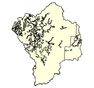
Zoning for the Coquille Watershed, 1986
Identification_Information
Data_Quality_Information
Spatial_Data_Organization_Information
Spatial_Reference_Information
Entity_and_Attribute_Information
Distribution_Information
Metadata_Reference_Information
Identification Information
Section Index
Citation:
Citation Information:
Originator: Oregon Department of Land Conservation and Development
Publication Date: 1998
Title: Zoning for the Coquille Watershed, 1986
Edition: 1998
Geospatial Data Presentation Form: Map
Publication Information:
Publication Place: Salem, Oregon
Publisher: Oregon Department of Land Conservation and Development
Online Linkage: http://www.lcd.state.or.us/
Larger Work Citation:
Citation Information:
Originator: Oregon Department of Land Conservation and Development
Publication Date: 1998
Title: Zoning
Publication Information:
Publication Place: Salem, Oregon
Publisher: Oregon Department of Land Conservation and Development
Online Linkage: http://www.lcd.state.or.us/
Description:
Abstract:
Generalized Zoning Coverage for the state of Oregon. The coverage is digitized from data collected from 1983 through
1986. Limited zoning changes have occured since this time. This dataset represents the best STATEWIDE zoning coverage available for the state of Oregon.
Purpose: This data set was devleoped to show generalized zoning throughout the state of Oregon.
Time Period of Content:
Time Period Information:
Range of Dates/Times:
Beginning Date:
Beginning Time: Unknown
Ending Date: 1999
Ending Time: Unknown
Currentness Reference: Legacy coverage in 1999, update status unknown.
Status:
Progress: Complete
Maintenance and Update Frequency: As needed
Spatial Domain:
Bounding Coordinates:
West Bounding Coordinate: -121.0124
East Bounding Coordinate: -120.2145
North Bounding Coordinate: 43.4103
South Bounding Coordinate: 42.7217
Keywords:
Theme:
Theme Keyword Thesaurus: None
Theme Keyword: Zoning
Theme Keyword: Land Use
Place:
Place Keyword Thesaurus: None
Place Keyword: Oregon
Place Keyword: Coast
Place Keyword: Coquille
Access Constraints:
The theme is free for distribution, but neither the SSCGIS, DLCD or the state of Oregon accept any responsitility for errors, omissions or positional accuracy in the digital data or the underlying records. There are no warranties, express or implied, including the warranty of merchantability or fitness for a particular purpose. This disclaimer must be included with the theme each time it is distributed.
Use Constraints:
The data set is a generalized zoning data coverage. It does not show zoning for areas inside Urban Growth Boundaries.
The data was digitized off of 100k usgs maps containing hand drawn zoning boundaries. These boundaries represent data collected from 1983 through 1986. While only limited changes have occured outside urban growth boundaries since than, changes have occured. The coverage is not to be used to determine zoning for a specific location. Specific information should be obtained from the county the site resides in. In areas of southern Oregon (Rogue Valley) the complexity of the zoning did not allow a separation of rural residential and agricultural zoning.
Point of Contact:
Contact Information:
Contact Organization Primary:
Contact Organization:
Oregon Ocean Coastal Management Program - Department of
Land Conservation and Development
Contact Person: Randy Dana
Contact Position: Coastal GIS Specialist
Contact Address:
Address Type: mailing and physical address
Address: 800 NE Oregon Street #18
City: Portland
State or Province: Oregon
Postal Code: 97232
Country: USA
Contact Voice Telephone: 503-731-4065 x31
Contact Facsimile Telephone: 503-731-4068
Contact Electronic Mail Address: randy.dana@state.or.us
Data Set Credit:
This dataset was worked on by numerous current and previous Oregon State Service Center for GIS staff. Lloyd Chapman and Randy Dana of DLCD spent numerous hours reviewing the layer and suggesting necessary changes to the dataset. DLCD staff created the orginal maps that all of the zoning data was compiled from.
Native Data Set Environment: Arc/Info coverage format
Data Quality Information
Section Index
Logical Consistency Report: Polygon and chain-node topology present.
Completeness Report:
This dataset was created to be a generalized zoning dataset. It did not incorporate all possible zoning information. See
Procedures Used for details. Coverage does not depict zoning within Urban Growth Boundaries
Positional Accuracy:
Horizontal Positional Accuracy:
Horizontal Positional Accuracy Report: Unknown
Vertical Positional Accuracy:
Vertical Positional Accuracy Report: Unknown
Lineage:
Source Information:
Source Citation:
Citation Information:
Originator: Oregon Department of Land Conservation and Development
Publication Date: Various
Title: 24 Existing 100,000 scale paper Zoning maps
Edition: Various
Geospatial Data Presentation Form: map
Publication Information:
Publication Place: Salem, Oregon
Publisher: Oregon Department of Land Conservation and Development
Online Linkage: http;//www.lcd.state.or.us/
Source Scale Denominator: 100000
Type of Source Media: Paper Maps
Source Time Period of Content:
Time Period Information:
Range of Dates/Times:
Beginning Date: 1983
Beginning Time: Unknown
Ending Date: 1986
Ending Time: Unknown
Source Currentness Reference: 1998
Source Contribution: Polygons and attributes
Process Step:
Process Description:
Zoning Coverage was clipped to the Coquille Watershed boundary. Original coverage processes as follows:
Twentyfour existing 1:100000 scale maps were digitized by Valuecad a Portland, Oregon CAD firm. Valuecad technicians used AutoCad and Hitachi CadCore software to trace the lines of the scanned raster images. The east side of the state was scanned by the Oregon Dept.of Corrections Engineering Support unit following similar procedures. The SSCGIS converted the DXF files into Arc/Info coverages. Once converted, the linework was cleaned up and topology was created. The polygons were attributed by the SSCGIS and checked by DLCD. When both the east and west sides of the state were completed and checked they were combined together to form the current statewide coverage. During the coding process there were some areas on the maps which sscgis staff couldnt identify. Those areas were pointed out to DLCD staff for assistance in coding. A category of the database item called LAND-USE identified as Problem B was put into the database to
identify those problem areas. These were subsequently corrected by DLCD and recoded by the SSCGIS. In 1996 the entire statewide coverage was checked for errors by staff members from the DLCD. There corrections were incorporated into the current generalized zoning coverage. At this time the general zoning designation was edited making it work more closely with other data items. In February 1998 the statewide theme was edited by DLCD in order to bring closer to the DLCD Urban Growth Boundary Coverage. The theme was conveted to a shapefile and edited using ArcView. The edited item was added to display which polygons were edited. Edited = 0 unchanged, Edited = 9999 changed. The theme was converted to an Arc/Info file using the shapearc command by the SSCGIS. Metadata was created showing the new changes.
Revisions: formal revisions have been done of the dataset, but it has undergone several minor attribute revisions. The
first edit occured in the summer of 1996. In February 1998 DLCD edited a few polygons to bring the theme in line with
the Urban Growth Boundary coverage. Reviews_Applied_to_Data: dataset was verified by using the original paper maps both internally and by DLCD. DLCD continues to periodically review the coverage looking for errors missed in prior corrections.
Cloud Cover: 0
Spatial Data Organization Information
Section Index
Direct Spatial Reference Method: Vector
Point and Vector Object Information:
SDTS Terms Description:
SDTS Point and Vector Object Type: GT-polygon composed of chains
Point and Vector Object Count: 319
Spatial Reference Information
Section Index
Horizontal Coordinate System Definition:
Planar:
Map Projection:
Map Projection Name: Lambert Conformal Conic
Lambert Conformal Conic:
Standard Parallel: 43
Standard Parallel: 45.5
Longitude of Central Meridian: -120.5
Latitude of Projection Origin: 41.75
False Easting: 400000
False Northing: 0
Planar Coordinate Information:
Planar Coordinate Encoding Method: Coordinate Pair
Coordinate Representation:
Abscissa Resolution: 0
Ordinate Resolution: 0
Planar Distance Units: international feet
Geodetic Model:
Horizontal Datum Name: North American Datum of 1983
Ellipsoid Name: Geodetic Reference System 80
Semi-major Axis: 6378137
Denominator of Flattening Ratio: 298.257
Entity and Attribute Information
Section Index
Detailed Description:
Entity Type:
Entity Type Label: zoning_c.pat
Entity Type Definition: Polygon Attribute Table
Entity Type Definition Source: None
Attribute:
Attribute Label: Area
Attribute Definition: Area of polygon
Attribute Definition Source: Software generated
Attribute Domain Values:
Unrepresentable Domain: Software computed
Attribute:
Attribute Label: County
Attribute Definition: County Name
Attribute Definition Source: DLCD
Attribute Domain Values:
Unrepresentable Domain: Character Field
Attribute:
Attribute Label: Descriptio
Attribute Definition: Description: Name of specific feature (Park Name, etc)
Attribute Definition Source: DLCD
Attribute Domain Values:
Unrepresentable Domain: Character Field
Attribute:
Attribute Label: Edited
Attribute Definition: Description on whether item was edited during February 1998
Attribute Domain Values:
Enumerated Domain:
Enumerated Domain Value: 0
Enumerated Domain Value Definition: Not Edited
Enumerated Domain Value: 9999
Enumerated Domain Value Definition: Edited
Attribute:
Attribute Label: General_zo
Attribute Definition: General Zoning Description
Attribute Definition Source: DLCD
Attribute Domain Values:
Unrepresentable Domain: Character Field
Attribute:
Attribute Label: Land_use
Attribute Definition: More detailed description of polygon
Attribute Definition Source: DLCD
Attribute Domain Values:
Unrepresentable Domain: Character Field
Attribute:
Attribute Label: Perimeter
Attribute Definition: Perimeter of polygon
Attribute Definition Source: Software generated
Attribute Domain Values:
Unrepresentable Domain: Software computed
Attribute:
Attribute Label: Symbol
Attribute Definition: Number describe data class
Attribute Definition Source: DLCD
Attribute Domain Values:
Range Domain:
Range Domain Minimum: 46
Range Domain Maximum: 263
Attribute:
Attribute Label: Zoning_c#
Attribute Definition: Internal feature number
Attribute Definition Source: Software generated
Attribute Domain Values:
Unrepresentable Domain: Software computed
Attribute:
Attribute Label: Zoning_c-id
Attribute Definition: Feature identification number
Attribute Definition Source: Software generated
Attribute Domain Values:
Unrepresentable Domain: User Defined
Attribute:
Attribute Label: Zoning_c_
Attribute Definition: Internal feature number
Attribute Definition Source: Software generated
Attribute Domain Values:
Unrepresentable Domain: Software computed
Attribute:
Attribute Label: Zoning_c_i
Attribute Definition: Feature identification number
Attribute Definition Source: Software generated
Attribute Domain Values:
Unrepresentable Domain: Software computed
Attribute:
Attribute Label: Zoning_lab
Attribute Definition:
ZONING_LABEL : County Zoning Code Abreviations (First two
letters represent County)
Attribute Definition Source: DLCD
Attribute Domain Values:
Unrepresentable Domain: Character Field
Distribution Information
Section Index
Distributor:
Contact Information:
Contact Organization Primary:
Contact Organization: Oregon State Service Center for GIS
Contact Person: Steve Barnett
Contact Position: GIS Data Librarian
Contact Address:
Address Type: mailing and physical address
Address: 155 Cottage St NE
City: Salem
State or Province: Oregon
Postal Code: 97310
Country: USA
Contact Voice Telephone: (503) 378-2166
Contact Electronic Mail Address: data@sscgis.state.or.us
Resource Description: Zoning
Distribution Liability:
THE DATA AND ASSOCIATED DATA FILES ON THIS CD-ROM ARE
PROVIDED ""AS IS,"" WITHOUT WARRANTY TO THEIR PERFORMANCE, MERCHANTABLE STATE, OR FITNESS FOR ANY PARTICULAR PURPOSE. THE ENTIRE RISK ASSOCIATED WITH THE RESULTS AND PERFORMANCES OF THE DATA IS ASSUMED
BY THE USER. THIS DATA IS NOT FOR NAVIGATIONAL OR LEGAL PURPOSES.
Custom Order Process: Contact Distributor, or download from http://www.sscgis.state.or.us
Metadata Reference Information
Section Index
Metadata Date: 1/1/2000
Metadata Review Date:
Metadata Future Review Date:
Metadata Contact:
Contact Information:
Contact Organization Primary:
Contact Organization:
Oregon Ocean Coastal Management Program - Department of
Land Conservation and Development
Contact Person: Tanya Haddad
Contact Position: DEMIS Coordinator
Contact Address:
Address Type: mailing and physical address
Address: 800 NE Oregon Street #18
City: Portland
State or Province: Oregon
Postal Code: 97232
Country: USA
Contact Voice Telephone: 503-731-4065 x30
Contact Facsimile Telephone: 503-731-4068
Contact Electronic Mail Address: tanya.haddad@state.or.us
Metadata Standard Name: FGDC CSDGM
Metadata Standard Version: FGDC-STD-001-1998
SMMS Metadata report generated 3/27/2002