USGS 7.5 minute Quadrangle Boundaries for the Coquille Basin
Identification_Information
Data_Quality_Information
Spatial_Data_Organization_Information
Spatial_Reference_Information
Entity_and_Attribute_Information
Distribution_Information
Metadata_Reference_Information
Identification Information
Section Index
Citation:
Citation Information:
Originator: Oregon State Service Center for GIS
Publication Date: 1997
Title: USGS 7.5 minute Quadrangle Boundaries for the Coquille Basin
Edition: 1997
Geospatial Data Presentation Form: Map
Publication Information:
Publication Place: Salem, Oregon
Publisher: Oregon State Service Center for GIS
Online Linkage: http://www.sscgis.state.or.us/
Larger Work Citation:
Citation Information:
Originator: Oregon State Service Center for GIS
Publication Date: 1997
Title: QuadIndx
Publication Information:
Publication Place: Salem, Oregon
Publisher: Oregon State Service Center for GIS
Online Linkage: http://www.sscgis.state.or.us/
Description:
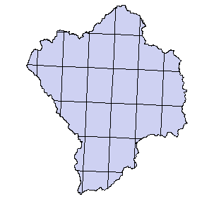
Abstract: This dataset shows the quad names and quad boundaries for the 7.5 minute quads in Oregon.
Purpose: This theme was used to help identify the location of specific quads in the state of Oregon.
Time Period of Content:
Time Period Information:
Range of Dates/Times:
Beginning Date: 1989
Beginning Time: Unknown
Ending Date: 1997
Ending Time: Unknown
Currentness Reference: 1999
Status:
Progress: Complete
Maintenance and Update Frequency: Irregular
Spatial Domain:
Bounding Coordinates:
West Bounding Coordinate: -121.0126
East Bounding Coordinate: -120.2139
North Bounding Coordinate: 43.4103
South Bounding Coordinate: 42.7217
Keywords:
Theme:
Theme Keyword Thesaurus: None
Theme Keyword: Oregon
Theme Keyword: USGS
Theme Keyword: 7.5 minute quad maps
Place:
Place Keyword Thesaurus: None
Place Keyword: Oregon
Place Keyword: Coast
Place Keyword: Coquille
Access Constraints: N/A
Use Constraints: The dataset was created in 1990. Several quadnames were changed after that time.
Point of Contact:
Contact Information:
Contact Organization Primary:
Contact Organization: Oregon State Service Center for GIS
Contact Person: Steve Barnett
Contact Position: GIS Data Librarian
Contact Address:
Address Type: mailing and physical address
Address: 155 Cottage St NE
City: Salem
State or Province: Oregon
Postal Code: 97310
Country: USA
Contact Voice Telephone: (503) 378-2166
Contact Electronic Mail Address: data@sscgis.state.or.us
Native Data Set Environment: Arc/Info coverage format
Data Quality Information
Section Index
Logical Consistency Report: Polygon and chain-node topology present.
Completeness Report: Unknown
Positional Accuracy:
Horizontal Positional Accuracy:
Horizontal Positional Accuracy Report: Unknown
Vertical Positional Accuracy:
Vertical Positional Accuracy Report: Unknown
Lineage:
Source Information:
Source Citation:
Citation Information:
Originator: Oregon State Service Center for GIS
Publication Date: 1997
Title: QuadIndx
Publication Information:
Publication Place: Salem, Oregon
Publisher: Oregon State Service Center for GIS
Online Linkage: http://www.sscgis.state.or.us/
Source Scale Denominator: 24000
Type of Source Media: ArcINFO coverage
Source Time Period of Content:
Time Period Information:
Range of Dates/Times:
Beginning Date: 1989
Beginning Time: Unknown
Ending Date: 1997
Ending Time: Unknown
Source Currentness Reference: 1999
Process Step:
Process Description: Imported from *.e00 to ARC/INFO, clipped to Coquille Basin converted to shapefile.
Process Date: 1999
Cloud Cover: 0
Spatial Data Organization Information
Section Index
Direct Spatial Reference Method: Vector
Point and Vector Object Information:
SDTS Terms Description:
SDTS Point and Vector Object Type: GT-polygon composed of chains
Point and Vector Object Count: 35
Spatial Reference Information
Section Index
Horizontal Coordinate System Definition:
Planar:
Map Projection:
Map Projection Name: Lambert Conformal Conic
Lambert Conformal Conic:
Standard Parallel: 43
Standard Parallel: 45.5
Longitude of Central Meridian: -120.5
Latitude of Projection Origin: 41.75
False Easting: 400000
False Northing: 0
Planar Coordinate Information:
Planar Coordinate Encoding Method: Coordinate Pair
Coordinate Representation:
Abscissa Resolution: 0
Ordinate Resolution: 0
Planar Distance Units: international feet
Geodetic Model:
Horizontal Datum Name: North American Datum of 1983
Ellipsoid Name: Geodetic Reference System 80
Semi-major Axis: 6378137
Denominator of Flattening Ratio: 298.257
Entity and Attribute Information
Section Index
Detailed Description:
Entity Type:
Entity Type Label: quads_c.pat
Entity Type Definition: Polygon Attribute Table
Entity Type Definition Source: None
Attribute:
Attribute Label: Area
Attribute Definition: Area of polygon
Attribute Definition Source: Software generated
Attribute Domain Values:
Unrepresentable Domain: Software computed
Attribute:
Attribute Label: Ch_f
Attribute Domain Values:
Range Domain:
Range Domain Minimum: 0
Range Domain Maximum: 1
Attribute:
Attribute Label: Ch_s
Attribute Domain Values:
Range Domain:
Range Domain Minimum: 0
Range Domain Maximum: 1
Attribute:
Attribute Label: Chum
Attribute Domain Values:
Range Domain:
Range Domain Minimum: 0
Range Domain Maximum: 0
Attribute:
Attribute Label: Coho
Attribute Domain Values:
Range Domain:
Range Domain Minimum: 1
Range Domain Maximum: 1
Attribute:
Attribute Label: Coord
Attribute Domain Values:
Unrepresentable Domain: Character Field
Attribute:
Attribute Label: Latdeg
Attribute Domain Values:
Unrepresentable Domain: Character Field
Attribute:
Attribute Label: Latmin
Attribute Domain Values:
Unrepresentable Domain: Character Field
Attribute:
Attribute Label: Longdeg
Attribute Domain Values:
Unrepresentable Domain: Character Field
Attribute:
Attribute Label: Longmin
Attribute Domain Values:
Unrepresentable Domain: Character Field
Attribute:
Attribute Label: Map_name
Attribute Definition: QuadName for usgs 7.5 minute quad as of 1990
Attribute Domain Values:
Unrepresentable Domain: Character Field
Attribute:
Attribute Label: Mname_uc
Attribute Definition: QuadName for usgs 7.5 minute quad as of 1990
Attribute Domain Values:
Unrepresentable Domain: Character Field
Attribute:
Attribute Label: Ohiocode
Attribute Definition: Ohio Code number for a specific quad
Attribute Domain Values:
Unrepresentable Domain: Character Field
Attribute:
Attribute Label: Perimeter
Attribute Definition: Perimeter of polygon
Attribute Definition Source: Software generated
Attribute Domain Values:
Unrepresentable Domain: Software computed
Attribute:
Attribute Label: Quad
Attribute Definition: Ohio Code number for a specific quad
Attribute Domain Values:
Unrepresentable Domain: Character Field
Attribute:
Attribute Label: Quads_c#
Attribute Definition: Internal feature number
Attribute Definition Source: Software generated
Attribute Domain Values:
Unrepresentable Domain: Software computed
Attribute:
Attribute Label: Quads_c-id
Attribute Definition: Feature identification number
Attribute Definition Source: Software generated
Attribute Domain Values:
Unrepresentable Domain: User Defined
Attribute:
Attribute Label: Quads_c_
Attribute Definition: Internal feature number
Attribute Definition Source: Software generated
Attribute Domain Values:
Unrepresentable Domain: Software computed
Attribute:
Attribute Label: Quads_c_id
Attribute Definition: User Assigned Feature ID
Attribute Domain Values:
Range Domain:
Range Domain Minimum: 6155
Range Domain Maximum: 7647
Attribute:
Attribute Label: Scale
Attribute Domain Values:
Enumerated Domain:
Enumerated Domain Value: 24
Attribute:
Attribute Label: St_s
Attribute Domain Values:
Range Domain:
Range Domain Minimum: 0
Range Domain Maximum: 1
Attribute:
Attribute Label: St_w
Attribute Domain Values:
Range Domain:
Range Domain Minimum: 1
Range Domain Maximum: 1
Attribute:
Attribute Label: State
Attribute Definition: Satet
Attribute Domain Values:
Enumerated Domain:
Enumerated Domain Value: OR
Enumerated Domain Value Definition: Oregon
Distribution Information
Section Index
Distributor:
Contact Information:
Contact Organization Primary:
Contact Organization: Oregon State Service Center for GIS
Contact Person: Steve Barnett
Contact Position: GIS Data Librarian
Contact Address:
Address Type: mailing and physical address
Address: 155 Cottage St NE
City: Salem
State or Province: Oregon
Postal Code: 97310
Country: USA
Contact Voice Telephone: (503) 378-2166
Contact Electronic Mail Address: data@sscgis.state.or.us
Resource Description: QuadIndex for Coquille Basin
Distribution Liability:
THE DATA AND ASSOCIATED DATA FILES ON THIS CD-ROM ARE
PROVIDED ""AS IS,"" WITHOUT WARRANTY TO THEIR PERFORMANCE, MERCHANTABLE
STATE, OR FITNESS FOR ANY PARTICULAR PURPOSE. THE ENTIRE RISK
ASSOCIATED WITH THE RESULTS AND PERFORMANCES OF THE DATA IS ASSUMED
BY THE USER. THIS DATA IS NOT FOR NAVIGATIONAL OR LEGAL PURPOSES.
Available Time Period:
Time Period Information:
Single Date/Time:
Calendar Date: 1900
Time of Day: Unknown
Metadata Reference Information
Section Index
Metadata Date: 1/1/2000
Metadata Review Date:
Metadata Future Review Date:
Metadata Contact:
Contact Information:
Contact Organization Primary:
Contact Organization:
Oregon Ocean Coastal Management Program - Department of
Land Conservation and Development
Contact Person: Tanya Haddad
Contact Position: DEMIS Coordinator
Contact Address:
Address Type: mailing and physical address
Address: 800 NE Oregon Street #18
City: Portland
State or Province: Oregon
Postal Code: 97232
Country: USA
Contact Voice Telephone: 503-731-4065 x30
Contact Facsimile Telephone: 503-731-4068
Contact Electronic Mail Address: tanya.haddad@state.or.us
Metadata Standard Name: FGDC CSDGM
Metadata Standard Version: FGDC-STD-001-1998
SMMS Metadata report generated 3/27/2002