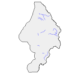
Stream Survey Habitat Inventory in the Sixes Watershed, ODFW, 1997
Identification_Information
Data_Quality_Information
Spatial_Data_Organization_Information
Spatial_Reference_Information
Entity_and_Attribute_Information
Distribution_Information
Metadata_Reference_Information
Identification Information
Section Index
Citation:
Citation Information:
Originator: ODFW
Publication Date: 200402
Title: Stream Survey Habitat Inventory in the Sixes Watershed, ODFW, 1997
Geospatial Data Presentation Form: vector digital data
Other Citation Details: To view ODFW metadata visit http://oregonstate.edu/Dept/ODFW/freshwater/inventory/pdffiles/metaweb.pdf
Online Linkage: http://oregonstate.edu/Dept/ODFW/freshwater/inventory/index.htm
Description:
Abstract:
The Oregon Department of Fish & Wildlife has been actively acquiring
stream habitat inventory information for the purpose of habitat assessment since
1990. This information is collected during the summer months by stream survey
crews using methods described in Moore et al. (1997). The field data focuses on
channel and valley morphology (stream and reach data), riparian characteristics
and condition (reach data), and instream habitat (habitat unit data).
The survey data is compiled into a comprehensive database that is used
in fish management and planning activities. The data are dynamically
segmented in a geographic information system (ArcInfo) onto a 1:100,000 scale
digitized stream layer to display habitat features and combinations of habitat
features relative to location of streams, reaches, and habitat units in the
watershed. The 1:100,000 scale digitized stream layer was originally digitized by
the USGS in their PNW River Routes Project. It was later modified by ODFW's
GIS Division to include a complete stream routing system. This modified route
system provides the basis for our reach and habitat coverages.
The stream habitat distribution coverages provide a means for accessing
stream data in an electronic medium. It increases the ease of data dispersal and
allows for the assessment of basin wide characteristics. It also allows for stream
and basin analysis to occur from a spatial scale and perspective.
To view originator's metadata visit http://oregonstate.edu/Dept/ODFW/freshwater/inventory/pdffiles/metaweb.pdf
Purpose:
The habitat dataset includes all of the unit data for the entire survey. It is
within this dataset that the most noticeable annual change will occur. There will
be changes in the distribution, size and location of habitat types annually. This
dataset is not intended to be a map of the absolute distribution of habitat types.
Rather, it indicates the condition of the stream at the time of the survey.
Supplemental Information:
The data for the two datasets are collected using the methodology as
described by Moore et al. (1995). The purpose of this survey method is to
inventory the applicable aspects of the riparian environment as they relate to fish
habitat. This data is meant to be used as a means of determining habitat
distribution and quality. It has been used successfully in the preparation of
restoration plans, assessment of fish production and survival potential, and the
determination of management priorities.
It is important to remember that the data contained in this dataset reflects
the condition of the stream at the time of the survey. Streams are dynamic
systems that change with every high or low flow event. Substrate and woody
debris move through the system, trees fall into the stream causing changes in
flow and habitat type. Pools are formed and filled in annually. It is the purpose
of the survey to document the condition of the stream at the time of the survey.
This data may be used later for comparison and management planning work.
The reach dataset generalizes the habitat units that are surveyed by the
crew. It gives an overview of the conditions within the reach or section of stream.
It should be a reference point for later comparative work or for the analysis of
stream conditions.
The habitat dataset includes all of the unit data for the entire survey. It is
within this dataset that the most noticeable annual change will occur. There will
be changes in the distribution, size and location of habitat types annually. This
dataset is not intended to be a map of the absolute distribution of habitat types.
Rather, it indicates the condition of the stream at the time of the survey.
20040226 For purposes of Oregon Coastal Atlas project this data was reprojected and clipped to basin boundaries. Please refer to originators for original data and further information regarding this data.
For additional information, see ODFW metadata.
Time Period of Content:
Time Period Information:
Single Date/Time:
Calendar Date: Unknown
Time of Day: Unknown
Currentness Reference: GROUND CONDITION
Status:
Progress: In work
Maintenance and Update Frequency:
The coverages are updated when new streams are surveyed. Surveys occur annually, however, new surveys do not occur within every huc drainage annually. Therefore, updates of our coverages does not necessarily occur on an annual basis.
Spatial Domain:
Bounding Coordinates:
West Bounding Coordinate: -124.703537
East Bounding Coordinate: -124.134727
North Bounding Coordinate: 43.122093
South Bounding Coordinate: 42.415104
Keywords:
Theme:
Theme Keyword Thesaurus: None
Theme Keyword: habitat
Theme Keyword: stream condition
Place:
Place Keyword Thesaurus: None
Place Keyword: Sixes
Place Keyword: Western Oregon
Access Constraints:
Data collected by state agencies becomes part of the public domain. As such, anyone may access the stream datasets. The Aquatic Inventories Project coverages may be obtained through contact with Kim Jones (listed previously) and downloaded from the ODFW State FTP site (ftp.dfw.state.or.us).
Use Constraints: none
Point of Contact:
Contact Information:
Contact Person Primary:
Contact Person: Kim Jones
Contact Organization: ODFW Aquatic Inventories Project
Contact Position: Project Leader
Contact Address:
Address Type: mailing and physical address
Address: 28655 Hwy 34
City: Corvallis
State or Province: OR
Postal Code: 97333
Country: USA
Contact Voice Telephone: (541) 757-4263 x260
Contact Electronic Mail Address: jonesk@fsl.orst.edu
Hours of Service: 8 am - 5 pm
Native Data Set Environment: ESRI
Cross Reference:
Citation Information:
Originator: Oregon Department of Fish and Wildlife
Publication Date: 1997
Title: ODFW Aquatic Inventories Project Stream Habitat Distribution Coverages.
Geospatial Data Presentation Form: vector digital data
Other Citation Details: Oregon Department of Fish & Wildlife. 1997. ODFW Aquatic Inventories Project Stream Habitat Distribution Coverages. Natural Production Section. Corvallis. Oregon Department of Fish & Wildlife.
Online Linkage: http://oregonstate.edu/Dept/ODFW/freshwater/inventory/
Data Quality Information
Section Index
Attribute Accuracy:
Attribute Accuracy Report: Unknown
Logical Consistency Report: Unknown
Completeness Report: Incomplete. Not all of the streams on the base HUC (hydrologic unit code) coverages have been surveyed. Surveys are an ongoing process and streams are added to the coverage as they are completed.
Positional Accuracy:
Horizontal Positional Accuracy:
Horizontal Positional Accuracy Report: Not assessed
Vertical Positional Accuracy:
Vertical Positional Accuracy Report: NA
Lineage:
Source Information:
Source Citation:
Citation Information:
Originator: Oregon Department of Fish and Wildlife
Publication Date: 1997
Title: River Information Coverages.
Edition: 1997
Geospatial Data Presentation Form: map
Publication Information:
Publication Place: Portland, OR
Publisher: Oregon Department of Fish and Wildlife
Online Linkage: http://www.dfw.state.or.us
Source Scale Denominator: 100000
Type of Source Media: paper
Source Time Period of Content:
Time Period Information:
Range of Dates/Times:
Beginning Date: 1996
Beginning Time: Unknown
Ending Date: 2000
Ending Time: Unknown
Source Currentness Reference: Effective Date
Source Citation Abbreviation: habitat
Source Contribution: patial and attribute information
Process Step:
Process Description:
The source coverages were acquired from the Oregon Department of Fish
& Wildlife's GIS Division. The coverages were originally digitized by the USGS
as part of the PNW River Reach File project which digitally entered stream
basins based on their Hydrologic Unit Code (HUC) which had been previously
defined by the Environmental Protection Agency (EPA). These HUC coverages
were completed at a scale of 1:100,000. They were altered by ODFW in order to
add unique stream identification numbers (LLID), as well as the addition of two
separate route systems. The route systems were created using dynamic
segmentation tools and have resulted in one route system composed of streams
and another for stream reaches. They were developed to assist in the
quantification and enumeration of fish distribution data.
In this project, we have taken the routed HUC coverages and dynamically
segmented the appropriate streams in order to append our stream habitat data.
The process that we use is summarized below:
1. Edit HUC cover routes to reflect the end point of the stream habitat survey.
2. Remeasure the route to the length (in meters) of the survey as determined by
the survey crew and the analysis of the data.
3. Create a calibration coverage based on the HUC coverage.
4. Add calibration points which are identified as locations on each streams
where we can be certain of the location of the crew. Points include bridge
crossings, tributaries or reach changes.
5. Each calibration point is given a distance measure that corresponds to the
distance from the start of the survey to that point on the stream.
6. Calibrate the routes on the huc coverage based on the calibration coverage.
7. Import the dbase file that contains the database information for the the reach
or habitat datasets.
8. Create an eventsource with the dbase file.
9. Link the eventsource to the routed HUC cover based on the llid field. (The llid
is the longitude and latitude of the starting arc of the stream. It was
calculated and assigned using an aml by the ODFW GIS Division.)
10. Build the new coverage and create an export file.
Process Date: 1997
Process Contact:
Contact Information:
Contact Person Primary:
Contact Person: Kim Jones
Contact Organization: Oregon Department of Fish and Wildlife
Contact Position: Project Leader Aquatic Inventories Project
Contact Address:
Address Type: mailing and physical address
Address: 28655 Hwy 34
City: Corvallis
State or Province: Oregon
Postal Code: 97333
Country: USA
Contact Voice Telephone: (541) 757-4263 x260
Contact Electronic Mail Address: jonesk@fsl.orst.edu
Hours of Service: 8 am - 5 pm
Cloud Cover: 0
Spatial Data Organization Information
Section Index
Direct Spatial Reference Method: Vector
Point and Vector Object Information:
SDTS Terms Description:
SDTS Point and Vector Object Type: Complete chain
Point and Vector Object Count: 10064
SDTS Terms Description:
SDTS Point and Vector Object Type: Point
Point and Vector Object Count: 4
Spatial Reference Information
Section Index
Horizontal Coordinate System Definition:
Planar:
Map Projection:
Map Projection Name: Lambert Conformal Conic
Lambert Conformal Conic:
Standard Parallel: 43
Standard Parallel: 45.5
Longitude of Central Meridian: -120.5
Latitude of Projection Origin: 41.75
False Easting: 400000
False Northing: 0
Planar Coordinate Information:
Planar Coordinate Encoding Method: Coordinate Pair
Coordinate Representation:
Abscissa Resolution: 0.000256
Ordinate Resolution: 0.000256
Planar Distance Units: international feet
Geodetic Model:
Horizontal Datum Name: North American Datum of 1983
Ellipsoid Name: Geodetic Reference System 80
Semi-major Axis: 6378137
Denominator of Flattening Ratio: 298.257
Entity and Attribute Information
Section Index
Detailed Description:
Entity Type:
Entity Type Label: basin.aat
Entity Type Definition: Arc Attribute Table
Entity Type Definition Source: software generated
Attribute:
Attribute Label: <BASIN>#
Attribute Definition: Computer generated identification number for arc.
Attribute Definition Source: ESRI
Attribute Domain Values:
Unrepresentable Domain: Computer generated identification number for arc.
Attribute:
Attribute Label: <BASIN>-ID
Attribute Definition: User-defined feature number.
Attribute Definition Source: ESRI
Attribute Domain Values:
Unrepresentable Domain: User generated identification number for arc.
Attribute:
Attribute Label: AC_EROSION
Attribute Definition: The percent of the lineal distance of both sides of the stream that is actively eroding at the active channel height.
Attribute Definition Source: ODFW
Attribute Domain Values:
Unrepresentable Domain: FREE TEXT FIELD
Attribute:
Attribute Label: AC_HEIGHT
Attribute Definition: Active channel height (m). The vertical distance from the streambed to the top of the active channel.
Attribute Definition Source: ODFW
Attribute Domain Values:
Unrepresentable Domain: FREE TEXT FIELD
Attribute:
Attribute Label: AC_WIDTH
Attribute Definition: Active or bankfull channel width (m). The horizontal distance across the channel at the ""bank full"" or annual high flow line.
Attribute Definition Source: ODFW
Attribute Domain Values:
Unrepresentable Domain: FREE TEXT FIELD
Attribute:
Attribute Label: BASIN
Attribute Definition: Major Basin or Watershed Associated with the Stream
Attribute Definition Source: Dataset developer
Attribute Domain Values:
Unrepresentable Domain: Free Text
Attribute:
Attribute Label: BLD_ADJ
Attribute Definition: Boulder adjusted. Measures the percent substrate of the boulder size class. Boulder is defined as material 256 mm in size and larger.
Attribute Definition Source: ODFW
Attribute Domain Values:
Unrepresentable Domain: FREE TEXT FIELD
Attribute:
Attribute Label: BLDR_COUNT
Attribute Definition: Boulder count. The number of boulders > 0.5 m in diameter within the unit that are exposed but touching the water.
Attribute Definition Source: ODFW
Attribute Domain Values:
Unrepresentable Domain: FREE TEXT FIELD
Attribute:
Attribute Label: BRK_ADJ
Attribute Definition: Bedrock adjusted. Measures the percent of substrate identified as bedrock.
Attribute Definition Source: ODFW
Attribute Domain Values:
Unrepresentable Domain: FREE TEXT FIELD
Attribute:
Attribute Label: C_50
Attribute Definition: Conifers of size class 50 - 90 cm. This field tallies the total number of conifers counted in the riparian transect of between 50 and 90 cm dbh.
Attribute Definition Source: ODFW
Attribute Domain Values:
Unrepresentable Domain: FREE TEXT FIELD
Attribute:
Attribute Label: C_90
Attribute Definition: Conifers of size class 90 cm and larger. This field tallies the number of conifers counted in the riparian transect with a dbh of at least 90 cm.
Attribute Definition Source: ODFW
Attribute Domain Values:
Unrepresentable Domain: FREE TEXT FIELD
Attribute:
Attribute Label: CANOPY_CL
Attribute Definition: Canopy closure. Measures the density of canopy cover in the riparian zone of the stream. This measure is taken at riparian transects which occur at least every 30 units during the habitat survey.
Attribute Definition Source: ODFW
Attribute Domain Values:
Unrepresentable Domain: FREE TEXT FIELD
Attribute:
Attribute Label: CBL_ADJ
Attribute Definition: Cobble adjusted. Measures the percent substrate of the cobble size class. Cobble is defined as material between 64 and 256 mm in size.
Attribute Definition Source: ODFW
Attribute Domain Values:
Unrepresentable Domain: FREE TEXT FIELD
Attribute:
Attribute Label: CHAN_FORM
Attribute Definition: Channel Form, describes the morphology of the active channel, hillslopes, terraces and floodplains.
Attribute Definition Source: Dataset developer
Attribute Domain Values:
Enumerated Domain:
Enumerated Domain Value: CB
Enumerated Domain Value Definition: Constrained by Bedrock (bedrock dominated gorge).
Enumerated Domain Value Definition Source: ODFW
Enumerated Domain:
Enumerated Domain Value: CH
Enumerated Domain Value Definition: Constrained by Hill slope.
Enumerated Domain Value Definition Source: ODFW
Enumerated Domain:
Enumerated Domain Value: CF
Enumerated Domain Value Definition: Constrained by alluvial Fan.
Enumerated Domain Value Definition Source: ODFW
Enumerated Domain:
Enumerated Domain Value: US
Enumerated Domain Value Definition: Unconstrained-predominantly Single channel.
Enumerated Domain Value Definition Source: ODFW
Enumerated Domain:
Enumerated Domain Value: UA
Enumerated Domain Value Definition: Unconstrained-Anastomosing (several complex, interconnecting channels).
Enumerated Domain Value Definition Source: ODFW
Enumerated Domain:
Enumerated Domain Value: UB
Enumerated Domain Value Definition: Unconstrained-Braided channel (numerous, small channels often flowing over alluvial deposits).
Enumerated Domain Value Definition Source: ODFW
Enumerated Domain:
Enumerated Domain Value: CT
Enumerated Domain Value Definition: Constraining Terraces. (terrace height > 10% active channel width and terrace to terrace width < 2X active channel width).
Enumerated Domain Value Definition Source: ODFW
Enumerated Domain:
Enumerated Domain Value: CA
Enumerated Domain Value Definition: Constrained by Alternating terraces and hill slope.
Enumerated Domain Value Definition Source: ODFW
Enumerated Domain:
Enumerated Domain Value: CL
Enumerated Domain Value Definition: Constrained by Land use (road, dike, landfill).
Enumerated Domain Value Definition Source: ODFW
Attribute:
Attribute Label: CHANL_TYPE
Attribute Definition: Channel type. The two number code identifying the unit as part of the primary channel (00 or 01), a secondary channel (02-09), a backwater (10), alcove (10), isolated pool (10) or tributary (11-19).
Attribute Definition Source: ODFW
Attribute Domain Values:
Enumerated Domain:
Enumerated Domain Value: 00
Enumerated Domain Value Definition: No Multiple Channels (all flow in one channel)
Enumerated Domain Value Definition Source: ODFW
Enumerated Domain:
Enumerated Domain Value: 01
Enumerated Domain Value Definition: Primary Channel (of multiple channel reach or in the unit where a tributary enters the channel)
Enumerated Domain Value Definition Source: ODFW
Enumerated Domain:
Enumerated Domain Value: 02
Enumerated Domain Value Definition: Secondary Channel (of multiple channel reach)
Enumerated Domain Value Definition Source: ODFW
Enumerated Domain:
Enumerated Domain Value: 03
Enumerated Domain Value Definition: Tertiary Channel (of multiple channel reach)
Enumerated Domain Value Definition Source: ODFW
Enumerated Domain:
Enumerated Domain Value: 10
Enumerated Domain Value Definition: Isolated Pools, Alcoves, or Backwater Pools.
Enumerated Domain Value Definition Source: ODFW
Enumerated Domain:
Enumerated Domain Value: 11
Enumerated Domain Value Definition: Primary channel of valley floor tributary.
Enumerated Domain Value Definition Source: ODFW
Enumerated Domain:
Enumerated Domain Value: 12
Enumerated Domain Value Definition: Secondary channel of valley floor tributary.
Enumerated Domain Value Definition Source: ODFW
Attribute:
Attribute Label: COMM_CODE
Attribute Definition: Comment code. Specific codes which identify important features are noted here. eg. BC = bridge crossing or TJ = tributary junction.
Attribute Definition Source: ODFW
Attribute Domain Values:
Enumerated Domain:
Enumerated Domain Value: BC
Enumerated Domain Value Definition: Bridge Crossing.
Enumerated Domain Value Definition Source: ODFW
Enumerated Domain:
Enumerated Domain Value: BD
Enumerated Domain Value Definition: Beaver Dam.
Enumerated Domain Value Definition Source: ODFW
Enumerated Domain:
Enumerated Domain Value: BK
Enumerated Domain Value Definition: Bug Kill. Patches of insect or disease tree mortality.
Enumerated Domain Value Definition Source: ODFW
Enumerated Domain:
Enumerated Domain Value: BV
Enumerated Domain Value Definition: BeaVer Activity (beaver den, cut trees, etc).
Enumerated Domain Value Definition Source: ODFW
Enumerated Domain:
Enumerated Domain Value: CC
Enumerated Domain Value Definition: Culvert Crossing.
Enumerated Domain Value Definition Source: ODFW
Enumerated Domain:
Enumerated Domain Value: CE
Enumerated Domain Value Definition: Culvert Entry. Tributary entering through culvert.
Enumerated Domain Value Definition Source: ODFW
Enumerated Domain:
Enumerated Domain Value: CS
Enumerated Domain Value Definition: Channelized Streambanks. Rip-rap or other artificial bank stabilization and stream control.
Enumerated Domain Value Definition Source: ODFW
Enumerated Domain:
Enumerated Domain Value: DJ
Enumerated Domain Value Definition: Debris Jam. Accumulation of large woody debris that fills the stream channel and traps additional debris and sediment.
Enumerated Domain Value Definition Source: ODFW
Enumerated Domain:
Enumerated Domain Value: FC
Enumerated Domain Value Definition: Fence Crossing.
Enumerated Domain Value Definition Source: ODFW
Enumerated Domain:
Enumerated Domain Value: GS
Enumerated Domain Value Definition: Gaging Station.
Enumerated Domain Value Definition Source: ODFW
Enumerated Domain:
Enumerated Domain Value: HS
Enumerated Domain Value Definition: Artificial Habitat Structure. Describe type: gabion, log weir, cabled or uncabled LWD, etc. in note.
Enumerated Domain Value Definition Source: ODFW
Enumerated Domain:
Enumerated Domain Value: MI
Enumerated Domain Value Definition: Mining
Enumerated Domain Value Definition Source: ODFW
Enumerated Domain:
Enumerated Domain Value: PA
Enumerated Domain Value Definition: Potential Artifical Barrier. Potential artificial or human created barrier to upstream or downstream migration of fish.
Enumerated Domain Value Definition Source: ODFW
Enumerated Domain:
Enumerated Domain Value: PN
Enumerated Domain Value Definition: Potential Natural Barrier. Potential natural barrier to upstream or downstream migration of fish.
Enumerated Domain Value Definition Source: ODFW
Enumerated Domain:
Enumerated Domain Value: RF
Enumerated Domain Value Definition: Road Ford.
Enumerated Domain Value Definition Source: ODFW
Enumerated Domain:
Enumerated Domain Value: SD
Enumerated Domain Value Definition: Screened Diversion (pump or canal).
Enumerated Domain Value Definition Source: ODFW
Enumerated Domain:
Enumerated Domain Value: SS
Enumerated Domain Value Definition: Spring or Seep.
Enumerated Domain Value Definition Source: ODFW
Enumerated Domain:
Enumerated Domain Value: TJ
Enumerated Domain Value Definition: Tributary Junction with named and unnamed tributaries.
Enumerated Domain Value Definition Source: ODFW
Enumerated Domain:
Enumerated Domain Value: UD
Enumerated Domain Value Definition: Unscreened Diversion (pump or canal).
Enumerated Domain Value Definition Source: ODFW
Enumerated Domain:
Enumerated Domain Value: WL
Enumerated Domain Value Definition: WildLife use of stream or riparian zone.
Enumerated Domain Value Definition Source: ODFW
Attribute:
Attribute Label: COR_AREA
Attribute Definition: Corrected area. Unit area calculated by using the corrected length and corrected width values.
Attribute Definition Source: ODFW
Attribute Domain Values:
Unrepresentable Domain: FREE TEXT FIELD
Attribute:
Attribute Label: COR_LENGTH
Attribute Definition: Corrected length (m) is the length of the unit identified by the field crew which has been adjusted to reflect bias identifed by field and map calibrations.
Attribute Definition Source: ODFW
Attribute Domain Values:
Unrepresentable Domain: FREE TEXT FIELD
Attribute:
Attribute Label: COR_WIDTH
Attribute Definition: Corrected width (m). The width of the unit measured by the field crew and adjusted based on field and map calibrations.
Attribute Definition Source: ODFW
Attribute Domain Values:
Unrepresentable Domain: FREE TEXT FIELD
Attribute:
Attribute Label: DEPTH
Attribute Definition: Depth of unit (m). Measured as modal depth in fast water units (glides, riffles, rapids, cascades) and maximum depth in slow water units (pools).
Attribute Definition Source: ODFW
Attribute Domain Values:
Unrepresentable Domain: FREE TEXT FIELD
Attribute:
Attribute Label: DEPTH_PTC
Attribute Definition: Unknown
Attribute Definition Source: Unknown
Attribute Domain Values:
Unrepresentable Domain: Unknown
Attribute:
Attribute Label: FID
Attribute Definition: Internal feature number.
Attribute Definition Source: ESRI
Attribute Domain Values:
Unrepresentable Domain: Sequential unique whole numbers that are automatically generated.
Attribute:
Attribute Label: FNODE#
Attribute Definition: Internal node number for the beginning of an arc (from-node).
Attribute Definition Source: ESRI
Attribute Domain Values:
Unrepresentable Domain: Whole numbers that are automatically generated.
Attribute:
Attribute Label: FP_HEIGHT
Attribute Definition: Floodprone height is determined by doubling the active channel height. It is the maximum depth in the channel during a flood with an occurrence of 50 years. (Info not collected prior to 1998.)
Attribute Definition Source: ODFW
Attribute Domain Values:
Unrepresentable Domain: FREE TEXT FIELD
Attribute:
Attribute Label: FP_WIDTH
Attribute Definition:
The floodprone width is the width of the valley floor inundated during a flood which occurs approximately every 50 years. The floodprone width is determined as the channel width measured on a level line at the level of the floodprone height. (Info not collected prior to 1998.)
Attribute Definition Source: ODFW
Attribute Domain Values:
Unrepresentable Domain: FREE TEXT FIELD
Attribute:
Attribute Label: FROMDIST
Attribute Definition: From Distance (m). Measures the distance from the start of the stream to the beginning of the unit.
Attribute Definition Source: ODFW
Attribute Domain Values:
Unrepresentable Domain: FREE TEXT FIELD
Attribute:
Attribute Label: GRV_ADJ
Attribute Definition: Gravel adjusted. Measures the percent substrate of gravel size class. Gravel is defined as particles of between 2 and 64 mm in size.
Attribute Definition Source: ODFW
Attribute Domain Values:
Unrepresentable Domain: FREE TEXT FIELD
Attribute:
Attribute Label: HABRCH
Attribute Definition: Unique identification number for the reach which equals the LLID number with reach number appended. eg. reach 1 of stream with llid # of 1230144425933 would have a habrch value of 123014442593301
Attribute Definition Source: ODFW
Attribute Domain Values:
Unrepresentable Domain: Unique identification number
Attribute:
Attribute Label: HABUNT
Attribute Definition:
Unique identification number for the unit which equals the habrch # with the unit number appended. eg. unit number 125 with habrch # of 123014442593301 would result in a habunt value of 1230144425933010125
Attribute Definition Source: ODFW
Attribute Domain Values:
Unrepresentable Domain: Unique identification number
Attribute:
Attribute Label: KEYPIECES
Attribute Definition: Number of keypieces of wood. This includes all pieces that are at least 0.6 meters in diameter and 12 meters long.
Attribute Definition Source: ODFW
Attribute Domain Values:
Unrepresentable Domain: FREE TEXT FIELD
Attribute:
Attribute Label: LAND_DOM
Attribute Definition: Dominant land use. Determined from observations of the hillslopes and terraces beyond the riparian zone of the stream.
Attribute Definition Source: stream survey crew
Attribute Domain Values:
Enumerated Domain:
Enumerated Domain Value: AG
Enumerated Domain Value Definition: AGricultural crop or dairy land.
Enumerated Domain Value Definition Source: ODFW
Enumerated Domain:
Enumerated Domain Value: TH
Enumerated Domain Value Definition: Timber Harvest. Active timber management including tree felling, logging, etc. Not yet replanted.
Enumerated Domain Value Definition Source: ODFW
Enumerated Domain:
Enumerated Domain Value: YT
Enumerated Domain Value Definition: Young forest Trees. Can range from recently planted harvest units to stands with trees up to 15 cm dbh.
Enumerated Domain Value Definition Source: ODFW
Enumerated Domain:
Enumerated Domain Value: ST
Enumerated Domain Value Definition: Second growth Timber. Trees 15-30 cm dbh in generally dense, rapidly growing, uniform stands.).
Enumerated Domain Value Definition Source: ODFW
Enumerated Domain:
Enumerated Domain Value: LT
Enumerated Domain Value Definition: Large Timber (30-50 cm dbh).
Enumerated Domain Value Definition Source: ODFW
Enumerated Domain:
Enumerated Domain Value: MT
Enumerated Domain Value Definition: Mature Timber (50-90 cm dbh).
Enumerated Domain Value Definition Source: ODFW
Enumerated Domain:
Enumerated Domain Value: OG
Enumerated Domain Value Definition: Old Growth forest. Many trees with 90+ cm dbh and plant community with old growth characteristics.
Enumerated Domain Value Definition Source: ODFW
Enumerated Domain:
Enumerated Domain Value: PT
Enumerated Domain Value Definition:
Partial cut Timber. Selection cut or shelterwood cut with partial removal of large trees. Combination of stumps and standing timber. If only a few live trees or snags in the unit, describe in note column.
Enumerated Domain Value Definition Source: ODFW
Enumerated Domain:
Enumerated Domain Value: FF
Enumerated Domain Value Definition: Forest Fire. Evidence of recent charring and tree mortality.
Enumerated Domain Value Definition Source: ODFW
Enumerated Domain:
Enumerated Domain Value: BK
Enumerated Domain Value Definition: Bug Kill. Eastside forests with > 60% mortality from pests and diseases. Enter bug kill as a comment on the unit sheet when it is observed in small patches.
Enumerated Domain Value Definition Source: ODFW
Enumerated Domain:
Enumerated Domain Value: LG
Enumerated Domain Value Definition: Light Grazing pressure. Grasses, forbs and shrubs present, banks not broken down, animal presence obvious only at limited points such as water crossings. Cow pies present.
Enumerated Domain Value Definition Source: ODFW
Enumerated Domain:
Enumerated Domain Value: HG
Enumerated Domain Value Definition: Heavy Grazing pressure. Broken banks, well established cow paths. Primarily bare earth or early successional stages of grasses and forbs present.
Enumerated Domain Value Definition Source: ODFW
Enumerated Domain:
Enumerated Domain Value: EX
Enumerated Domain Value Definition: EXclosure. Fenced area that excludes cattle from a portion of range land.
Enumerated Domain Value Definition Source: ODFW
Enumerated Domain:
Enumerated Domain Value: GN
Enumerated Domain Value Definition: GreeNway. Designated Green Way areas, Parks (city, county, state).
Enumerated Domain Value Definition Source: ODFW
Enumerated Domain:
Enumerated Domain Value: UR
Enumerated Domain Value Definition: URban.
Enumerated Domain Value Definition Source: ODFW
Enumerated Domain:
Enumerated Domain Value: RR
Enumerated Domain Value Definition: Rural Residential.
Enumerated Domain Value Definition Source: ODFW
Enumerated Domain:
Enumerated Domain Value: IN
Enumerated Domain Value Definition: INdustrial.
Enumerated Domain Value Definition Source: ODFW
Enumerated Domain:
Enumerated Domain Value: CR
Enumerated Domain Value Definition: Conservation area or wildlife Refuge
Enumerated Domain Value Definition Source: ODFW
Enumerated Domain:
Enumerated Domain Value: MI
Enumerated Domain Value Definition: MIning.
Enumerated Domain Value Definition Source: ODFW
Enumerated Domain:
Enumerated Domain Value: WL
Enumerated Domain Value Definition: WetLand.
Enumerated Domain Value Definition Source: ODFW
Enumerated Domain:
Enumerated Domain Value: NU
Enumerated Domain Value Definition: No Use identified.
Enumerated Domain Value Definition Source: ODFW
Enumerated Domain:
Enumerated Domain Value: WA
Enumerated Domain Value Definition: Designated Wilderness Area
Enumerated Domain Value Definition Source: ODFW
Attribute:
Attribute Label: LAND_SUB
Attribute Definition: Subdominant land use. Determined from observations of the hillslopes and terraces beyond the riparian zone of the stream.
Attribute Definition Source: stream survey crew
Attribute Domain Values:
Unrepresentable Domain: sAME vALUES AS ""LAND_DOM""... SEE LIST ABOVE.
Attribute:
Attribute Label: LENGTH
Attribute Definition: Length of arc in meters.
Attribute Definition Source: ESRI
Attribute Domain Values:
Unrepresentable Domain: Positive real numbers that are automatically generated.
Attribute:
Attribute Label: LLID
Attribute Definition: Unique identification number which equals the longitude and latitude of the starting arc of the stream.
Attribute Definition Source: ODFW
Attribute Domain Values:
Unrepresentable Domain: Unique identification number
Attribute:
Attribute Label: LOCATION
Attribute Definition: Legal description of reach location. It includes the township-range-section as identified on USGS 1:24000 topographic maps.
Attribute Definition Source: Dataset developer
Attribute Domain Values:
Unrepresentable Domain: Unknown
Attribute:
Attribute Label: LPOLY#
Attribute Definition: Internal node number for the left polygon.
Attribute Definition Source: ESRI
Attribute Domain Values:
Unrepresentable Domain: Whole numbers that are automatically generated.
Attribute:
Attribute Label: NOTE_1
Attribute Definition: Notes taken by the crew member completing the ""Unit 1"" sheet.
Attribute Definition Source: Survey Crew
Attribute Domain Values:
Unrepresentable Domain: FREE TEXT FIELD
Attribute:
Attribute Label: NOTE_2
Attribute Definition: Notes taken by the crew member completing the ""Unit 2"" sheet.
Attribute Definition Source: ODFW
Attribute Domain Values:
Unrepresentable Domain: FREE TEXT FIELD
Attribute:
Attribute Label: NPIECES
Attribute Definition: Number of pieces of countable wood. Countable wood must be at least 15 cm in diameter and 3 meters long.
Attribute Definition Source: ODFW
Attribute Domain Values:
Unrepresentable Domain: FREE TEXT FIELD
Attribute:
Attribute Label: PER_FLOW
Attribute Definition:
Percent flow. A visual estimate of the amount of flow in the channel relative to secondary channels or tributaries. eg. flow of primary channel without tributaries/secondary channels = 100. Flow of primary and secondary channels with an equal distribution of water.
Attribute Definition Source: ODFW
Attribute Domain Values:
Unrepresentable Domain: FREE TEXT FIELD
Attribute:
Attribute Label: REACH_NEW
Attribute Definition: Reach number in which habitat unit is contained. Modified reach number determined during data analysis.
Attribute Definition Source: Dataset developer
Attribute Domain Values:
Unrepresentable Domain: Unknown
Attribute:
Attribute Label: REACH_NUMB
Attribute Definition:
Stream Reach #. It may be defined by geomorphic characteristics such as changes in valley and channel form or an area between named tributaries or by major changes in vegetation type, land use or ownership.
Attribute Definition Source: identified by field survey crew.
Attribute Domain Values:
Unrepresentable Domain: Free text
Attribute:
Attribute Label: RPOLY#
Attribute Definition: Internal node number for the right polygon.
Attribute Definition Source: ESRI
Attribute Domain Values:
Unrepresentable Domain: Whole numbers that are automatically generated.
Attribute:
Attribute Label: SAMPL_DATE
Attribute Definition: Date unit of stream surveyed.
Attribute Definition Source: Dataset developer
Attribute Domain Values:
Unrepresentable Domain: Free Text Date
Attribute:
Attribute Label: SHADE
Attribute Definition: Shade. Measures the amount of shade provided to the habitat unit from vegetation and topography.
Attribute Definition Source: ODFW
Attribute Domain Values:
Unrepresentable Domain: FREE TEXT FIELD
Attribute:
Attribute Label: Shape
Attribute Definition: Feature geometry.
Attribute Definition Source: ESRI
Attribute Domain Values:
Unrepresentable Domain: Coordinates defining the features.
Attribute:
Attribute Label: SLOPE
Attribute Definition: Slope. The gradient of the water surface for the unit. It is measured as percent change in elevation over the length of the unit and is measured with a climometer.
Attribute Definition Source: ODFW
Attribute Domain Values:
Unrepresentable Domain: FREE TEXT FIELD
Attribute:
Attribute Label: SMALLCON
Attribute Definition: Small conifers. This field contains the number of conifers counted in the riparian transect with a dbh of less than 50 cm.
Attribute Definition Source: ODFW
Attribute Domain Values:
Unrepresentable Domain: FREE TEXT FIELD
Attribute:
Attribute Label: SND_ADJ
Attribute Definition: Sand adjusted. Measures the percent substrate of sand size class.
Attribute Definition Source: ODFW
Attribute Domain Values:
Unrepresentable Domain: FREE TEXT FIELD
Attribute:
Attribute Label: SO_ADJ
Attribute Definition: Silt and organics adjusted. Measures the percent of substrate within the unit which is composed of silt and organics.
Attribute Definition Source: ODFW
Attribute Domain Values:
Unrepresentable Domain: FREE TEXT FIELD
Attribute:
Attribute Label: STREAM
Attribute Definition: Stream Name
Attribute Definition Source: Dataset developer
Attribute Domain Values:
Unrepresentable Domain: Free Text
Attribute:
Attribute Label: TERR_HEIGH
Attribute Definition: Height of terrace above streambed to the active channel (m)
Attribute Definition Source: ODFW
Attribute Domain Values:
Unrepresentable Domain: FREE TEXT FIELD
Attribute:
Attribute Label: TERR_WIDTH
Attribute Definition: Inter-terrace width (m). Width across stream from terrace edge to terrace edge.
Attribute Definition Source: ODFW
Attribute Domain Values:
Unrepresentable Domain: FREE TEXT FIELD
Attribute:
Attribute Label: TNODE#
Attribute Definition: Internal node number for the end of an arc (to-node).
Attribute Definition Source: ESRI
Attribute Domain Values:
Unrepresentable Domain: Whole numbers that are automatically generated.
Attribute:
Attribute Label: TODIST
Attribute Definition: To Distance (m). Measures the distance from the start of the stream to the end of the unit.
Attribute Definition Source: ODFW
Attribute Domain Values:
Unrepresentable Domain: FREE TEXT FIELD
Attribute:
Attribute Label: TOTHWOOD
Attribute Definition: Total hardwoods. This field contains the total number of hardwoods counted in the riparian transect taken at this unit number.
Attribute Definition Source: ODFW
Attribute Domain Values:
Unrepresentable Domain: FREE TEXT FIELD
Attribute:
Attribute Label: UNDERCUT
Attribute Definition: Undercut bank. Percent of bank along perimeter of unit that is undercut and providing cover habitat.
Attribute Definition Source: ODFW
Attribute Domain Values:
Unrepresentable Domain: FREE TEXT FIELD
Attribute:
Attribute Label: UNIT_NAME
Attribute Definition: Unit name. The decoded name of the habitat unit type.
Attribute Definition Source: ODFW
Attribute Domain Values:
Unrepresentable Domain: FREE TEXT FIELD
Attribute:
Attribute Label: UNIT_NUMB
Attribute Definition: Unit number. Units numbers are assigned sequentially from the start to end of the survey.
Attribute Definition Source: stream survey crew
Attribute Domain Values:
Unrepresentable Domain: Unknown
Attribute:
Attribute Label: UNIT_TYPE
Attribute Definition: Unit type. The two letter code which identifies one of the 33 habitat types identified by the ODFW Aquatic Inventories Project Methods for Stream Habitat Surveys.
Attribute Definition Source: ODFW
Attribute Domain Values:
Enumerated Domain:
Enumerated Domain Value: PP
Enumerated Domain Value Definition:
Plunge Pool. Formed by scour below a complete or nearly complete channel obstruction (logs, boulders, or bedrock). Substrate is highly variable. Frequently, but not always, shorter than the active channel width.
Enumerated Domain Value Definition Source: ODFW
Enumerated Domain:
Enumerated Domain Value: SP
Enumerated Domain Value Definition: Straight scour Pool. Formed by mid-channel scour. Generally with a broad scour hole and symmetrical cross section.
Enumerated Domain Value Definition Source: ODFW
Enumerated Domain:
Enumerated Domain Value: LP
Enumerated Domain Value Definition:
Lateral scour Pool. Formed by flow impinging against one stream bank or partial obstruction (logs, root wad, or bedrock). Asymmetrical cross section. Includes corner pools in meandering lowland or valley bottom streams.
Enumerated Domain Value Definition Source: ODFW
Enumerated Domain:
Enumerated Domain Value: TP
Enumerated Domain Value Definition: Trench Pool. Slow flow with U or V-shaped cross section typically flanked by bedrock walls. Often very long and narrow with at least half of the substrate comprised of bedrock.
Enumerated Domain Value Definition Source: ODFW
Enumerated Domain:
Enumerated Domain Value: DP
Enumerated Domain Value Definition: Dammed Pool. Water impounded upstream of channel blockage (debris jams, rock landslides).
Enumerated Domain Value Definition Source: ODFW
Enumerated Domain:
Enumerated Domain Value: BP
Enumerated Domain Value Definition: Beaver dam Pool. Dammed pool formed by beaver activity.
Enumerated Domain Value Definition Source: ODFW
Enumerated Domain:
Enumerated Domain Value: AL
Enumerated Domain Value Definition:
ALcove. Most protected type of subunit pool. Alcoves are laterally displaced from the general bounds of the active channel. Substrate is typically sand and organic matter. Formed during extreme flow events or by beaver activity; not scoured during typical high flows.
Enumerated Domain Value Definition Source: ODFW
Enumerated Domain:
Enumerated Domain Value: BW
Enumerated Domain Value Definition: BackWater pool. Found along channel margins; created by eddies around obstructions such as boulders, root wads, or woody debris
Enumerated Domain Value Definition Source: ODFW
Enumerated Domain:
Enumerated Domain Value: IP
Enumerated Domain Value Definition:
Isolated Pool. Pools formed outside the primary wetted channel, but within the active channel. Isolated pools are usually associated with gravel bars and may dry up or be dependent on inter-gravel flow during late summer.
Enumerated Domain Value Definition Source: ODFW
Enumerated Domain:
Enumerated Domain Value: GL
Enumerated Domain Value Definition:
GLide. An area with generally uniform depth and flow with no surface turbulence. Glides may have some small scour areas but are distinguished from pools by their overall homogeneity and lack of structure.
Enumerated Domain Value Definition Source: ODFW
Enumerated Domain:
Enumerated Domain Value: RI
Enumerated Domain Value Definition: RIffle. Fast, turbulent, shallow flow over submerged or partially submerged gravel and cobble substrates.
Enumerated Domain Value Definition Source: ODFW
Enumerated Domain:
Enumerated Domain Value: RP
Enumerated Domain Value Definition: Riffle with Pockets. Same flow and gradient as Riffle but with numerous sub-unit sized pools or pocket water.
Enumerated Domain Value Definition Source: ODFW
Enumerated Domain:
Enumerated Domain Value: RB
Enumerated Domain Value Definition: Rapid with protruding Boulders. Swift, turbulent flow including chutes and some hydraulic jumps swirling around boulders.
Enumerated Domain Value Definition Source: ODFW
Enumerated Domain:
Enumerated Domain Value: RR
Enumerated Domain Value Definition: Rapid over bedRock. Swift, turbulent, ""sheeting"" flow over smooth bedrock.
Enumerated Domain Value Definition Source: ODFW
Enumerated Domain:
Enumerated Domain Value: CB
Enumerated Domain Value Definition: Cascade over Boulders. Much of the exposed substrate composed of boulders organized into clusters, partial bars, or step-pool sequences.
Enumerated Domain Value Definition Source: ODFW
Enumerated Domain:
Enumerated Domain Value: CR
Enumerated Domain Value Definition:
Cascade over bedRock. Same flow characteristics as Cascade over Boulders but structure is derived from sequence of bedrock steps. Slope 3.5% or greater. SR Step over BedRock (include hardpan and clay steps). SB Step over Boulders. SC Step over face of Cobble bar. SL Step over Log(s), branches. SS Step created by Structure (culvert, weir, artificial dams). SD Step created by Beaver Dam.
Enumerated Domain Value Definition Source: ODFW
Enumerated Domain:
Enumerated Domain Value: DU
Enumerated Domain Value Definition: Dry Unit. Dry section of stream separating wetted channel units.
Enumerated Domain Value Definition Source: ODFW
Enumerated Domain:
Enumerated Domain Value: PD
Enumerated Domain Value Definition: PuDdled. Nearly dry channel but with sequence of small isolated pools less than one channel width in length or width.
Enumerated Domain Value Definition Source: ODFW
Enumerated Domain:
Enumerated Domain Value: DC
Enumerated Domain Value Definition: Dry Channel. Section of the main channel or side channel that is completely dry at time of survey.
Enumerated Domain Value Definition Source: ODFW
Enumerated Domain:
Enumerated Domain Value: CC
Enumerated Domain Value Definition: Culvert Crossing. Stream flowing through a culvert.
Enumerated Domain Value Definition Source: ODFW
Enumerated Domain:
Enumerated Domain Value: MT
Enumerated Domain Value Definition: Meadow Trench. Low gradient, low energy system with meandering channel flowing through meadow soils and peat.
Enumerated Domain Value Definition Source: ODFW
Enumerated Domain:
Enumerated Domain Value: BR
Enumerated Domain Value Definition: BRaided. Multiple channels with poorly defined riffles and few pools.
Enumerated Domain Value Definition Source: ODFW
Enumerated Domain:
Enumerated Domain Value: PR
Enumerated Domain Value Definition: Pool-Riffle. Low to moderate gradient. Sequence of full channel width pools and riffles; may include glides.
Enumerated Domain Value Definition Source: ODFW
Enumerated Domain:
Enumerated Domain Value: PS
Enumerated Domain Value Definition: Pool-Step-pool Moderate to high gradient. Full channel width pools separated by steps, riffles, rapids, or cascades.
Enumerated Domain Value Definition Source: ODFW
Enumerated Domain:
Enumerated Domain Value: CA
Enumerated Domain Value Definition: CAscade. High gradient. Rapids, boulder strewn chutes, falls, and very small pools.
Enumerated Domain Value Definition Source: ODFW
Enumerated Domain:
Enumerated Domain Value: CD
Enumerated Domain Value Definition: Colluvial Debris. Channel filled with unsorted material from the adjacent hillslopes (boulders, smaller sediments, and/or large wood).
Enumerated Domain Value Definition Source: ODFW
Enumerated Domain:
Enumerated Domain Value: BD
Enumerated Domain Value Definition: BeDrock. Channel bottom more that 50 percent bedrock.
Enumerated Domain Value Definition Source: ODFW
Attribute:
Attribute Label: VALLEY_FM
Attribute Definition: Valley Form or Type. Describes the configuration of the valley floor
Attribute Definition Source: Dataset developer
Attribute Domain Values:
Enumerated Domain:
Enumerated Domain Value: SV
Enumerated Domain Value Definition: Steep V-Shaped valley or bedrock gorge (side slopes >60%).
Enumerated Domain Value Definition Source: ODFW
Enumerated Domain:
Enumerated Domain Value: MV
Enumerated Domain Value Definition: Moderate V-Shaped valley (side slopes > 30%).
Enumerated Domain Value Definition Source: ODFW
Enumerated Domain:
Enumerated Domain Value: OV
Enumerated Domain Value Definition: Open V-Shaped valley (side slopes <30%).
Enumerated Domain Value Definition Source: ODFW
Enumerated Domain:
Enumerated Domain Value: CT
Enumerated Domain Value Definition: Constraining Terraces. Terraces typically high and close to the active channel. Terrace surface is unlikely to receive flood flows.
Enumerated Domain Value Definition Source: ODFW
Enumerated Domain:
Enumerated Domain Value: MT
Enumerated Domain Value Definition: Multiple Terraces. Surfaces with varying height and distance from the channel. High terraces may be present but they are a sufficient distance from the channel that they have little impact.
Enumerated Domain Value Definition Source: ODFW
Enumerated Domain:
Enumerated Domain Value: WF
Enumerated Domain Value Definition: Wide-Active Flood plain. Significant portion of valley floor influenced by annual floods. Any terraces present do not impinge on the lateral movement and expansion of the channel.
Enumerated Domain Value Definition Source: ODFW
Attribute:
Attribute Label: VEG_CL_DOM
Attribute Definition: Vegetation classification. Identifies the dominant vegetation located within the riparian zone of the stream based on canopy density and height.
Attribute Definition Source: stream survey crew
Attribute Domain Values:
Enumerated Domain:
Enumerated Domain Value: N
Enumerated Domain Value Definition: No Vegetation (bare soil, rock).
Enumerated Domain Value Definition Source: ODFW
Enumerated Domain:
Enumerated Domain Value: B
Enumerated Domain Value Definition: SageBrush (sagebrush, greasewood, rabbit brush, etc.).
Enumerated Domain Value Definition Source: ODFW
Enumerated Domain:
Enumerated Domain Value: G
Enumerated Domain Value Definition: Annual Grasses, herbs, and forbs.
Enumerated Domain Value Definition Source: ODFW
Enumerated Domain:
Enumerated Domain Value: P
Enumerated Domain Value Definition: Perennial grasses, sedges and rushes.
Enumerated Domain Value Definition Source: ODFW
Enumerated Domain:
Enumerated Domain Value: S
Enumerated Domain Value Definition: Shrubs (willow, salmonberry, some alder).
Enumerated Domain Value Definition Source: ODFW
Enumerated Domain:
Enumerated Domain Value: D
Enumerated Domain Value Definition: Deciduous Dominated (canopy more than 70% alder, cottonwood, big leaf maple, or other deciduous spp.).
Enumerated Domain Value Definition Source: ODFW
Enumerated Domain:
Enumerated Domain Value: M
Enumerated Domain Value Definition: Mixed conifer/deciduous (approx. a 50:50 distribution).
Enumerated Domain Value Definition Source: ODFW
Enumerated Domain:
Enumerated Domain Value: C
Enumerated Domain Value Definition: Coniferous Dominated (canopy more than 70% conifer).
Enumerated Domain Value Definition Source: ODFW
Enumerated Domain:
Enumerated Domain Value: 1-3
Enumerated Domain Value Definition: Seedlings and new plantings.
Enumerated Domain Value Definition Source: ODFW
Enumerated Domain:
Enumerated Domain Value: 3-15
Enumerated Domain Value Definition: Young established trees or saplings.
Enumerated Domain Value Definition Source: ODFW
Enumerated Domain:
Enumerated Domain Value: 15-30
Enumerated Domain Value Definition: Typical sizes for second growth stands. West side communities may have fully closed canopy at this stage.
Enumerated Domain Value Definition Source: ODFW
Enumerated Domain:
Enumerated Domain Value: 30-50
Enumerated Domain Value Definition: Large trees in established stands.
Enumerated Domain Value Definition Source: ODFW
Enumerated Domain:
Enumerated Domain Value: 50-90
Enumerated Domain Value Definition: Mature timber. Developing understory of trees and shrubs.
Enumerated Domain Value Definition Source: ODFW
Enumerated Domain:
Enumerated Domain Value: 90+
Enumerated Domain Value Definition: Old growth. Very large trees, nearly always conifers. Plant community likely to include a combination of big trees, snags, down woody debris, and a multi-layered canopy.
Enumerated Domain Value Definition Source: ODFW
Attribute:
Attribute Label: VEG_CL_SUB
Attribute Definition: Subdominant vegetation in the riparian zone.
Attribute Definition Source: stream survey crew
Attribute Domain Values:
Unrepresentable Domain: sAME AS ""VEG_CL_DOM"". SEE LIST ABOVE....
Attribute:
Attribute Label: VWI
Attribute Definition: Valley Width Index. Ratio of active channel to valley floor.
Attribute Definition Source: ODFW
Attribute Domain Values:
Unrepresentable Domain: FREE TEXT FIELD
Attribute:
Attribute Label: WATER_TEMP
Attribute Definition: Water temperature. Measured at each reach.
Attribute Definition Source: stream survey crew
Attribute Domain Values:
Unrepresentable Domain: Unknown
Attribute:
Attribute Label: WOOD_CLASS
Attribute Definition: Wood Class. Measures the complexity of habitat provided by woody debris within the unit. (not collected after 1997)
Attribute Definition Source: ODFW
Attribute Domain Values:
Enumerated Domain:
Enumerated Domain Value: 1
Enumerated Domain Value Definition: Woody debris absent or in very low abundance. No habitat complexity or cover created.
Enumerated Domain Value Definition Source: ODFW
Enumerated Domain:
Enumerated Domain Value: 2
Enumerated Domain Value Definition: Wood present, but contributes little to habitat complexity. Mostly small, single pieces, creating little cover or complex flow patterns. Ineffective at moderate to high discharge.
Enumerated Domain Value Definition Source: ODFW
Enumerated Domain:
Enumerated Domain Value: 3
Enumerated Domain Value Definition: Wood present as combinations of single pieces and small accumulations. Providing cover and some complex habitat at low to moderate discharge, less effective at high discharge.
Enumerated Domain Value Definition Source: ODFW
Enumerated Domain:
Enumerated Domain Value: 4
Enumerated Domain Value Definition:
Wood present with medium and large pieces comprising accumulations and debris jams that incorporate smaller root wads and branches. Good hiding cover for fish. Woody debris providing cover and complex habitat that persists over most stream discharge levels.
Enumerated Domain Value Definition Source: ODFW
Enumerated Domain:
Enumerated Domain Value: 5
Enumerated Domain Value Definition:
Wood present as large single pieces, accumulations, and jams that trap large amounts of additional material and create a variety of cover and refuge habitats. Woody debris providing excellent persistent and complex habitat. Complex flow patterns will exist at all discharge levels.
Enumerated Domain Value Definition Source: ODFW
Attribute:
Attribute Label: WVOLUME
Attribute Definition: Wood Volume (m3). Volume of countable wood contained within the unit.
Attribute Definition Source: ODFW
Attribute Domain Values:
Unrepresentable Domain: FREE TEXT FIELD
Distribution Information
Section Index
Distributor:
Contact Information:
Contact Person Primary:
Contact Person: Kim Jones
Contact Organization: ODFW Aquatic Inventories Project
Contact Position: Project Leader
Contact Address:
Address Type: mailing and physical address
Address: 28655 Hwy 34
City: Corvallis
State or Province: OR
Postal Code: 97333
Country: USA
Contact Voice Telephone: (541) 757-4263 x260
Contact Electronic Mail Address: jonesk@fsl.orst.edu
Hours of Service: 8 am - 5 pm
Resource Description: Sixes HABITAT
Distribution Liability:
Ecotrust makes no express or implied warrantees with respect to
the character, fitness, or accuracy of the information presented,
or their appropriateness for any users purposes.
Standard Order Process:
Digital Form:
Digital Transfer Information:
Format Name: .E00
Format Version Number: 7.2.1
File Decompression Technique: Unzip or pkunzip
Digital Transfer Option:
Online Option:
Computer Contact Information:
Network Address:
Network Resource Name: http://oregonstate.edu/Dept/ODFW/freshwater/inventory/habitgis.html
Access Instructions: Anonymous FTP
Fees: None
Ordering Instructions: Obtain data at http://oregonstate.edu/Dept/ODFW/freshwater/inventory/habitgis.html
Turnaround: Less than 1 hour
Available Time Period:
Time Period Information:
Single Date/Time:
Calendar Date: Unknown
Time of Day: Unknown
Metadata Reference Information
Section Index
Metadata Date: 3/1/2004
Metadata Review Date:
Metadata Future Review Date:
Metadata Contact:
Contact Information:
Contact Organization Primary:
Contact Organization: Ecotrust
Contact Address:
Address Type: mailing address
Address: 721 NW 9th Suite 200
City: Portland
State or Province: Oregon
Postal Code: 97209
Country: USA
Contact Voice Telephone: 503-227-6225
Contact Instructions: Ecotrust created FGDC metadata from the originator's metadata so we can serve the GIS information. Please refer back to the originator for updates and additional information or clarification.
Metadata Standard Name: FGDC Content Standards for Digital Geospatial Metadata
Metadata Standard Version: FGDC-STD-001-1998
Metadata Time Convention: local time
Metadata Extensions:
Online Linkage: http://www.esri.com/metadata/esriprof80.html
Profile Name: ESRI Metadata Profile
SMMS Metadata report generated 3/31/2005