Presettlement Vegetation in the Sixes Watershed, ONHP
Identification_Information
Data_Quality_Information
Spatial_Data_Organization_Information
Spatial_Reference_Information
Entity_and_Attribute_Information
Distribution_Information
Metadata_Reference_Information
Identification Information
Section Index
Citation:
Citation Information:
Originator: Claudine Tobalske
Publication Date: 200206
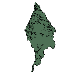
Title: Presettlement Vegetation in the Sixes Watershed, ONHP
Geospatial Data Presentation Form: vector digital data
Publication Information:
Publication Place: Corvallis, OR
Publisher: Oregon Natural Heritage Program
Online Linkage: http://oregonstate.edu/ornhic/ORNHP.html
Description:
Abstract:
This is a map of historical (""presettlement"") vegetation for
the state of Oregon, created with Arcview 3.2 by merging
digital data from different sources: H. J. Andrews, General
Land Office (GLO), Soil Survey Geographic (SSURGO), BLM,
Oregon Gap analysis. The H. J. Andrews map forms the
background into which more detailed coverages were
incorporated. The data consist of an ArcView shapefile.
Scale varies throughout the coverage, depending on the
source of the data; the overall scale is 1:100,000.
Purpose:
This map was created to allow the comparison between the
distribution of historical and current vegetation land cover
types in oregon.
Supplemental Information: For the purposes of the Coastal Atlas project this coverage was clipped to the Sixes basin boundary.
Time Period of Content:
Time Period Information:
Range of Dates/Times:
Beginning Date: 1800
Beginning Time: Unknown
Ending Date: 1938
Ending Time: Unknown
Currentness Reference: ground condition
Status:
Progress: Complete
Maintenance and Update Frequency: Irregular
Spatial Domain:
Bounding Coordinates:
West Bounding Coordinate: -124.703537
East Bounding Coordinate: -124.134727
North Bounding Coordinate: 43.122093
South Bounding Coordinate: 42.415104
Keywords:
Theme:
Theme Keyword Thesaurus: Unknown
Theme Keyword: Historic (presettlement) vegetation
Place:
Place Keyword Thesaurus: Unknown
Place Keyword: Oregon
Access Constraints: None
Use Constraints: N/A
Point of Contact:
Contact Information:
Contact Person Primary:
Contact Person: Claudine Tobalske
Contact Organization: Oregon Natural Heritage Program
Contact Position: Ecologist / GIS analyst
Contact Address:
Address Type: mailing and physical address
Address: 1322 SE Morrison Street
City: Portland
State or Province: OR
Postal Code: 97214
Country: USA
Contact Voice Telephone: 503-731-3070 ext. 117
Contact Facsimile Telephone: 503-731-3070
Contact Electronic Mail Address: claudine.tobalske@orst.edu
Hours of Service: 9am-5pm PT
Native Data Set Environment:
Microsoft Windows 2000 Version 5.0 (Build 2195) Service Pack 3;
ESRI ArcCatalog 8.1.2.671
Data Quality Information
Section Index
Attribute Accuracy:
Attribute Accuracy Report: See Entity_Attribute_Information
Logical Consistency Report: Polygon and chain-node topology present
Completeness Report: covers all of oregon. Clipped for Coastal Atlas watershed project.
Positional Accuracy:
Horizontal Positional Accuracy:
Horizontal Positional Accuracy Report: NA.
Vertical Positional Accuracy:
Vertical Positional Accuracy Report: NA.
Lineage:
Source Information:
Source Citation:
Citation Information:
Originator: U.S.F.S.-ICBEMP
Publication Date: 19950114
Title: H.J. Andrews land cover map of Oregon and Washington
Edition: 1995
Source Scale Denominator: 500000
Type of Source Media: Paper Map
Source Time Period of Content:
Time Period Information:
Single Date/Time:
Calendar Date: 1/14/1995
Time of Day: Unknown
Source Currentness Reference: publication date
Source Citation Abbreviation: Historical vegetation of Oregon and Washington
Source Contribution: Base cover
Source Information:
Source Citation:
Citation Information:
Originator: U.S.D.A.-NRCS Soil Survey Division
Title: Soil Survey Geographic (SSURGO) data
Edition: 1996
Other Citation Details:
General description available at
<http:www.ftw.nrcs.usda.govssurgo.html>
<http:www.ftw.nrcs.usda.govssurgo.html>
Online Linkage:
<http:www.ftw.nrcs.usda.govssur_data.html>
<http:www.ftw.nrcs.usda.govssur_data.html>
Source Scale Denominator: 24000
Type of Source Media: Digital Soils data
Source Time Period of Content:
Time Period Information:
Range of Dates/Times:
Beginning Date: 1996
Beginning Time: Unknown
Ending Date: 2001
Ending Time: Unknown
Source Currentness Reference: Ground Condtion
Source Citation Abbreviation: SSURGO
Source Contribution:
Sherman, Gilliam, Morrow, Harney counties; parts of
Wasco, Jefferson, Deschutes, Lake, malheur, Baker,
Union, and Umatilla counties.
Source Information:
Source Citation:
Citation Information:
Originator: Oregon Natural Heritage Program
Title: General Land Office (GLO) survey
Edition: 1851
Other Citation Details:
Detailed metadata access for the Willamette
Valley can be obtained at the following URL:
www.fsl.orst.edupnwercwrbaccess.html. Go to
Metadata -> 1851 vegetation. The same
methodology was used for the other areas.
Online Linkage: www.fsl.orst.edupnwercwrbaccess.html
Source Scale Denominator: 24000
Type of Source Media: GLO Survey records (text)
Source Time Period of Content:
Time Period Information:
Range of Dates/Times:
Beginning Date: 1851
Beginning Time: Unknown
Ending Date: 1909
Ending Time: Unknown
Source Currentness Reference: Ground Condtion
Source Citation Abbreviation: GLO survey
Source Contribution:
Willamette Valley, Umpqua Basin, parts of the Oregon
coast, Sycan Marsh, and southern Klamath Lake Basin.
Source Information:
Source Citation:
Citation Information:
Originator:
Oregon Gap Analysis Program, directed by the Idaho
Cooperative Fish & Wildlife Research Unit, University of
Idaho, in cooperation with the Oregon Department of Fish
and Wildlife and the Oregon Natural Heritage Program.
Publication Date: 2/28/96
Title: Oregon Gap Analysis
Publication Information:
Publication Place: Portland, OR
Source Scale Denominator: 100000
Type of Source Media: Digital polygon data derived from Landsat
Source Time Period of Content:
Time Period Information:
Single Date/Time:
Calendar Date: 1999
Time of Day: Unknown
Source Currentness Reference: Ground Condtion
Source Citation Abbreviation: OR-GAP
Source Contribution:
The use of Gap data was restricted to areas labeled ""non
forest"" in the H.J. Andrews coverage, and for which no
other source of data was available: parts of Malheur,
Harney, Wheeler, Deschutes, Jefferson, Wasco, Crook, and
Grant counties.
Source Information:
Source Citation:
Citation Information:
Originator: Siskiyou National forest
Title: n/a
Source Scale Denominator: 24000
Type of Source Media: Paper map
Source Time Period of Content:
Time Period Information:
Single Date/Time:
Calendar Date:
Time of Day: Unknown
Source Currentness Reference: Ground Condtion
Source Citation Abbreviation: Siskiyou National forest
Source Contribution:
A forest cover map was used to help delineate the extent
of Douglas fir-tan oak in southwestern Oregon.
Process Step:
Process Description:
(H. J. Andrews) A digital map of the forests of Oregon and Washington
was obtained from Janet Ohman of the PNW Forest and
Research Station in Corvallis. No metadata is available
with the exception of a list of types. Based on the
detail in the cover, it appears to have been developed
at an approximately 1:100,000 scale. The map was
digitized from original surveys of USFS crews headed by
H.J. Andrews in the 1930s, presumably from WPA. The
original cover was mapped to forest type, with a
secondary classification for young forests. Recent
timber harvest areas (clear-cuts) and burned forest were
also mapped. Disclaimer: The ICBEMP cannot assure the reliability or
suitability of this information for a particular
purpose. Original data was compiled from various
sources. Spatial information may not meet National Map
Accuracy Standards. This information may be updated
without notification. Project Name: ICBEMP
Process Date: 19950614
Process Contact:
Contact Information:
Contact Person Primary:
Contact Person: Andy Wilson
Contact Organization: U.S. Forest Service
Contact Position: GIS Analyst, ICBEMP SPATIAL ANALYSIS TEAM
Contact Address:
Address Type: mailing and physical address
Address: 333 SW FIRST
City: Portland
State or Province: OR
Postal Code: 97204
Country: USA
Contact Voice Telephone: n/a
Contact Electronic Mail Address: n/a
Hours of Service: 8-5, m-f, PST
Process Step:
Process Description:
(SE Oregon) A digital map of current vegetation for southeastern
Oregon was originally created from BLM coverages, SSURGO
data, and Gap data when no other data source was
available, as part of a different project. Specific
metadata for this coverage can be obtained from Claudine
Tobalske. The coverage was updated to reflect plausible
presettlement vegetation patterns. The following
vegetation and land-use types were removed or modified:
crested wheatgrass (Agropyron cristatum); cheatgrass
(Bromus tectorum); agriculture; recent burns; recent
cuts; urban; reservoirs; mines and quarries; western
juniper woodland; and forest.
For Wasco, Sherman, Gilliam, Morrow, Umatilla, Union,
Baker, and part of Jefferson and Lake counties, land
cover polygons were obtained from from the Soil Survey
Geographic (SSURGO) database. The 1:24,000 soil polygons
came with associated databases for climaxhistorical
plant composition and climaxhistorical tree cover.
Because SSURGO data present potential vegetation based
on soil types, they were used to replace post-settlement
vegetation and land-use types. Where SSURGO data were
not available, these types were replaced with potential
pre-settlement vegetation based on the composition of
adjacent polygons, and the presence of rivers and
streams (for riparian areas and bottomlands). Recent
burns and regenerating young forests were reverted to
forest. In addition, polygons from the GLO survey were
incorporated in Umatilla county (prickly pear grassland,
tufted hairgrass). SSURGO polygons were also recoded
throughout the area to reflect the presence of riparian
vegetation (with on-screen digitizing when necessary).
Location of western juniper patches was checked against
their location in the H.J. Andrews map. Those polygons
that were not labeled juniper in the H.J. Andrews map
were recoded based on shrub vegetation in the polygons
(e.g., ""Western juniperWyoming big sagebrush"" polygons
were recoded ""Wyoming big sagebrush""), or based on the
composition of adjacent polygons. On-screen digitizing
was sometimes required.
Forest boundaries were adjusted to match those of the
Andrews map, with on-screen digitizing when necessary.
Process Date: 2001
Process Contact:
Contact Information:
Contact Person Primary:
Contact Person: Claudine Tobalske
Contact Organization: Oregon Natural Heritage Program
Contact Position: Ecologist / GIS analyst
Contact Address:
Address Type: mailing and physical address
Address: 1322 SE Morrison Street
City: Portland
State or Province: OR
Postal Code: 97214
Country: USA
Contact Voice Telephone: 503-731-3070 ext. 117
Contact Facsimile Telephone: 503-731-3070
Contact Electronic Mail Address: claudine.tobalske@orst.edu
Hours of Service: 9am-5pm PT
Process Step:
Process Description:
General Land Office (GLO) survey
GLO surveys depict presettlement vegetation in Oregon as
described by surveyors for the General Land Office
between 1851 and 1909, when surveying township and
section lines. Most low-elevation sites with arable land
were surveyed between 1851 and 1865, while most foothill
and mountainous areas were surveyed between 1865 and
1895. Coverages were created at 1:24,000 using databased
transcriptions of survey notes for township and section
lines, with standard USGS 7.5 topographic maps as a
base. Soil Survey Geographic (SSURGO) digital data were
used in the Willamette Valley to identify hydric soils
and separate wet prairies from upland prairies. Because
the survey presents vegetation patterns at a specific
date, burned and storm-damaged forest patches were
recoded to the corresponding forest type to make the
coverage less time-specific. A map of current forest
cover types for the Siskiyou National Forest was used to
help delineate the extent of Douglas fir-tan oak forest
east of the available GLO data in southwestern oregon.
Process Date: 2001
Process Contact:
Contact Information:
Contact Person Primary:
Contact Person: Claudine Tobalske
Contact Organization: Oregon Natural Heritage Program
Contact Position: Ecologist / GIS analyst
Contact Address:
Address Type: mailing and physical address
Address: 1322 SE Morrison Street
City: Portland
State or Province: OR
Postal Code: 97214
Country: USA
Contact Voice Telephone: 503-731-3070 ext. 117
Contact Facsimile Telephone: 503-731-3070
Contact Electronic Mail Address: claudine.tobalske@orst.edu
Hours of Service: 9am-5pm PT
Process Step:
Process Description:
(Edge matching) After updating the H.J. Andrews coverage with other
coverages, straight edges sometimes resulted from
polygons abruptly ending at the end of a coverage and
not continuing into the adjacent coverage. These were
eliminated as best as possible through polygon recoding
and on-screen digitizing. The most detailed coverage was
given priority when vegetation types differed between
two adjacent coverages: SSURGO dominant over Gap, GLO
dominant over H.J. Andrews. Exceptions were made when
the less detailed coverage was historically more
accurate (e.g., H.J. Andrews vs. SSURGO).
Process Date: 2001
Process Contact:
Contact Information:
Contact Person Primary:
Contact Person: Claudine Tobalske
Contact Organization: Oregon Natural Heritage Program
Contact Position: Ecologist / GIS analyst
Contact Address:
Address Type: mailing and physical address
Address: 1322 SE Morrison Street
City: Portland
State or Province: OR
Postal Code: 97214
Country: USA
Contact Voice Telephone: 503-731-3070 ext. 117
Contact Facsimile Telephone: 503-731-3070
Contact Electronic Mail Address: claudine.tobalske@orst.edu
Hours of Service: 9am-5pm PT
Cloud Cover: 0
Spatial Data Organization Information
Section Index
Direct Spatial Reference Method: Vector
Point and Vector Object Information:
SDTS Terms Description:
SDTS Point and Vector Object Type: G-polygon
Point and Vector Object Count: 43999
Spatial Reference Information
Section Index
Horizontal Coordinate System Definition:
Planar:
Map Projection:
Map Projection Name: Lambert Conformal Conic
Lambert Conformal Conic:
Standard Parallel: 43
Standard Parallel: 45.5
Longitude of Central Meridian: -120.5
Latitude of Projection Origin: 41.75
False Easting: 400000
False Northing: 0
Planar Coordinate Information:
Planar Coordinate Encoding Method: Coordinate Pair
Coordinate Representation:
Abscissa Resolution: 0.001024
Ordinate Resolution: 0.001024
Planar Distance Units: international feet
Geodetic Model:
Horizontal Datum Name: North American Datum of 1983
Ellipsoid Name: Geodetic Reference System 80
Semi-major Axis: 6378137
Denominator of Flattening Ratio: 298.257
Entity and Attribute Information
Section Index
Detailed Description:
Entity Type:
Entity Type Label: histveg02.pat
Entity Type Definition: Polygon Attribute Table
Entity Type Definition Source: ESRI
Attribute:
Attribute Label: AREA
Attribute Definition: Area of Polygon
Attribute Definition Source: ESRI
Attribute Domain Values:
Unrepresentable Domain: computer calculated
Attribute:
Attribute Label: PERIMETER
Attribute Definition: Perimeter of Polygon
Attribute Definition Source: ESRI
Attribute Domain Values:
Unrepresentable Domain: computer calculated
Attribute:
Attribute Label: VEGNAME
Attribute Definition: Land cover type
Attribute Definition Source: ONHP
Attribute Domain Values:
Enumerated Domain:
Enumerated Domain Value: Alder-conifer riparian
Enumerated Domain Value Definition: Alder-conifer riparian
Enumerated Domain Value Definition Source: Oregon Natural Heritage Program
Enumerated Domain:
Enumerated Domain Value: Alkaline grasslands and seasonal wetlands
Enumerated Domain Value Definition: Alkaline grasslands and seasonal wetlands
Enumerated Domain Value Definition Source: Oregon Natural Heritage Program
Enumerated Domain:
Enumerated Domain Value: Alpine tundra-barren
Enumerated Domain Value Definition: Alpine tundra-barren
Enumerated Domain Value Definition Source: Oregon Natural Heritage Program
Enumerated Domain:
Enumerated Domain Value: Ash beds
Enumerated Domain Value Definition: Alpine tundra-barren
Enumerated Domain Value Definition Source: Oregon Natural Heritage Program
Enumerated Domain:
Enumerated Domain Value: Ash savanna
Enumerated Domain Value Definition: Ash savanna
Enumerated Domain Value Definition Source: Oregon Natural Heritage Program
Enumerated Domain:
Enumerated Domain Value: Ash-willow swamp
Enumerated Domain Value Definition: Ash-willow swamp
Enumerated Domain Value Definition Source: Oregon Natural Heritage Program
Enumerated Domain:
Enumerated Domain Value: Aspen
Enumerated Domain Value Definition: Aspen
Enumerated Domain Value Definition Source: Oregon Natural Heritage Program
Enumerated Domain:
Enumerated Domain Value: Bare rock
Enumerated Domain Value Definition: Bare Rock
Enumerated Domain Value Definition Source: Oregon Natural Heritage Program
Enumerated Domain:
Enumerated Domain Value: Basin big sagebrush
Enumerated Domain Value Definition: Basin big sagebrush
Enumerated Domain Value Definition Source: Oregon Natural Heritage Program
Enumerated Domain:
Enumerated Domain Value: Basin wildrye
Enumerated Domain Value Definition: Basin wildrye
Enumerated Domain Value Definition Source: Oregon Natural Heritage Program
Enumerated Domain:
Enumerated Domain Value: Bitterbrush
Enumerated Domain Value Definition: Bitterbrush
Enumerated Domain Value Definition Source: Oregon Natural Heritage Program
Enumerated Domain:
Enumerated Domain Value: Black cottonwood riparian woodland
Enumerated Domain Value Definition: Black cottonwood riparian woodland
Enumerated Domain Value Definition Source: Oregon Natural Heritage Program
Enumerated Domain:
Enumerated Domain Value: Black greasewood
Enumerated Domain Value Definition: Black greasewood
Enumerated Domain Value Definition Source: Oregon Natural Heritage Program
Enumerated Domain:
Enumerated Domain Value: Bluebunch wheatgrass
Enumerated Domain Value Definition: Bluebunch wheatgrass
Enumerated Domain Value Definition Source: Oregon Natural Heritage Program
Enumerated Domain:
Enumerated Domain Value: Chaparral
Enumerated Domain Value Definition: Chaparral
Enumerated Domain Value Definition Source: Oregon Natural Heritage Program
Enumerated Domain:
Enumerated Domain Value: Coastal headland
Enumerated Domain Value Definition: Coastal headland
Enumerated Domain Value Definition Source: Oregon Natural Heritage Program
Enumerated Domain:
Enumerated Domain Value: Coastal redwood
Enumerated Domain Value Definition: Coastal redwood
Enumerated Domain Value Definition Source: Oregon Natural Heritage Program
Enumerated Domain:
Enumerated Domain Value: Curl-leaf mountain mahogany
Enumerated Domain Value Definition: Curl-leaf mountain mahogany
Enumerated Domain Value Definition Source: Oregon Natural Heritage Program
Enumerated Domain:
Enumerated Domain Value: Douglas fir
Enumerated Domain Value Definition: Douglas fir
Enumerated Domain Value Definition Source: Oregon Natural Heritage Program
Enumerated Domain:
Enumerated Domain Value: Douglas fir-ponderosa pine
Enumerated Domain Value Definition: Douglas fir-ponderosa pine
Enumerated Domain Value Definition Source: Oregon Natural Heritage Program
Enumerated Domain:
Enumerated Domain Value: Douglas fir-sugar pine
Enumerated Domain Value Definition: Douglas fir-sugar pine
Enumerated Domain Value Definition Source: Oregon Natural Heritage Program
Enumerated Domain:
Enumerated Domain Value: Douglas fir-white pine
Enumerated Domain Value Definition: Douglas fir-white pine
Enumerated Domain Value Definition Source: Oregon Natural Heritage Program
Enumerated Domain:
Enumerated Domain Value: Early sagebrush
Enumerated Domain Value Definition: Early sagebrush
Enumerated Domain Value Definition Source: Oregon Natural Heritage Program
Enumerated Domain:
Enumerated Domain Value: Grand fir
Enumerated Domain Value Definition: Grand fir
Enumerated Domain Value Definition Source: Oregon Natural Heritage Program
Enumerated Domain:
Enumerated Domain Value: Greasebush
Enumerated Domain Value Definition: Greasebush
Enumerated Domain Value Definition Source: Oregon Natural Heritage Program
Enumerated Domain:
Enumerated Domain Value: Hawthorn
Enumerated Domain Value Definition: Hawthorn
Enumerated Domain Value Definition Source: Oregon Natural Heritage Program
Enumerated Domain:
Enumerated Domain Value: Horsebrush
Enumerated Domain Value Definition: Horsebrush
Enumerated Domain Value Definition Source: Oregon Natural Heritage Program
Enumerated Domain:
Enumerated Domain Value: Idaho fescue
Enumerated Domain Value Definition: Idaho fescue
Enumerated Domain Value Definition Source: Oregon Natural Heritage Program
Enumerated Domain:
Enumerated Domain Value: Jeffrey pine
Enumerated Domain Value Definition: Jeffrey pine
Enumerated Domain Value Definition Source: Oregon Natural Heritage Program
Enumerated Domain:
Enumerated Domain Value: Lodgepole pine
Enumerated Domain Value Definition: Lodgepole pine
Enumerated Domain Value Definition Source: Oregon Natural Heritage Program
Enumerated Domain:
Enumerated Domain Value: Low sagebrush
Enumerated Domain Value Definition: Low sagebrush
Enumerated Domain Value Definition Source: Oregon Natural Heritage Program
Enumerated Domain:
Enumerated Domain Value: Low sagebrush-Wyoming big sagebrush
Enumerated Domain Value Definition: Low sagebrush-Wyoming big sagebrush
Enumerated Domain Value Definition Source: Oregon Natural Heritage Program
Enumerated Domain:
Enumerated Domain Value: MarshWetland
Enumerated Domain Value Definition: MarshWetland
Enumerated Domain Value Definition Source: Oregon Natural Heritage Program
Enumerated Domain:
Enumerated Domain Value: Mixed conifer
Enumerated Domain Value Definition: Mixed conifer
Enumerated Domain Value Definition Source: Oregon Natural Heritage Program
Enumerated Domain:
Enumerated Domain Value: Mountain big sagebrush
Enumerated Domain Value Definition: Mountain big sagebrush
Enumerated Domain Value Definition Source: Oregon Natural Heritage Program
Enumerated Domain:
Enumerated Domain Value: Mountain snowberry
Enumerated Domain Value Definition: Mountain snowberry
Enumerated Domain Value Definition Source: Oregon Natural Heritage Program
Enumerated Domain:
Enumerated Domain Value: Needle-and-thread grass
Enumerated Domain Value Definition: Needle-and-thread grass
Enumerated Domain Value Definition Source: Oregon Natural Heritage Program
Enumerated Domain:
Enumerated Domain Value: Needlegrass
Enumerated Domain Value Definition: Needlegrass
Enumerated Domain Value Definition Source: Oregon Natural Heritage Program
Enumerated Domain:
Enumerated Domain Value: Ninebark-snowberry
Enumerated Domain Value Definition: Ninebark-snowberry
Enumerated Domain Value Definition Source: Oregon Natural Heritage Program
Enumerated Domain:
Enumerated Domain Value: Oak savanna
Enumerated Domain Value Definition: Oak savanna
Enumerated Domain Value Definition Source: Oregon Natural Heritage Program
Enumerated Domain:
Enumerated Domain Value: Oak-conifer savanna
Enumerated Domain Value Definition: Oak-conifer savanna
Enumerated Domain Value Definition Source: Oregon Natural Heritage Program
Enumerated Domain:
Enumerated Domain Value: Oak-Douglas fir
Enumerated Domain Value Definition: Oak-Douglas fir
Enumerated Domain Value Definition Source: Oregon Natural Heritage Program
Enumerated Domain:
Enumerated Domain Value: Oak-madrone
Enumerated Domain Value Definition: Oak-madrone
Enumerated Domain Value Definition Source: Oregon Natural Heritage Program
Enumerated Domain:
Enumerated Domain Value: Open water
Enumerated Domain Value Definition: Open water
Enumerated Domain Value Definition Source: Oregon Natural Heritage Program
Enumerated Domain:
Enumerated Domain Value: Oregon ash
Enumerated Domain Value Definition: Oregon ash
Enumerated Domain Value Definition Source: Oregon Natural Heritage Program
Enumerated Domain:
Enumerated Domain Value: Pacific silver fir-mountain hemlock
Enumerated Domain Value Definition: Pacific silver fir-mountain hemlock
Enumerated Domain Value Definition Source: Oregon Natural Heritage Program
Enumerated Domain:
Enumerated Domain Value: Playa
Enumerated Domain Value Definition: Playa
Enumerated Domain Value Definition Source: Oregon Natural Heritage Program
Enumerated Domain:
Enumerated Domain Value: Ponderosa pine
Enumerated Domain Value Definition: Ponderosa pine
Enumerated Domain Value Definition Source: Oregon Natural Heritage Program
Enumerated Domain:
Enumerated Domain Value: Ponderosa pine-lodgepole pine
Enumerated Domain Value Definition: Ponderosa pine-lodgepole pine
Enumerated Domain Value Definition Source: Oregon Natural Heritage Program
Enumerated Domain:
Enumerated Domain Value: Port-Orford cedar
Enumerated Domain Value Definition: Port-Orford cedar
Enumerated Domain Value Definition Source: Oregon Natural Heritage Program
Enumerated Domain:
Enumerated Domain Value: Prickly pear grassland
Enumerated Domain Value Definition: Prickly pear grassland
Enumerated Domain Value Definition Source: Oregon Natural Heritage Program
Enumerated Domain:
Enumerated Domain Value: Rabbitbrush
Enumerated Domain Value Definition: Rabbitbrush
Enumerated Domain Value Definition Source: Oregon Natural Heritage Program
Enumerated Domain:
Enumerated Domain Value: Red alder
Enumerated Domain Value Definition: Red alder
Enumerated Domain Value Definition Source: Oregon Natural Heritage Program
Enumerated Domain:
Enumerated Domain Value: Rigid sagebrush
Enumerated Domain Value Definition: Rigid sagebrush
Enumerated Domain Value Definition Source: Oregon Natural Heritage Program
Enumerated Domain:
Enumerated Domain Value: Riparian
Enumerated Domain Value Definition: Riparian
Enumerated Domain Value Definition Source: Oregon Natural Heritage Program
Enumerated Domain:
Enumerated Domain Value: Riparian hardwoods
Enumerated Domain Value Definition: Riparian hardwoods
Enumerated Domain Value Definition Source: Oregon Natural Heritage Program
Enumerated Domain:
Enumerated Domain Value: River wash
Enumerated Domain Value Definition: River wash
Enumerated Domain Value Definition Source: Oregon Natural Heritage Program
Enumerated Domain:
Enumerated Domain Value: Roemer fescue
Enumerated Domain Value Definition: Roemer fescue
Enumerated Domain Value Definition Source: Oregon Natural Heritage Program
Enumerated Domain:
Enumerated Domain Value: Saltbush
Enumerated Domain Value Definition: Saltbush
Enumerated Domain Value Definition Source: Oregon Natural Heritage Program
Enumerated Domain:
Enumerated Domain Value: Sand dunes
Enumerated Domain Value Definition: Sand dunes
Enumerated Domain Value Definition Source: Oregon Natural Heritage Program
Enumerated Domain:
Enumerated Domain Value: Sandberg bluegrass
Enumerated Domain Value Definition: Sandberg bluegrass
Enumerated Domain Value Definition Source: Oregon Natural Heritage Program
Enumerated Domain:
Enumerated Domain Value: Shadscale
Enumerated Domain Value Definition: Shadscale
Enumerated Domain Value Definition Source: Oregon Natural Heritage Program
Enumerated Domain:
Enumerated Domain Value: Shasta fir-white fir
Enumerated Domain Value Definition: Shasta fir-white fir
Enumerated Domain Value Definition Source: Oregon Natural Heritage Program
Enumerated Domain:
Enumerated Domain Value: Shore pine
Enumerated Domain Value Definition: Shore pine
Enumerated Domain Value Definition Source: Oregon Natural Heritage Program
Enumerated Domain:
Enumerated Domain Value: Shrub swamp
Enumerated Domain Value Definition: Shrub swamp
Enumerated Domain Value Definition Source: Oregon Natural Heritage Program
Enumerated Domain:
Enumerated Domain Value: Silver fir-western hemlock
Enumerated Domain Value Definition: Silver fir-western hemlock
Enumerated Domain Value Definition Source: Oregon Natural Heritage Program
Enumerated Domain:
Enumerated Domain Value: Silver sagebrush
Enumerated Domain Value Definition: Silver sagebrush
Enumerated Domain Value Definition Source: Oregon Natural Heritage Program
Enumerated Domain:
Enumerated Domain Value: Sitka spruce-western hemlock
Enumerated Domain Value Definition: Sitka spruce-western hemlock
Enumerated Domain Value Definition Source: Oregon Natural Heritage Program
Enumerated Domain:
Enumerated Domain Value: Spiny hopsage
Enumerated Domain Value Definition: Spiny hopsage
Enumerated Domain Value Definition Source: Oregon Natural Heritage Program
Enumerated Domain:
Enumerated Domain Value: Subalpine fir
Enumerated Domain Value Definition: Subalpine fir
Enumerated Domain Value Definition Source: Oregon Natural Heritage Program
Enumerated Domain:
Enumerated Domain Value: Threetip sagebrush
Enumerated Domain Value Definition: Threetip sagebrush
Enumerated Domain Value Definition Source: Oregon Natural Heritage Program
Enumerated Domain:
Enumerated Domain Value: Tufted hairgrass
Enumerated Domain Value Definition: Tufted hairgrass
Enumerated Domain Value Definition Source: Oregon Natural Heritage Program
Enumerated Domain:
Enumerated Domain Value: Western juniper woodland
Enumerated Domain Value Definition: Western juniper woodland
Enumerated Domain Value Definition Source: Oregon Natural Heritage Program
Enumerated Domain:
Enumerated Domain Value: Western redcedar
Enumerated Domain Value Definition: Western redcedar
Enumerated Domain Value Definition Source: Oregon Natural Heritage Program
Enumerated Domain:
Enumerated Domain Value: Wet meadow
Enumerated Domain Value Definition: Wet meadow
Enumerated Domain Value Definition Source: Oregon Natural Heritage Program
Enumerated Domain:
Enumerated Domain Value: White oak woodland
Enumerated Domain Value Definition: White oak woodland
Enumerated Domain Value Definition Source: Oregon Natural Heritage Program
Enumerated Domain:
Enumerated Domain Value: White oak-black oak
Enumerated Domain Value Definition: White oak-black oak
Enumerated Domain Value Definition Source: Oregon Natural Heritage Program
Enumerated Domain:
Enumerated Domain Value: Whitebark pine
Enumerated Domain Value Definition: Whitebark pine
Enumerated Domain Value Definition Source: Oregon Natural Heritage Program
Enumerated Domain:
Enumerated Domain Value: Willows
Enumerated Domain Value Definition: Willows
Enumerated Domain Value Definition Source: Oregon Natural Heritage Program
Enumerated Domain:
Enumerated Domain Value: Winterfat
Enumerated Domain Value Definition: Winterfat
Enumerated Domain Value Definition Source: Oregon Natural Heritage Program
Enumerated Domain:
Enumerated Domain Value: Wyoming big sagebrush
Enumerated Domain Value Definition: Wyoming big sagebrush
Enumerated Domain Value Definition Source: Oregon Natural Heritage Program
Enumerated Domain:
Enumerated Domain Value: Wyoming big sagebrush-squawapple
Enumerated Domain Value Definition: Wyoming big sagebrush-squawapple
Enumerated Domain Value Definition Source: Oregon Natural Heritage Program
Distribution Information
Section Index
Resource Description: Level III and IV Ecoregions of Oregon
Distribution Liability:
Ecotrust makes no express or implied warrantees with respect to
the character, fitness, or accuracy of the information presented,
or their appropriateness for any users purposes.
Custom Order Process: Download from http://www.gis.state.or.us/data/alphalist.html
Available Time Period:
Time Period Information:
Single Date/Time:
Calendar Date: Unknown
Time of Day: Unknown
Metadata Reference Information
Section Index
Metadata Date: 9/23/2002
Metadata Review Date:
Metadata Future Review Date:
Metadata Contact:
Contact Information:
Contact Person Primary:
Contact Person: Claudine Tobalske
Contact Organization: Oregon Natural Heritage Program
Contact Position: Ecologist / GIS analyst
Contact Address:
Address Type: mailing and physical address
Address: 1322 SE Morrison Street
City: Portland
State or Province: OR
Postal Code: 97214
Country: USA
Contact Voice Telephone: 503-731-3070 ext. 117
Contact Facsimile Telephone: 503-731-3070
Contact Electronic Mail Address: claudine.tobalske@orst.edu
Hours of Service: 9am-5pm PT
Metadata Standard Name:
FGDC Content Standards for Digital
Geospatial Metadata
Metadata Standard Version: FGDC-STD-001-1998
SMMS Metadata report generated 3/31/2005