Oyster Management Plan Harvest Area Classifications of the Lower Coquille Estuary
Identification_Information
Data_Quality_Information
Spatial_Data_Organization_Information
Spatial_Reference_Information
Entity_and_Attribute_Information
Distribution_Information
Metadata_Reference_Information
Identification Information
Section Index
Citation:
Citation Information:
Originator: Oregon Department of Agriculture
Publication Date: 1999
Title: Oyster Management Plan Harvest Area Classifications of the Lower Coquille Estuary
Edition: 1999
Geospatial Data Presentation Form: Map
Publication Information:
Publication Place: Salem, Oregon
Publisher: Southwest Oregon Province Resource Information - Coos Coquille Assessment Unit
Other Citation Details: The Information for this coverage was obtained from Deb Canon at the Shellfish Division of the Oregon Department of Agriculture.
Online Linkage: http://www.reo.gov/
Larger Work Citation:
Citation Information:
Originator: Regional Ecosystems Office, US Forest Service
Publication Date: 03012000
Title: Southwest Oregon Province Resource Information - Coos Coquille Assessment Unit
Publication Information:
Publication Place: Roseburg, Oregon
Publisher: VESTRA Resources (contract)
Online Linkage: http://www.reo.gov/
Description:
Abstract:
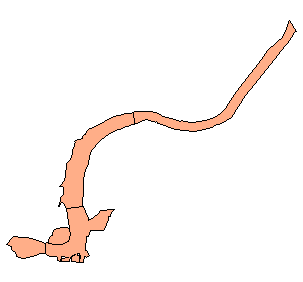
The coverge depicts different Harvest Classification Areas (as defined by the local Oyster Management Plan) in the
Lower Coquille Estuary,
Purpose:
This coverage is intended for general map use / informational purposes only. It IS NOT a direct product of
the Oregon Department of Agriculture.
Time Period of Content:
Time Period Information:
Range of Dates/Times:
Beginning Date: 1996
Beginning Time: Unknown
Ending Date: 1999
Ending Time: Unknown
Currentness Reference: 1999
Status:
Progress: Complete
Maintenance and Update Frequency: None planned
Spatial Domain:
Bounding Coordinates:
West Bounding Coordinate: -121.0107
East Bounding Coordinate: -120.9376
North Bounding Coordinate: 43.2316
South Bounding Coordinate: 43.1868
Keywords:
Theme:
Theme Keyword Thesaurus: None
Theme Keyword: Estuary
Theme Keyword: Habitat
Theme Keyword: Planning
Theme Keyword: Water Quality
Theme Keyword: Shellfish
Theme Keyword: Oysters
Place:
Place Keyword Thesaurus: None
Place Keyword: Coquille River
Place Keyword: Bandon
Place Keyword: Oregon
Place Keyword: Coast
Access Constraints: None
Use Constraints: For informational purposes only
Point of Contact:
Contact Information:
Contact Organization Primary:
Contact Organization:
Oregon Ocean Coastal Management Program - Department of
Land Conservation and Development
Contact Person: Tanya Haddad
Contact Position: DEMIS Coordinator
Contact Address:
Address Type: mailing and physical address
Address: 800 NE Oregon Street #18
City: Portland
State or Province: Oregon
Postal Code: 97232
Country: USA
Contact Voice Telephone: 503-731-4065 x30
Contact Facsimile Telephone: 503-731-4068
Contact Electronic Mail Address: tanya.haddad@state.or.us
Native Data Set Environment: Arc/Info coverage format
Data Quality Information
Section Index
Logical Consistency Report: Polygon Topology Present
Completeness Report: Complete according to infomation available in 1999.
Positional Accuracy:
Horizontal Positional Accuracy:
Horizontal Positional Accuracy Report: NA
Vertical Positional Accuracy:
Vertical Positional Accuracy Report: NA
Lineage:
Source Information:
Source Citation:
Citation Information:
Originator: Oregon Department of Agriculture, Shellfish Division
Publication Date: June 1 1996
Title: LOWER COQUILLE ESTUARY MANAGEMENT PLAN FOR COMMERCIAL SHELLFISH HARVESTING
Edition: June 1 1996
Geospatial Data Presentation Form: map
Publication Information:
Publication Place: Salem, Oregon
Publisher: Oregon Department of Agriculture,Shellfish Division
Other Citation Details:
The Information for this coverage was obtained from Deb Canon at the Shellfish Division of the Oregon Department of Agriculture. Original format was several faxed maps and three Shellfish Management Plan text sheets. Follow-up conversations with Deb Cannon were necessary to determine
that digitization from the text descriptions of the management areas was the best approach to creating this layer.
Online Linkage: http://www.oda.state.or.us
Type of Source Media: Text Descriptions
Source Time Period of Content:
Time Period Information:
Range of Dates/Times:
Beginning Date: 1996
Beginning Time: Unknown
Ending Date: 1996
Ending Time: Unknown
Source Currentness Reference: 1999
Source Contribution:
Follow-up conversations with Deb Cannon were necessary to determine that digitization from the text descriptions of
the management areas was the best approach to creating this layer.
Process Step:
Process Description:
Follow-up conversations with Deb Cannon were necessary to determine that digitization from the text descriptions of the management areas was the best approach to creating this layer. This was done in ArcView in a ""heads-up"" mode using
NOAA's middle resolution shoreline as the primary base map (Oregon Lambert Projection). Where available, rectified airphoto's were used to further refine the edges of the polygons, and national wetland inventory map coverages were
consulted ("best available"). The Shapefile was attributed with the Area ""Grow Classification"" (from the text files) and a description of area location. The Shapefile was then imported into ArcInfo using SHAPEARC.To preserve polygon attributes, a preliminary REGIONS coverage was constructed, which was then CLEAN-ed so that polygon topology could be constructed using REGIONPOLY.
Process Date: 1999
Cloud Cover: 0
Spatial Data Organization Information
Section Index
Direct Spatial Reference Method: Vector
Point and Vector Object Information:
SDTS Terms Description:
SDTS Point and Vector Object Type: GT-polygon composed of chains
Point and Vector Object Count: 5
Spatial Reference Information
Section Index
Horizontal Coordinate System Definition:
Planar:
Map Projection:
Map Projection Name: Lambert Conformal Conic
Lambert Conformal Conic:
Standard Parallel: 43
Standard Parallel: 45.5
Longitude of Central Meridian: -120.5
Latitude of Projection Origin: 41.75
False Easting: 400000
Planar Coordinate Information:
Planar Coordinate Encoding Method: Coordinate Pair
Coordinate Representation:
Abscissa Resolution: 0
Ordinate Resolution: 0
Planar Distance Units: international feet
Geodetic Model:
Horizontal Datum Name: North American Datum of 1983
Ellipsoid Name: Geodetic Reference System 80
Semi-major Axis: 6378137
Denominator of Flattening Ratio: 298.257
Entity and Attribute Information
Section Index
Detailed Description:
Entity Type:
Entity Type Label: oysters.pat
Entity Type Definition: Polygon Attribute Table
Entity Type Definition Source: None
Attribute:
Attribute Label: Area
Attribute Definition: Area of polygon
Attribute Definition Source: Software generated
Attribute Domain Values:
Unrepresentable Domain: Software computed
Attribute:
Attribute Label: Growclass
Attribute Domain Values:
Enumerated Domain:
Enumerated Domain Value: Conditionally Approved
Enumerated Domain Value: Prohibited
Attribute:
Attribute Label: Id
Attribute Domain Values:
Range Domain:
Range Domain Minimum: 18
Range Domain Maximum: 22
Attribute:
Attribute Label: Name
Attribute Definition: Area Name as referred to in Oyster Harvest Management Plan
Attribute Domain Values:
Unrepresentable Domain: Character Field
Attribute:
Attribute Label: Oysters#
Attribute Definition: Internal feature number
Attribute Definition Source: Software generated
Attribute Domain Values:
Unrepresentable Domain: Software computed
Attribute:
Attribute Label: Oysters-id
Attribute Definition: Feature identification number
Attribute Definition Source: Software generated
Attribute Domain Values:
Unrepresentable Domain: User Defined
Attribute:
Attribute Label: Oysters_
Attribute Definition: Internal feature number
Attribute Definition Source: Software generated
Attribute Domain Values:
Unrepresentable Domain: Software computed
Attribute:
Attribute Label: Oysters_id
Attribute Definition: user assigned feature id
Attribute Domain Values:
Range Domain:
Range Domain Minimum: 19
Range Domain Maximum: 23
Attribute:
Attribute Label: Perimeter
Attribute Definition: Perimeter of polygon
Attribute Definition Source: Software generated
Attribute Domain Values:
Unrepresentable Domain: Software computed
Attribute:
Attribute Label: Poly_
Attribute Definition: software generated poly id
Attribute Domain Values:
Range Domain:
Range Domain Minimum: 20
Range Domain Maximum: 24
Attribute:
Attribute Label: Rings_nok
Attribute Definition: software generated
Attribute Domain Values:
Range Domain:
Range Domain Minimum: 0
Range Domain Maximum: 0
Attribute:
Attribute Label: Rings_ok
Attribute Definition: software generated
Attribute Domain Values:
Range Domain:
Range Domain Minimum: 1
Range Domain Maximum: 1
Attribute:
Attribute Label: Subclass
Attribute Domain Values:
Enumerated Domain:
Enumerated Domain Value: GROWCL
Attribute:
Attribute Label: Subclass_
Attribute Definition: software generated poly id
Distribution Information
Section Index
Distributor:
Contact Information:
Contact Organization Primary:
Contact Organization:
Oregon Ocean Coastal Management Program - Department of
Land Conservation and Development
Contact Person: Tanya Haddad
Contact Position: DEMIS Coordinator
Contact Address:
Address Type: mailing and physical address
Address: 800 NE Oregon Street #18
City: Portland
State or Province: Oregon
Postal Code: 97232
Country: USA
Contact Voice Telephone: 503-731-4065 x30
Contact Facsimile Telephone: 503-731-4068
Contact Electronic Mail Address: tanya.haddad@state.or.us
Resource Description: Coquille Estuary Oyster Harvest Area Classifictions
Distribution Liability:
THE DATA AND ASSOCIATED DATA FILES ON THIS CD-ROM ARE
PROVIDED ""AS IS,"" WITHOUT WARRANTY TO THEIR PERFORMANCE, MERCHANTABLE
STATE,OR FITNESS FOR ANY PARTICULAR PURPOSE. THE ENTIRE RISK
ASSOCIATED WITH THE RESULTS AND PERFORMANCES OF THE DATA IS ASSUMED
BY THE USER. THIS DATA IS NOT FOR NAVIGATIONAL OR LEGAL PURPOSES.
Available Time Period:
Time Period Information:
Single Date/Time:
Calendar Date:
Time of Day: Unknown
Metadata Reference Information
Section Index
Metadata Date: 1/1/2000
Metadata Review Date:
Metadata Future Review Date:
Metadata Contact:
Contact Information:
Contact Organization Primary:
Contact Organization:
Oregon Ocean Coastal Management Program - Department of
Land Conservation and Development
Contact Person: Tanya Haddad
Contact Position: DEMIS Coordinator
Contact Address:
Address Type: mailing and physical address
Address: 800 NE Oregon Street #18
City: Portland
State or Province: Oregon
Postal Code: 97232
Country: USA
Contact Voice Telephone: 503-731-4065 x30
Contact Facsimile Telephone: 503-731-4068
Contact Electronic Mail Address: tanya.haddad@state.or.us
Metadata Standard Name: FGDC CSDGM
Metadata Standard Version: FGDC-STD-001-1998
SMMS Metadata report generated 3/27/2002