Newport OPT Wave Energy Facility, FERC, 2007
Identification_Information
Data_Quality_Information
Spatial_Data_Organization_Information
Spatial_Reference_Information
Entity_and_Attribute_Information
Distribution_Information
Metadata_Reference_Information
Identification Information
Section Index
Citation:
Citation Information:
Originator: Data set generated by the USFWS
Title: Newport OPT Wave Energy Facility, FERC, 2007
Geospatial Data Presentation Form: vector digital data
Other Citation Details: Project No. 12743-000
Online Linkage: Newport_OPTWave_FERC_2007.shp
Description:
Abstract:
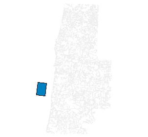
This data set is the spatial documentation of the Newport Ocean Power Technology (OPT) preliminary permit application. The Project is to be sited in the Pacific Ocean in Lincoln County, Oregon, south of the town of Newport and north of Waldport. The site is situated in the open ocean about from 3 to 6 miles from shore in water depths that range from 20 to 35 fathoms (36 - 60 m). The approximate dimensions of the proposed site are 3.5 mile wide (east-west direction) by 5 miles long (in the north-south direction). It is anticipated that the power transmission cable will be connected to approximately the central portion of the array and will follow an easterly course to an existing distribution line onshore operated by Cental Lincoln Public Utility District.
Purpose: To document the geospatial location of the preliminary permit application by Newport OPT Wave Energy Project.
Supplemental Information:
The Newport OPT Wave facility will utilize a wave evergy converter (WEC) to tranform the kinetic energy of the ocean swell into clean, renewable electricity. The proposed site has the potential of producing 100 MW or more of electirc power. It is anticipated thate proposed project will cosist of 200-400 PowerBuoys deployed in an array of columns which are oriented paralell to the beach.
The exact layout and number of WEC's has yet to be determined, and will be based upon further studies.
Time Period of Content:
Time Period Information:
Single Date/Time:
Calendar Date: 3/9/2007
Time of Day: Unknown
Currentness Reference: publication date
Status:
Progress: Complete
Maintenance and Update Frequency: As needed
Spatial Domain:
Bounding Coordinates:
West Bounding Coordinate: -124.209294
East Bounding Coordinate: -124.122179
North Bounding Coordinate: 44.574999
South Bounding Coordinate: 44.493874
Keywords:
Theme:
Theme Keyword Thesaurus: GMCD
Theme Keyword: Electricity
Theme Keyword: Human dimension
Theme Keyword: Power
Theme Keyword: Wave Energy
Theme Keyword: Ocean
Place:
Place Keyword Thesaurus: None
Place Keyword: Coos County
Place Keyword: Oregon Coast
Place Keyword: Coos Bay
Place Keyword: Pacific Ocean
Stratum:
Stratum Keyword Thesaurus: None
Stratum Keyword: Sea Surface
Stratum Keyword: Water Column
Stratum Keyword: Seafloor
Stratum Keyword: Benthic
Access Constraints: None
Use Constraints: None
Point of Contact:
Contact Information:
Contact Organization Primary:
Contact Organization: Oregon Wave Energy Partners I, LLC
Contact Person: Charles Dunleavy
Contact Address:
Address Type: mailing and physical address
Address: 1590 Reed Road
City: Pennington
State or Province: NJ
Postal Code: 08534
Country: USA
Contact Voice Telephone: (609) 730 - 0400
Contact Facsimile Telephone: (609) 730 - 0404
Contact Electronic Mail Address: cdunleavy@oceanpowertech.com
Data Set Credit: Data set was originally generated by the USFWS
Native Data Set Environment: Microsoft Windows XP Version 5.1 (Build 2600) Service Pack 2; ESRI ArcCatalog 9.2.0.1324
Data Quality Information
Section Index
Lineage:
Source Information:
Source Citation:
Citation Information:
Originator: Data set generated by the USFWS
Title: Douglas County Wave and Tidal Energy Project, FERC, 2007
Other Citation Details: Project No. 12743-000
Source Time Period of Content:
Source Citation Abbreviation: FERC Licensing Project No. 12743-000
Process Step:
Process Description: Original data set generated by USFWS
Process Date: Unknown
Process Step:
Process Description: Metadata imported.
Process Step:
Process Description: Dataset moved.
Process Step:
Process Description: Dataset moved.
Cloud Cover: 0
Spatial Data Organization Information
Section Index
Direct Spatial Reference Method: Vector
Point and Vector Object Information:
SDTS Terms Description:
SDTS Point and Vector Object Type: G-polygon
Point and Vector Object Count: 1
Spatial Reference Information
Section Index
Horizontal Coordinate System Definition:
Planar:
Map Projection:
Map Projection Name: Lambert Conformal Conic
Lambert Conformal Conic:
Standard Parallel: 43
Standard Parallel: 45.5
Longitude of Central Meridian: -120.5
Latitude of Projection Origin: 41.75
False Easting: 1312335.958005
False Northing: 0
Planar Coordinate Information:
Planar Coordinate Encoding Method: Coordinate Pair
Coordinate Representation:
Abscissa Resolution: 0.000064
Ordinate Resolution: 0.000064
Planar Distance Units: international feet
Geodetic Model:
Horizontal Datum Name: North American Datum of 1983
Ellipsoid Name: Geodetic Reference System 80
Semi-major Axis: 6378137
Denominator of Flattening Ratio: 298.257
Entity and Attribute Information
Section Index
Detailed Description:
Entity Type:
Entity Type Label: reedsport
Attribute:
Attribute Label: APP_DATE
Attribute:
Attribute:
Attribute Label: COMMENT_DU
Attribute:
Attribute:
Attribute:
Attribute:
Attribute Label: FID
Attribute Definition: Internal feature number.
Attribute Definition Source: ESRI
Attribute Domain Values:
Unrepresentable Domain: Sequential unique whole numbers that are automatically generated.
Attribute:
Attribute Label: LOCATION
Attribute:
Attribute Label: NO_DEVICES
Attribute:
Attribute Label: PERIMETER
Attribute:
Attribute Label: PERMIT_NO
Attribute:
Attribute:
Attribute Label: Shape
Attribute Definition: Feature geometry.
Attribute Definition Source: ESRI
Attribute Domain Values:
Unrepresentable Domain: Coordinates defining the features.
Attribute:
Distribution Information
Section Index
Resource Description: Downloadable Data
Standard Order Process:
Digital Form:
Digital Transfer Information:
Available Time Period:
Time Period Information:
Single Date/Time:
Calendar Date: 1983
Time of Day: Unknown
Metadata Reference Information
Section Index
Metadata Date: 12/11/2007
Metadata Review Date:
Metadata Future Review Date:
Metadata Contact:
Contact Information:
Contact Person Primary:
Contact Person: Andy Lanier
Contact Organization: Dept. Of Land Conservation and Development
Contact Position: NOAA Coastal Management Fellow
Contact Address:
Address Type: mailing and physical address
Address: 635 Capitol St. NE
City: Salem
State or Province: OR
Postal Code: 97301
Country: USA
Contact Voice Telephone: (503) 373 - 0050 x246
Contact Facsimile Telephone: (503) 378 - 6033
Contact Electronic Mail Address: Andy.Lanier@state.or.us
Hours of Service: Regular Business Hours
Contact Instructions: Email preferred
Metadata Standard Name: FGDC Content Standards for Digital Geospatial Metadata
Metadata Standard Version: FGDC-STD-001-1998
Metadata Time Convention: local time
Metadata Extensions:
Online Linkage: http://www.esri.com/metadata/esriprof80.html
Profile Name: ESRI Metadata Profile
Metadata Extensions:
Online Linkage: http://www.esri.com/metadata/esriprof80.html
Profile Name: ESRI Metadata Profile
SMMS Metadata report generated 2/26/2009