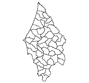
Nested 6th and 7th code Hydrologic Units in the Sixes Watershed, CLAMS, 2000
Identification_Information
Data_Quality_Information
Spatial_Data_Organization_Information
Spatial_Reference_Information
Entity_and_Attribute_Information
Distribution_Information
Metadata_Reference_Information
Identification Information
Section Index
Citation:
Citation Information:
Originator: Zoe Rickenbach,Sharon Clarke,Kelly Burnett
Publication Date: 20000530
Title: Nested 6th and 7th code Hydrologic Units in the Sixes Watershed, CLAMS, 2000
Geospatial Data Presentation Form: vector digital data
Other Citation Details: none
Online Linkage: http://www.fsl.orst.edu/clams/
Description:
Abstract:
Nested 6th and 7th code Hydrologic Units (HU) were produced for the Coastal Landscape Analysis and Modeling Study (CLAMS). Preliminary 6th code HU were produced using the USGS GIS Weasel program with 10m Drainage Enforced-Digital Elevation Models (DE-DEM). These boundaries were hand edited to remove very small Basins. In an effort to conform to existing and ongoing efforts, the boundaries were given to the USFS and BLM for review. Working with the BLM and FS we produced both a 6th and 7th code HU coverage combining our original lines, their lines, and digitizing new lines where necessary. We discussed discrepancies in boundaries with the Salem, Eugene, Coos Bay, and Roseburg districts of the Bureau of Land Management(BLM) and Siuslaw National Forest (SNF). The final 6th and 7th code HUs are attributed with: 1)unique identifiers, 2) corresponding 5th code HU code number (7th codes HU have the corresponding 6th code HUnumber as well), 3) 4th and 5th code HU names, and 4)codes to differentiate between true, composite and frontal watersheds. Basins meet the National Resource Conservation Service's guidelines for 6th code HUs.
Purpose: To provide a 6th/7th field HU coverage for the CLAMS area, for use in natural resource research, management planning and regional ecology studies on both public and private lands.
Supplemental Information:
Procedures_Used:
Revisions: This is version one. Reviews_Applied_to_Data: Data reviewed by Chester Novak, Kirk Appleman (Salem BLM); Barb Ellis-Sugai (USFS-SNF); Mary D'Aversa (Eugene BLM); Dan Carpenter, Lance Finnegan (Coos Bay BLM); Rick Momsen, Lowell Duell (Roseburg BLM); and Sharon Clarke, Alissa Moses (OSU),
References: USGS GIS Weasel (<http://wwwbrr.cr.usgs.gov/weasel/>) 10m Drainage Enforced Digital Elevation Models (DE-DEM) (<http://www.reo.gov/dem/ore>) (<http://www.averstar.com/news/dedem.html>) Coastal Landscape Analysis and Modeling Study (CLAMS) (<http://www.fsl.orst.edu/clams/>) Fifth field HUC (<http://www.sscgis.state.or.us/data/themes.html>) Digital Raster Graphics (DRG) (<http://mcmcweb.er.usgs.gov/drg/>) 1:24,000 Hydrology Digital Line Graphs (DLG) (<http://edcwww.cr.usgs.gov/doc/edchome/ndcdb/ndcdb.html>) USFS Interagency Guideline on Delineation of Watershed and Subwatershed Hydrologic Unit Boundaries (<http://wwwga.usgs.gov/gis/iag.html>) Mapping and Digitizing Watershed and Subwatershed Hydrologic Unit Boundaries (<http://www.nhq.nrcs.usda.gov/hu/ni170304.html>)
20040211 For purposes of Oregon Coastal Atlas project this data was reprojected and clipped to basin boundaries. Please refer to originators for original data and further information regarding this data.
Time Period of Content:
Time Period Information:
Range of Dates/Times:
Beginning Date: 1999
Beginning Time: Unknown
Ending Date: 2000
Ending Time: Unknown
Currentness Reference: available data
Status:
Progress: Complete
Maintenance and Update Frequency: Irregular
Spatial Domain:
Bounding Coordinates:
West Bounding Coordinate: -124.703537
East Bounding Coordinate: -124.134727
North Bounding Coordinate: 43.122093
South Bounding Coordinate: 42.415104
Keywords:
Theme:
Theme Keyword Thesaurus: None
Theme Keyword: sixth field watersheds
Theme Keyword: seventh field watersheds
Theme Keyword: watersheds
Theme Keyword: 6th field watersheds
Theme Keyword: 7th field watersheds
Theme Keyword: DE-DEM
Theme Keyword: gis weasel
Theme Keyword: HU
Theme Keyword: basins
Theme Keyword: 6th code HU
Theme Keyword: 7th code HU
Theme Keyword: sixth code HU
Theme Keyword: seventh code HU
Theme Keyword: Hydrologic Unit
Place:
Place Keyword Thesaurus: None
Place Keyword: WATERSHED
Place Keyword: CLAMS Area
Place Keyword: Coastal Landscape Analysis and Modeling Study
Place Keyword: Coast Range of Oregon
Place Keyword: Oregon
Access Constraints: none
Use Constraints:
Notify CLAMS when distributing any work based on or derived from original CLAMS data. Inform recipients of your derived work that it is not original CLAMS data. Do not redistribute original data. Cite Sharon Clarke/Kelly Burnett unpublished data in published work. We would appreciate a copy of any publication that cites our data. Please send to: Sharon Clarke, Forestry Sciences Lab, 3200 Jefferson Way, Corvallis OR 97331
Point of Contact:
Contact Information:
Contact Organization Primary:
Contact Organization: Oregon State University
Contact Person: Sharon Clarke
Contact Position: GIS Analyst
Contact Address:
Address Type: mailing and physical address
Address: Forestry Sciences Laboratory, 3200 Jefferson Way
City: Corvallis
State or Province: OR
Postal Code: 97331
Country: USA
Contact Voice Telephone: 541-750-7288
Contact Facsimile Telephone: 541-750-7329
Contact Electronic Mail Address: clarkes@fsl.orst.edu
Native Data Set Environment: Microsoft Windows 2000 Version 5.0 (Build 2195) Service Pack 4; ESRI ArcCatalog 8.3.0.800
Data Quality Information
Section Index
Attribute Accuracy:
Attribute Accuracy Report: no test for accuracy was preformed
Logical Consistency Report: No logical inconsistencies were detected using the Arc/Info BUILD command
Completeness Report:
For the original coverage Fifth code basins were done in the CLAMS area, with the exception of 1710030212 (Ollala Creek/Lookingglass Creek). HUs were not made for this 5th code because it flows into the South Fork of the Umpqua River which is outside of the CLAMS area. Fifth codes that straddled the boundary were only completed for the CLAMS area. The clipped coverage for the Sixes watershed was created from the original with no alterations to provided a layer for the Coastal Watershed Assessment tool.
Positional Accuracy:
Horizontal Positional Accuracy:
Horizontal Positional Accuracy Report: no estimate of horizontal accuracy
Vertical Positional Accuracy:
Vertical Positional Accuracy Report: does not apply
Lineage:
Source Information:
Source Citation:
Citation Information:
Originator: USGS
Publication Date: 1999
Title: DE-DEM
Geospatial Data Presentation Form: grid
Publication Information:
Publication Place: Oregon
Publisher: Avastar
Source Time Period of Content:
Time Period Information:
Single Date/Time:
Calendar Date: 1999
Time of Day: Unknown
Source Currentness Reference: publication date
Source Citation Abbreviation: DE-DEM
Source Contribution: elevation data
Process Step:
Process Description:
Complete 6th and 7th code HU coverage for the CLAMS area was non-existent. For some of the federal ownership where HU data was available, the data was inconsistent; created by different agencies for different purposes. Our goal was to produce consistent HUs, incorporating existing work. We used the USGS GIS Weasel program with 10m Drainage Enforced-Digital Elevation Models (DE-DEM) to produce a Hydrologic Unit(HU) coverage for the Coastal Landscape Analysis and Modeling Study (CLAMS) area. Where possible, the watersheds were generated by 4th code HU using a threshold value of 110,000 pixels (1100 ha). Initially, several different threshold values were evaluated to determine an appropriate range of drainage areas and to ensure that basins from the automated process approximated the basins hand drawn by the Eugene BLM and Siuslaw NF using 1:24K topographic maps. We hand edited the boundaries of the computer-delineated basins to: 1) eliminate any polygons less than 1000 square meters, 2) adjust HUs that were too small (<600 ha) or too large (> 6000 ha), 3) match them to existing 5th code HUs boundaries, unless the 5th codes were incorrect, and 4) delineate 6th code HUs for small coastal basins including basins draining into the Columbia River, where computer generated basins were hydrologically incorrect. For basins smaller than 600 ha, 100k stream names were used to choose which adjacent HU to merge with the >600 ha HU. To reduce the size of HU larger than 6000 ha, additional HU boundary lines were screen digitized using contours shown on Digital Raster Graphics (DRG) to identify ridgelines. Additionally, we hand drew hydrologic unit boundaries for some of the smaller coastal basins where running the GIS Weasel program was inefficient and prone to errors. It is difficult for the GIS Weasel to differentiate between low gradient terrestrial areas and estuaries or the ocean on the DEMs. Consequently, the mouth of coastal HUs frequently were a series of parallel lines extending to the limit of the DEM coverage. A coverage identifying the coastline and bays was needed as a boundary for our HU. Because we were unable to locate a """"standard"""" coastline coverage and we wanted the boundary line to match our 10m DEM, we generated a coastline coverage from the 10m DE-DEM. Using the Arc/Info Grid command contour, contours were made starting at zero. The contour coverage was edited in ArcEdit to eliminate contours that were not 0 and any islands. The resulting coastline coverage was added to the HU coverage and the coastal HUs were hand edited to this boundary. We worked with agencies that had existing HUs to produce a coverage that incorporated their boundaries while maintaining consistency throughout the CLAMS area. This improved the mostly computer-generated lines with human decision making skills. Using the computer generated lines provided some consistency and were faster to produce than hand-drawn lines. Our intention was to produce a coverage that was acceptable for both theirs and our use. Because the starting point was different for each agency or district, our methods had to be flexible to incorporate their existing work. The 5th code HU coverage provided an organization structure for editing. Both the Forest Service and BLM owned lands in some 5th codes. They either worked together in these areas or defaulted to the other agency. Following is a description of the methods we used on a case by case basis. SALEM BLM The draft HU coverage was given to the Salem BLM for their review. In comparing it to some of their preliminary 6th and 7th code HUs, they found that our size range from 600-6000 ha, straddled their 6th (4000-16,000) and 7th (800-4000) HU size ranges. To maximize the utility of our work for other groups and provide flexibility for our research it was worth the effort to develop both a 6th and 7th code HU coverage from our draft coverage. Through a series of interactive meetings, the Salem BLM used our draft HUs and identified """"concept lines"""". These were lines that were screen digitized using only streams for guidance. These """"concept lines"""" provided further delineations to our draft lines to make 7th code HU. They also identified groups of adjacent 7th code HUs to merge into one 6th code HU. We made topographically correct basins from their """"concept lines"""" by digitizing along ridgetops shown on the DRGs. In addition, they provided lines for Washington County, an area where the 10m DE-DEMs from which to generate draft 6th codes were non-existent. EUGENE BLM Concurrently with our efforts, the Eugene BLM was hand drawing 6th code HU boundaries on 1:24,000 topographic maps and digitizing these lines. During our initial editing phase where we adjusted HUs that were too small or large, we used their linework for guidance. Then, we compared their lines with our draft 6th code lines and met to resolve areas of difference. The Eugene BLM participated in the meetings to create both a 6th and 7th code coverage. They provided us with hand drawn paper maps to further subdivide the draft 6th codes coverage into 7th code HU and to identify groups of 7th code HU to be combined into a 6th code HU. We digitized their lines and coded the 7th code HU groupings. SIUSLAW NATIONAL FOREST (SNF) The SNF had delineated 6th code HU for various purposes for their watersheds. They had specific areas where they wanted to keep their lines. The SNF reviewed our draft 6th code lines and we met to resolve areas of concern. As with the Eugene BLM, they participated in meetings to create both a 6th and 7th code HU coverage. COOSBAY and ROSEBURG BLM Both of these districts had existing 6th and 7th code HU coverages that had some inconsistencies. We used their 7th code lines to further subdivide our draft 6th code HU and their 6th code HU delineations for aggregating our draft HUs. In the process we tried to fix some of the inconsistencies and any errors we found. Our adjusted lines were shown to them for review. New basins and any adjustments were made taking several things into account: 1)maximize the number of true watersheds wherever possible, 2)make basin outlets at tributary junctions by matching the basin to the stream layer that the DE-DEM was enforced to (e.g. if the DE-DEM was enforced to the 1:24,000 hydrology Digital Line Graphs(DLG) then we would match the basin outlet to the DLG tributary junction.), 3)all streams flowing into a tributary junction should be contained within the basin, unless the tributary was a large enough to be a true watershed on its own, and 4)where possible, draw a HU across a stream to match the outlet of the HU on the opposite bank.
Each 7th code HU was coded with a 6th code HU number to identify which adjacent 7th code HUs to combine. To do this, the BLM and SNF contributed paper maps, concept lines, or 7th codes HUs coverage attributed with a 6th code HU number. On occasion a sixth code was small and further subdivision was inappropriate. So the 7th code polyon is the same as the 6th code polygon. A 6th code coverage can be created from the 7th code coverage by merging adjacent polygons with the same 6th code number using the Arc/Info command dissolve. Each polygon was attributed with 4th and 5th code HU name, complete 5th code HU number, 6th code number, 7th code number and watershed type-true/composite/frontal for both the 6th and 7th code HUs.
Process Date: 200005
Process Step:
Process Description: Metadata imported.
Process Date: 200403
Cloud Cover: 0
Spatial Data Organization Information
Section Index
Direct Spatial Reference Method: Vector
Point and Vector Object Information:
SDTS Terms Description:
SDTS Point and Vector Object Type: Complete chain
Point and Vector Object Count: 6789
SDTS Terms Description:
SDTS Point and Vector Object Type: Label point
Point and Vector Object Count: 1662
SDTS Terms Description:
SDTS Point and Vector Object Type: GT-polygon composed of chains
Point and Vector Object Count: 1662
SDTS Terms Description:
SDTS Point and Vector Object Type: Point
Point and Vector Object Count: 138
Spatial Reference Information
Section Index
Horizontal Coordinate System Definition:
Planar:
Map Projection:
Map Projection Name: Lambert Conformal Conic
Lambert Conformal Conic:
Standard Parallel: 43
Standard Parallel: 45.5
Longitude of Central Meridian: -120.5
Latitude of Projection Origin: 41.75
False Easting: 400000
False Northing: 0
Planar Coordinate Information:
Planar Coordinate Encoding Method: Coordinate Pair
Coordinate Representation:
Abscissa Resolution: 0.002048
Ordinate Resolution: 0.002048
Planar Distance Units: international feet
Geodetic Model:
Horizontal Datum Name: North American Datum of 1983
Ellipsoid Name: Geodetic Reference System 80
Semi-major Axis: 6378137
Denominator of Flattening Ratio: 298.257
Entity and Attribute Information
Section Index
Detailed Description:
Entity Type:
Entity Type Label: basin67.aat
Entity Type Definition: Arc Attribute Table
Entity Type Definition Source: software generated
Attribute:
Attribute Label: BASIN67#
Attribute Definition: Internal feature number.
Attribute Definition Source: ESRI
Attribute Domain Values:
Codeset Domain:
Codeset Name: HU Code
Codeset Source: USGS/EPA <http://www.sscgis.state.or.us/data/themes.html>
Unrepresentable Domain: Sequential unique whole numbers that are automatically generated.
Attribute:
Attribute Label: BASIN67-ID
Attribute Definition: User-defined feature number.
Attribute Definition Source: ESRI
Attribute Domain Values:
Codeset Domain:
Codeset Name: HU Code
Codeset Source: USGS/EPA <http://www.sscgis.state.or.us/data/themes.html>
Attribute:
Attribute Label: FID
Attribute Definition: Internal feature number.
Attribute Definition Source: ESRI
Attribute Domain Values:
Range Domain:
Range Domain Minimum: 0
Range Domain Maximum: no limit
Attribute Units of Measure: METERS^2
Unrepresentable Domain: Sequential unique whole numbers that are automatically generated.
Attribute:
Attribute Label: FNODE#
Attribute Definition: Internal node number for the beginning of an arc (from-node).
Attribute Definition Source: ESRI
Attribute Domain Values:
Unrepresentable Domain: Whole numbers that are automatically generated.
Attribute:
Attribute Label: LENGTH
Attribute Definition: Length of feature in internal units.
Attribute Definition Source: ESRI
Attribute Domain Values:
Unrepresentable Domain: Positive real numbers that are automatically generated.
Attribute:
Attribute Label: LPOLY#
Attribute Definition: Internal node number for the left polygon.
Attribute Definition Source: ESRI
Attribute Domain Values:
Enumerated Domain:
Enumerated Domain Value: c
Enumerated Domain Value Definition: Composite watershed
Enumerated Domain Value Definition Source: any watershed with an inlet and an outlet with the exception of Frontals (see below)
Enumerated Domain:
Enumerated Domain Value: t
Enumerated Domain Value Definition: True watershed
Enumerated Domain Value Definition Source: A watershed with only one outlet.
Enumerated Domain:
Enumerated Domain Value: f
Enumerated Domain Value Definition: Frontal watershed
Enumerated Domain Value Definition Source: A watershed that has more then one outlet (e.g. a watershed along the ocean or the Columbia River)
Unrepresentable Domain: Whole numbers that are automatically generated.
Attribute:
Attribute Label: RPOLY#
Attribute Definition: Internal node number for the right polygon.
Attribute Definition Source: ESRI
Attribute Domain Values:
Codeset Domain:
Codeset Name: HU Code
Codeset Source: USGS/EPA <http://www.sscgis.state.or.us/data/themes.html>
Unrepresentable Domain: Whole numbers that are automatically generated.
Attribute:
Attribute Label: Shape
Attribute Definition: Feature geometry.
Attribute Definition Source: ESRI
Attribute Domain Values:
Unrepresentable Domain: Coordinates defining the features.
Attribute:
Attribute Label: TNODE#
Attribute Definition: Internal node number for the end of an arc (to-node).
Attribute Definition Source: ESRI
Attribute Domain Values:
Range Domain:
Range Domain Minimum: 0
Range Domain Maximum: no limit
Attribute Units of Measure: METERS
Unrepresentable Domain: Whole numbers that are automatically generated.
Attribute:
Attribute Label: Watershed
Attribute Definition: The complete fifth field HUC number.
Attribute Definition Source: User Defined
Attribute Domain Values:
Codeset Domain:
Codeset Name: HU Code
Codeset Source: USGS/EPA <http://www.sscgis.state.or.us/data/themes.html>
Attribute:
Attribute Label: Watershed_name
Attribute Definition: Fifth field HUC name
Attribute Definition Source: User Defined
Attribute Domain Values:
Codeset Domain:
Codeset Name: HU code
Codeset Source: USGS/EPA <http://www.sscgis.state.or.us/data/themes.html>
Detailed Description:
Entity Type:
Entity Type Label: basin67.pat
Entity Type Definition: Polygon Attribute Table
Entity Type Definition Source: software generated
Attribute:
Attribute Label: AREA
Attribute Definition: Area of feature in internal units squared.
Attribute Definition Source: ESRI
Attribute Domain Values:
Unrepresentable Domain: Positive real numbers that are automatically generated.
Attribute:
Attribute Label: BASIN67#
Attribute Definition: Internal feature number.
Attribute Definition Source: ESRI
Attribute Domain Values:
Unrepresentable Domain: Sequential unique whole numbers that are automatically generated.
Attribute:
Attribute Label: BASIN67-ID
Attribute Definition: User-defined feature number.
Attribute Definition Source: ESRI
Attribute Domain Values:
Unrepresentable Domain: User-defined feature number
Attribute:
Attribute Label: FID
Attribute Definition: Internal feature number.
Attribute Definition Source: ESRI
Attribute Domain Values:
Unrepresentable Domain: Sequential unique whole numbers that are automatically generated.
Attribute:
Attribute Label: PERIMETER
Attribute Definition: Perimeter of feature in internal units.
Attribute Definition Source: ESRI
Attribute Domain Values:
Unrepresentable Domain: Positive real numbers that are automatically generated.
Attribute:
Attribute Label: SEVENTH_FIELD
Attribute Definition: the seventh field HUC Number
Attribute Definition Source: USGS/ EPA
Attribute Domain Values:
Unrepresentable Domain: Numeric
Attribute:
Attribute Label: SEVTYPE
Attribute Definition: True/Composite/Frontal Watershed for the seventh_field HU
Attribute Definition Source: User Defined
Attribute Domain Values:
Enumerated Domain:
Enumerated Domain Value: c
Enumerated Domain Value Definition: Composite watershed
Enumerated Domain Value Definition Source: any watershed with an inlet and an outlet with the exception of Frontals (see below)
Enumerated Domain:
Enumerated Domain Value: t
Enumerated Domain Value Definition: True watershed
Enumerated Domain Value Definition Source: A watershed with only one outlet.
Enumerated Domain:
Enumerated Domain Value: f
Enumerated Domain Value Definition: Frontal watershed
Enumerated Domain Value Definition Source: A watershed that has more then one outlet (e.g. a watershed along the ocean or the Columbia River)
Attribute:
Attribute Label: Shape
Attribute Definition: Feature geometry.
Attribute Definition Source: ESRI
Attribute Domain Values:
Unrepresentable Domain: Coordinates defining the features.
Attribute:
Attribute Label: SIXTH_FIELD
Attribute Definition: the sixth field HUC Number
Attribute Definition Source: USGS/ EPA
Attribute Domain Values:
Unrepresentable Domain: Numeric
Attribute:
Attribute Label: SIXTYPE
Attribute Definition: True/Composite/Frontal Watershed for the sixth_field HU
Attribute Definition Source: User Defined
Attribute Domain Values:
Enumerated Domain:
Enumerated Domain Value: c
Enumerated Domain Value Definition: Composite watershed
Enumerated Domain Value Definition Source: any watershed with an inlet and an outlet with the exception of Frontals (see below)
Enumerated Domain:
Enumerated Domain Value: t
Enumerated Domain Value Definition: True watershed
Enumerated Domain Value Definition Source: A watershed with only one outlet.
Enumerated Domain:
Enumerated Domain Value: f
Enumerated Domain Value Definition: Frontal watershed
Enumerated Domain Value Definition Source: A watershed that has more then one outlet (e.g. a watershed along the ocean or the Columbia River)
Attribute:
Attribute Label: SUB_WATERSHED
Attribute Definition: Complete sixth field HUC Number
Attribute Definition Source: USGS/ EPA
Attribute Domain Values:
Unrepresentable Domain: Numeric
Attribute:
Attribute Label: SUBBASIN_NAME
Attribute Definition: fourth field HUC Name
Attribute Definition Source: USGS/ EPA
Attribute Domain Values:
Unrepresentable Domain: TEXT
Attribute:
Attribute Label: WATERSHED
Attribute Definition: The complete fifth field HUC number
Attribute Definition Source: USGS/ EPA
Attribute Domain Values:
Unrepresentable Domain: NUMERIC
Attribute:
Attribute Label: WATERSHED_NAME
Attribute Definition: fifth field HUC Name
Attribute Definition Source: USGS/ EPA
Attribute Domain Values:
Unrepresentable Domain: TEXT
Distribution Information
Section Index
Distributor:
Contact Information:
Contact Person Primary:
Contact Person: CLAMS Webmaster
Contact Organization: CLAMS
Contact Address:
Address Type: mailing address
Address: 3200 Jefferson Way
City: Corvallis
State or Province: OR
Postal Code: 97331
Country: USA
Contact Voice Telephone: (541) 750-7279
Contact Facsimile Telephone: (541) 750-7760
Contact Electronic Mail Address: clamsweb@fsl.orst.edu
Hours of Service: 8 am - 5 pm
Resource Description: Downloadable Data
Distribution Liability:
Ecotrust clipped the original data to the Sixes watershed.
Ecotrust makes no express or implied warrantees with respect to
the character, fitness, or accuracy of the information presented,
or their appropriateness for any users purposes.
Standard Order Process:
Digital Form:
Digital Transfer Information:
Format Name: ARCE
Format Version Number: ArcInfo 7.2.1
File Decompression Technique: No compression applied
Transfer Size: 28.055
Digital Transfer Option:
Online Option:
Computer Contact Information:
Network Address:
Network Resource Name: <http://www.fsl.orst.edu/clams/>
Access Instructions: Anonymous FTP
Fees: none
Ordering Instructions: Obtain data at <http://www.fsl.orst.edu/clams/>
Turnaround: Less than 1 hour
Metadata Reference Information
Section Index
Metadata Date: 2/27/2004
Metadata Review Date:
Metadata Future Review Date:
Metadata Contact:
Contact Information:
Contact Organization Primary:
Contact Organization: Ecotrust
Contact Address:
Address Type: mailing address
Address: 721 NW 9th Suite 200
City: Portland
State or Province: Oregon
Postal Code: 97209
Country: USA
Contact Voice Telephone: 503-227-6225
Contact Instructions: Ecotrust created FGDC metadata from the originator's metadata so we can serve the GIS information. Please refer back to the originator for updates and additional information or clarification.
Metadata Standard Name: FGDC Content Standards for Digital Geospatial Metadata
Metadata Standard Version: FGDC-STD-001-1998
Metadata Time Convention: local time
Metadata Extensions:
Online Linkage: http://www.esri.com/metadata/esriprof80.html
Profile Name: ESRI Metadata Profile
SMMS Metadata report generated 3/30/2005