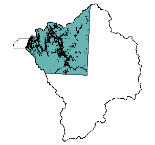
National Wetlands Inventory : Coquille Basin
Identification_Information
Data_Quality_Information
Spatial_Data_Organization_Information
Spatial_Reference_Information
Entity_and_Attribute_Information
Distribution_Information
Metadata_Reference_Information
Identification Information
Section Index
Citation:
Citation Information:
Originator: US Fish and Wildlife Service
Title: National Wetlands Inventory : Coquille Basin
Edition: NA
Geospatial Data Presentation Form: Map
Publication Information:
Publication Place: St.Petersburg, Florida
Publisher:
U.S. Fish & Wildlife Service, National
Wetlands Inventory
Online Linkage: http://www.nwi.fws.gov/
Description:
Abstract:
NWI digital data files are records of wetlands location and classification as defined by the U.S. Fish & Wildlife Service. This dataset is one of a series available in 7.5 minute by 7.5 minute blocks containing ground planimetric coordinates of wetlands point, line, and area features and wetlands attributes. When completed, the series will provide coverage for all of the contiguous United States, Hawaii, Alaska, and U.S. protectorates in the Pacific and Caribbean. The digital data as well as the hardcopy maps that were used as the source for the digital data are produced and distributed by the U.S. Fish & Wildlife Service's National Wetlands Inventory project.
Purpose:
The data provide consultants, planners, and resource managers with information on wetland location and type. The data were collected to meet U.S. Fish & Wildlife Service's mandate to map the wetland and deepwater habitats of the United States.
Supplemental Information: This Particular coverage represents the nwi data available for the Coquille Estuary.
Time Period of Content:
Time Period Information:
Single Date/Time:
Calendar Date: 1995
Time of Day: Unknown
Status:
Progress: Complete
Maintenance and Update Frequency: Unknown
Spatial Domain:
Bounding Coordinates:
West Bounding Coordinate: -121.0125
East Bounding Coordinate: -120.5698
North Bounding Coordinate: 43.4008
South Bounding Coordinate: 43.0535
Keywords:
Theme:
Theme Keyword Thesaurus: None
Theme Keyword: Estuary
Theme Keyword: Habitat
Theme Keyword: Wetland
Place:
Place Keyword Thesaurus: None
Place Keyword: Coquille Estuary
Place Keyword: Oregon
Access Constraints: None
Use Constraints:
Federal, State, and local regulatory agencies with jurisdiction over wetlands may define and describe wetlands in a different manner than that used in this inventory.
There is no attempt, in either the design or products of this inventory, to define the limits of proprietary jurisdiction of any Federal, State, or local government or to establish the geographical scope of the regulatory programs of government
agencies. Persons intending to engage in activities involving modifications within or adjacent to wetland areas should
seek the advice of appropriate Federal, State, or local agencies concerning specified agency regulatory programs and proprietary jurisdictions that may affect such activities.
Point of Contact:
Contact Information:
Contact Organization Primary:
Contact Organization:
Oregon Ocean Coastal Management Program - Department of
Land Conservation and Development
Contact Person: Tanya Haddad
Contact Position: DEMIS Coordinator
Contact Address:
Address Type: mailing and physical address
Address: 800 NE Oregon Street #18
City: Portland
State or Province: Oregon
Postal Code: 97232
Country: USA
Contact Voice Telephone: 503-731-4065 x30
Contact Facsimile Telephone: 503-731-4068
Contact Electronic Mail Address: tanya.haddad@state.or.us
Native Data Set Environment: Arc/Info coverage format
Data Quality Information
Section Index
Logical Consistency Report:
Polygons intersecting the
neatline are closed along the border. Segments making up
the outer and inner boundaries of a polygon tie end-to-end to
completely enclose the area. Line segments are a set of sequentially
numbered coordinate pairs. No duplicate features exist nor duplicate
points in a data string. Intersecting lines are separated into
individual line segments at the point of intersection. Point data are
represented by two sets of coordinate pairs, each with the
same coordinate values. All nodes are represented by a single
coordinate pair which indicates the beginning or end of a
line segment. The neatline is generated by connecting the four
corners of the digital file, as established during initialization
of the digital file. All data crossing the neatline are clipped to
the neatline and data within a specified tolerance of the
neatline are snapped to the neatline. Tests for logical consistency are
performed by WAMS verification software (USFWS-NWI).
Lineage:
Source Information:
Source Citation:
Citation Information:
Originator: US Fish and Wildlife Service
Title: National Wetlands Inventory : Coquille Basin
Edition: NA
Geospatial Data Presentation Form: Map
Publication Information:
Publication Place: St.Petersburg, Florida
Publisher:
U.S. Fish & Wildlife Service, National
Wetlands Inventory
Online Linkage: http://www.nwi.fws.gov/
Source Scale Denominator: 58000
Type of Source Media:
black and white, color infrared, or natural color aerial photograph
film transparency
Source Time Period of Content:
Source Contribution:
Source quads were appended (tiled) together and then
clipped to the Basin.
Process Step:
Process Description:
Source quads were appended (tiled) together and then clipped to the Basin Detail: The NWI data does not cover the entire state, and the coverages here represent the full extent of the digital data at this time. The data was downloaded from the NWI ftp site and subsequently unzipped and tarred to produce .dlg and .att files. These files were then subjected to dlg2arc.aml, which was also downloaded from the ftp site. In this way, the initial coverages were reproduced. These files were then appended in ArcInfo to create one coverage for the 250K Coos Bay map. This appended coverage was
cleaned (1 1) to create a primary coverage. This was then divided into arc and polygon coverages, to preserve the full range of attribute data associated with the features.
This was necessary because the dissolve function did not recognize the arc attributes and as a result this information was lost in the process. By reselecting the line features, the arc attributes were preserved in a separate coverage. A new field named TYPE was added and populated with the NWI class for each polygon, to create the option of a simple legend in Arcview. The Polygon coverage was then clipped to the DEMIS estuary basin in ArcInfo, reprojected into Oregon Lambert, and exported from ArcInfo into an e00 and a shapefile.
Cloud Cover: 0
Spatial Data Organization Information
Section Index
Direct Spatial Reference Method: Vector
Point and Vector Object Information:
SDTS Terms Description:
SDTS Point and Vector Object Type: GT-polygon composed of chains
Point and Vector Object Count: 1346
Spatial Reference Information
Section Index
Horizontal Coordinate System Definition:
Planar:
Map Projection:
Map Projection Name: Lambert Conformal Conic
Lambert Conformal Conic:
Standard Parallel: 43
Standard Parallel: 45.5
Longitude of Central Meridian: -120.5
Latitude of Projection Origin: 41.75
False Easting: 400000
False Northing: 0
Planar Coordinate Information:
Planar Coordinate Encoding Method: Coordinate Pair
Coordinate Representation:
Abscissa Resolution: 0
Ordinate Resolution: 0
Planar Distance Units: international feet
Geodetic Model:
Horizontal Datum Name: North American Datum of 1983
Ellipsoid Name: Geodetic Reference System 80
Semi-major Axis: 6378137
Denominator of Flattening Ratio: 298.257
Entity and Attribute Information
Section Index
Detailed Description:
Entity Type:
Entity Type Label: nwi.pat
Entity Type Definition: Polygon Attribute Table
Entity Type Definition Source: None
Attribute:
Attribute Label: Area
Attribute Definition: Area of polygon
Attribute Definition Source: Software generated
Attribute Domain Values:
Unrepresentable Domain: Software computed
Attribute:
Attribute Label: Attribute
Attribute:
Attribute Label: Nwi#
Attribute Definition: Internal feature number
Attribute Definition Source: Software generated
Attribute Domain Values:
Unrepresentable Domain: Software computed
Attribute:
Attribute Label: Nwi-id
Attribute Definition: Feature identification number
Attribute Definition Source: Software generated
Attribute Domain Values:
Unrepresentable Domain: User Defined
Attribute:
Attribute Label: Nwi_new_
Attribute Domain Values:
Range Domain:
Range Domain Minimum: 1356
Range Domain Maximum: 3902
Attribute:
Attribute Label: Nwi_new_id
Attribute Domain Values:
Range Domain:
Range Domain Minimum: 1
Range Domain Maximum: 6169
Attribute:
Attribute Label: Perimeter
Attribute Definition: Perimeter of polygon
Attribute Definition Source: Software generated
Attribute Domain Values:
Unrepresentable Domain: Software computed
Attribute:
Distribution Information
Section Index
Distributor:
Contact Information:
Contact Organization Primary:
Contact Organization:
Oregon Ocean Coastal Management Program - Department of
Land Conservation and Development
Contact Person: Tanya Haddad
Contact Position: DEMIS Coordinator
Contact Address:
Address Type: mailing and physical address
Address: 800 NE Oregon Street #18
City: Portland
State or Province: Oregon
Postal Code: 97232
Country: USA
Contact Voice Telephone: 503-731-4065 x30
Contact Facsimile Telephone: 503-731-4068
Contact Electronic Mail Address: tanya.haddad@state.or.us
Resource Description: Coquille Estuary NWI
Distribution Liability:
THE DATA AND ASSOCIATED DATA FILES ON THIS CD-ROM ARE
PROVIDED ""AS IS,"" WITHOUT WARRANTY TO THEIR PERFORMANCE, MERCHANTABLE
STATE, OR FITNESS FOR ANY PARTICULAR PURPOSE. THE ENTIRE RISK
ASSOCIATED WITH THE RESULTS AND PERFORMANCES OF THE DATA IS ASSUMED
BY THE USER. THIS DATA IS NOT FOR NAVIGATIONAL OR LEGAL PURPOSES.
Available Time Period:
Metadata Reference Information
Section Index
Metadata Date: 1/1/2000
Metadata Review Date:
Metadata Future Review Date:
Metadata Contact:
Contact Information:
Contact Organization Primary:
Contact Organization:
Oregon Ocean Coastal Management Program - Department of
Land Conservation and Development
Contact Person: Tanya Haddad
Contact Position: DEMIS Coordinator
Contact Address:
Address Type: mailing and physical address
Address: 800 NE Oregon Street #18
City: Portland
State or Province: Oregon
Postal Code: 97232
Country: USA
Contact Voice Telephone: 503-731-4065 x30
Contact Facsimile Telephone: 503-731-4068
Contact Electronic Mail Address: tanya.haddad@state.or.us
Metadata Standard Name: FGDC CSDGM
Metadata Standard Version: FGDC-STD-001-1998
SMMS Metadata report generated 3/27/2002