Instream Water Rights for the Coquille Basin, 1999
Identification_Information
Data_Quality_Information
Spatial_Data_Organization_Information
Spatial_Reference_Information
Entity_and_Attribute_Information
Distribution_Information
Metadata_Reference_Information
Identification Information
Section Index
Citation:
Citation Information:
Originator: Oregon Water Resources Department
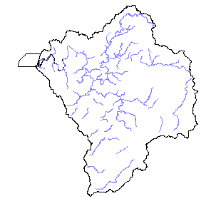
Title: Instream Water Rights for the Coquille Basin, 1999
Edition: 1999
Geospatial Data Presentation Form: Map
Publication Information:
Publication Place: Salem, Oregon
Publisher: Oregon Water Resources Department
Online Linkage: http://www.wrd.state.or.us/
Larger Work Citation:
Citation Information:
Originator: Oregon Water Resources Department
Title: Oregon Instream Water Rights
Description:
Abstract: The water rights information portrayed in the OWRD GIS
Supplemental Information:
It is STRONGLY recommended that if you have any questions concerning individual water rights that you contact your
local watermaster or the water rights staff at the Oregon Water Resources Department.
Time Period of Content:
Time Period Information:
Single Date/Time:
Calendar Date: 1981
Time of Day: Unknown
Currentness Reference: 1999
Status:
Progress: In work
Maintenance and Update Frequency: Continually
Spatial Domain:
Bounding Coordinates:
West Bounding Coordinate: -121.0107
East Bounding Coordinate: -120.2464
North Bounding Coordinate: 43.3811
South Bounding Coordinate: 42.7476
Keywords:
Theme:
Theme Keyword Thesaurus: None
Theme Keyword: Water
Theme Keyword: Water Rights
Theme Keyword: Minimum Flow
Place:
Place Keyword Thesaurus: None
Place Keyword: Oregon Coquille
Access Constraints: None
Use Constraints: see Distribution Liability
Point of Contact:
Contact Information:
Contact Organization Primary:
Contact Organization: US Forest Service
Contact Person: Anne Boeder/ Jim McGuinnes
Contact Position: GIS Analyst
Contact Address:
Address Type: mailing and physical address
Address: 1300 Airport Way
City: North Bend
State or Province: Oregon
Postal Code: 97459
Country: USA
Native Data Set Environment: Arc/Info coverage format
Data Quality Information
Section Index
Logical Consistency Report: The data are assumed to be logically consistent. No extensive tests were performed.
Completeness Report: NA
Positional Accuracy:
Horizontal Positional Accuracy:
Horizontal Positional Accuracy Report:
The data are compiled by the GIS section using 1:100,000 scale hydrography. The water rights information portrayed in the OWRD GIS themes have been interpreted by the Department's Staff from information in the Department's files and are intended to represent that interpretation graphically. Locations shown are only approximate and should not be used in legal, financial, or real estate decisions.
Lineage:
Source Information:
Source Citation:
Citation Information:
Originator: Oregon Water Resources Department
Title: Instream Water Rights Theme (South Coast)
Edition: 1999
Geospatial Data Presentation Form: map
Publication Information:
Publication Place: Salem, Oregon
Publisher: Oregon Water Resources Department
Other Citation Details:
Ver. 1.1, 4/13/2000 - OWRD INSTREAM WATER RIGHTS THEMES DOC Oregon Water Resources Department INSTREAM WATER RIGHTS THEMES Document version 1.1 April 13, 2000 WRIS Contact: GIS Contact: Kathy Boles, WRIS Administrator Robert Harmon, GIS
Coordinator Tel.: 503-378-8455, x313 Tel.: 503-378-8455, x258
Email: Kathy.J.BOLES@wrd.state.or.us Email: robert.c.harmon@wrd.state.or.us
Content & structure
The early generation of instream rights were defined by minimum flow past a point. Current instream rights are defined along stream reaches. Both types of themes have attributes attached from OWRD’s Water Right Information System (WRIS). The information is broken down by minimum flow for two-week periods (first and second half of each month) and expressed in CFS (cubic feet per second). The data are compiled by the GIS section using 1:100,000-scale hydrography in the Oregon Lambert Projection (box at right). The themes, points (if present) and lines, are distributed in the ESRI ‘shapefile’ format by basin and use the following naming convention: <basin>ispt.shp (points) and <basin>isln.shp
(lines) They are distributed on the OWRD web site zipped together
as: <basin>iswr.zip
Legal disclaimer
The water rights information portrayed in the OWRD GIS themes have been interpreted by the Department's staff from information in the department's files and are intended to represent that interpretation graphically. Locations shown are only approximate and should not be used in legal, financial, or real estate decisions. For more accurate legal location information, please contact the Department. It is strongly recommended that if you have any questions concerning individual water rights that you contact your local watermaster or the water rights staff at the Oregon
Water Resources Department.
Online Linkage: http://www.wrd.state.or.us/
Larger Work Citation:
Citation Information:
Originator: Oregon Water Resources Department
Title: Oregon Instream Water Rights
Source Scale Denominator: 100000
Source Time Period of Content:
Time Period Information:
Range of Dates/Times:
Beginning Time: Unknown
Ending Time: Unknown
Source Currentness Reference: 1999
Source Citation Abbreviation: H20_rts
Source Contribution: The Coquille coverage is merely a clip from the south coast Instream Water Rights Theme
Process Step:
Process Description:
The South Coast Instream Water Rights coverage was downloaded from the OWRD website, unzipped, converted to an
Arc Info Coverage, and clipped to the Coquille Basin.
Process Date: 1999
Cloud Cover: 0
Spatial Data Organization Information
Section Index
Direct Spatial Reference Method: Vector
Point and Vector Object Information:
SDTS Terms Description:
SDTS Point and Vector Object Type: Complete Chain
Point and Vector Object Count: 348
Spatial Reference Information
Section Index
Horizontal Coordinate System Definition:
Planar:
Map Projection:
Map Projection Name: Lambert Conformal Conic
Lambert Conformal Conic:
Standard Parallel: 43
Standard Parallel: 45.5
Longitude of Central Meridian: -120.5
Latitude of Projection Origin: 41.75
False Easting: 400000
False Northing: 0
Planar Coordinate Information:
Planar Coordinate Encoding Method: Coordinate Pair
Coordinate Representation:
Abscissa Resolution: 0
Ordinate Resolution: 0
Planar Distance Units: international feet
Geodetic Model:
Horizontal Datum Name: North American Datum of 1983
Ellipsoid Name: Geodetic Reference System 80
Semi-major Axis: 6378137
Denominator of Flattening Ratio: 298.257
Entity and Attribute Information
Section Index
Overview Description:
Entity and Attribute Overview: The early generation of instream rights were defined by minimum flow past a point. Current instream rights are defined along stream reaches. Both types of themes have
Entity and Attribute Detail Citation:
see http://www.wrd.state.or.us/waterrights/wrisuse.html
ftp://www.wrd.state.or.us/pub/water_right_data/documentation/wrisdbfdoc.pdf
ftp://www.wrd.state.or.us/pub/water_right_data/documentation/iswr.pdf
Distribution Information
Section Index
Distributor:
Contact Information:
Contact Organization Primary:
Contact Organization: Oregon Water Resources Department
Contact Person: Robert Harmon
Contact Position: GIS Coordinator
Contact Address:
Address Type: mailing and physical address
Address: 158 12th Street NE
City: Salem
State or Province: Oregon
Postal Code: 97310
Country: USA
Contact Voice Telephone: 503-378-8455 x258
Contact Facsimile Telephone: 503-378-2496
Contact Electronic Mail Address: robert.c.harmon@wrd.state.or.us
Distribution Liability:
The water rights information portrayed in the OWRD GIS themes have been interpreted by the Department's staff from information in the Department's files and are intended to represent that interpretation graphically. Locations shown are only approximate and should not be used in legal, financial, or real estate decisions. For more accurate legal location information, please contact the Department. It is strongly recommended that if you have any questions concerning individual water rights that you contact your local watermaster or the water rights staff at the Oregon
Water Resources Department.
Available Time Period:
Time Period Information:
Single Date/Time:
Calendar Date: 1900
Time of Day: Unknown
Metadata Reference Information
Section Index
Metadata Date: 1/1/2000
Metadata Review Date: 1/1/2000
Metadata Future Review Date:
Metadata Contact:
Contact Information:
Contact Organization Primary:
Contact Organization:
Oregon Ocean Coastal Management Program - Department of
Land Conservation and Development
Contact Person: Tanya Haddad
Contact Position: DEMIS Coordinator
Contact Address:
Address Type: mailing and physical address
Address: 800 NE Oregon Street #18
City: Portland
State or Province: Oregon
Postal Code: 97232
Country: USA
Contact Voice Telephone: 503-731-4065 x30
Contact Facsimile Telephone: 503-731-4068
Contact Electronic Mail Address: tanya.haddad@state.or.us
Metadata Standard Name: FGDC CSDGM
Metadata Standard Version: FGDC-STD-001-1998
SMMS Metadata report generated 3/27/2002