Instream Water Rights along Stream Reaches in the Sixes Watershed, OWRD, 2001
Identification_Information
Data_Quality_Information
Spatial_Data_Organization_Information
Spatial_Reference_Information
Entity_and_Attribute_Information
Distribution_Information
Metadata_Reference_Information
Identification Information
Section Index
Citation:
Citation Information:
Originator: Water Resources Division
Publication Date: 20010308
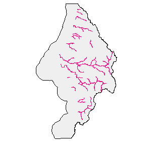
Title: Instream Water Rights along Stream Reaches in the Sixes Watershed, OWRD, 2001
Geospatial Data Presentation Form: vector digital data
Online Linkage: http://www.wrd.state.or.us/maps/wrexport.shtml
Description:
Abstract:
The early generation of instream rights were defined by minimum flow past a point. Current instream
rights are defined along stream reaches. Both types of themes have attributes attached from OWRD's
Water Right Information System (WRIS). The information is broken down by
minimum flow for two-week periods (first and second half of each month) and
expressed in CFS (cubic feet per second).
Purpose:
The water rights information portrayed in the OWRD GIS themes have been interpreted by the
Department's staff from information in the Department's files and are intended to represent that
interpretation graphically. Locations shown are only approximate and should not be used in legal,
financial, or real estate decisions. For more accurate legal location information, please contact the
Department.
Supplemental Information:
20040226 For purposes of Oregon Coastal Atlas project this data was reprojected and clipped to basin boundaries. Please refer to originators for original data and further information regarding this data.
Time Period of Content:
Time Period Information:
Single Date/Time:
Calendar Date: 3/8/2001
Time of Day: Unknown
Currentness Reference: publication date
Status:
Progress: Complete
Maintenance and Update Frequency: Unknown
Spatial Domain:
Bounding Coordinates:
West Bounding Coordinate: -124.703537
East Bounding Coordinate: -124.134727
North Bounding Coordinate: 43.122093
South Bounding Coordinate: 42.415104
Keywords:
Theme:
Theme Keyword Thesaurus: None
Theme Keyword: water rights
Theme Keyword: instream
Place:
Place Keyword Thesaurus: None
Place Keyword: Oregon
Place Keyword: Sixes
Access Constraints: none
Use Constraints:
The water rights information portrayed in the OWRD GIS themes have been interpreted by the
Department's staff from information in the Department's files and are intended to represent that
interpretation graphically. Locations shown are only approximate and should not be used in legal,
financial, or real estate decisions. For more accurate legal location information, please contact the
Department. It is strongly recommended that if you have any questions concerning individual water rights that you
contact your local watermaster or the water rights staff at the Oregon Water Resources Department.
Point of Contact:
Contact Information:
Contact Person Primary:
Contact Person: Robert Harmon
Contact Organization: Oregon Water Resources Department
Contact Position: GIS Coordinator
Contact Address:
Address Type: mailing and physical address
Address: 725 Summer Street NE, Suite A
City: Salem
State or Province: OR
Postal Code: 97301-1271
Country: USA
Contact Voice Telephone: 503.378.8455 x258
Contact Electronic Mail Address: robert.c.harmon@wrd.state.or.us
Native Data Set Environment: Microsoft Windows 2000 Version 5.0 (Build 2195) Service Pack 4; ESRI ArcCatalog 8.3.0.800
Data Quality Information
Section Index
Attribute Accuracy:
Attribute Accuracy Report: attributes are attached from WRIS
Logical Consistency Report: line topology
Completeness Report: No exclusions in western oregon
Positional Accuracy:
Horizontal Positional Accuracy:
Horizontal Positional Accuracy Report: mapped to 1:100,000 hydrography
Lineage:
Process Step:
Process Description: See purpose
Process Date: 2002
Cloud Cover: 0
Spatial Data Organization Information
Section Index
Direct Spatial Reference Method: Vector
Point and Vector Object Information:
SDTS Terms Description:
SDTS Point and Vector Object Type: Complete chain
Point and Vector Object Count: 5237
SDTS Terms Description:
SDTS Point and Vector Object Type: Point
Point and Vector Object Count: 641
Spatial Reference Information
Section Index
Horizontal Coordinate System Definition:
Planar:
Map Projection:
Map Projection Name: Lambert Conformal Conic
Lambert Conformal Conic:
Standard Parallel: 43
Standard Parallel: 45.5
Longitude of Central Meridian: -120.5
Latitude of Projection Origin: 41.75
False Easting: 400000
False Northing: 0
Planar Coordinate Information:
Planar Coordinate Encoding Method: Coordinate Pair
Coordinate Representation:
Abscissa Resolution: 0.004096
Ordinate Resolution: 0.004096
Planar Distance Units: international feet
Geodetic Model:
Horizontal Datum Name: North American Datum of 1983
Ellipsoid Name: Geodetic Reference System 80
Semi-major Axis: 6378137
Denominator of Flattening Ratio: 298.257
Entity and Attribute Information
Section Index
Detailed Description:
Entity Type:
Entity Type Label: isln.aat
Entity Type Definition: Arc attribute table
Entity Type Definition Source: ArcInfo 7.2.1
Attribute:
Attribute Label: ADDSTR
Attribute Definition Source: Oregon Water Resources Division
Attribute:
Attribute Label: APR1
Attribute Definition: Minimum flow for the two-week period beginning Apr 1
Attribute Definition Source: Oregon Water Resources Division
Attribute Domain Values:
Unrepresentable Domain: Minimum flow expressed in CFS (cubic feet per second)
Attribute:
Attribute Label: APR16
Attribute Definition: Minimum flow for the two-week period beginning Apr 16
Attribute Definition Source: Oregon Water Resources Division
Attribute Domain Values:
Unrepresentable Domain: Minimum flow expressed in CFS (cubic feet per second)
Attribute:
Attribute Label: AUG1
Attribute Definition: Minimum flow for the two-week period beginning Aug 1
Attribute Definition Source: Oregon Water Resources Division
Attribute Domain Values:
Unrepresentable Domain: Minimum flow expressed in CFS (cubic feet per second)
Attribute:
Attribute Label: AUG16
Attribute Definition: Minimum flow for the two-week period beginning Aug 16
Attribute Definition Source: Oregon Water Resources Division
Attribute Domain Values:
Unrepresentable Domain: Minimum flow expressed in CFS (cubic feet per second)
Attribute:
Attribute Label: CERTIFICATE
Attribute Definition: OWRD Certificate Number
Attribute Definition Source: Oregon Water Resources Division
Attribute Domain Values:
Unrepresentable Domain: OWRD Certificate Number
Attribute:
Attribute Label: COMMENTS
Attribute Definition Source: Oregon Water Resources Division
Attribute:
Attribute Label: COND_CODE
Attribute Definition Source: Oregon Water Resources Division
Attribute:
Attribute Label: DEC1
Attribute Definition: Minimum flow for the two-week period beginning Dec 1
Attribute Definition Source: Oregon Water Resources Division
Attribute Domain Values:
Unrepresentable Domain: Minimum flow expressed in CFS (cubic feet per second)
Attribute:
Attribute Label: DEC16
Attribute Definition: Minimum flow for the two-week period beginning Dec 16
Attribute Definition Source: Oregon Water Resources Division
Attribute Domain Values:
Unrepresentable Domain: Minimum flow expressed in CFS (cubic feet per second)
Attribute:
Attribute Label: FEB1
Attribute Definition: Minimum flow for the two-week period beginning Feb 1
Attribute Definition Source: Oregon Water Resources Division
Attribute Domain Values:
Unrepresentable Domain: Minimum flow expressed in CFS (cubic feet per second)
Attribute:
Attribute Label: FEB16
Attribute Definition: Minimum flow for the two-week period beginning Feb 16
Attribute Definition Source: Oregon Water Resources Division
Attribute Domain Values:
Unrepresentable Domain: Minimum flow expressed in CFS (cubic feet per second)
Attribute:
Attribute Label: FID
Attribute Definition: Internal feature number.
Attribute Definition Source: ESRI
Attribute Domain Values:
Unrepresentable Domain: Sequential unique whole numbers that are automatically generated.
Attribute:
Attribute Label: FNODE#
Attribute Definition: Internal node number for the beginning of an arc (from-node).
Attribute Definition Source: ESRI
Attribute Domain Values:
Unrepresentable Domain: Whole numbers that are automatically generated.
Attribute:
Attribute Label: ISLN#
Attribute Definition: Internal feature number.
Attribute Definition Source: ESRI
Attribute Domain Values:
Unrepresentable Domain: Sequential unique whole numbers that are automatically generated.
Attribute:
Attribute Label: ISLN-ID
Attribute Definition: User-defined feature number.
Attribute Definition Source: ESRI
Attribute Domain Values:
Unrepresentable Domain: ID
Attribute:
Attribute Label: JAN1
Attribute Definition: Minimum flow for the two-week period beginning Jan 1
Attribute Definition Source: Oregon Water Resources Division
Attribute Domain Values:
Unrepresentable Domain: Minimum flow expressed in CFS (cubic feet per second)
Attribute:
Attribute Label: JAN16
Attribute Definition: Minimum flow for the two-week period beginning Jan 16
Attribute Definition Source: Oregon Water Resources Division
Attribute Domain Values:
Unrepresentable Domain: Minimum flow expressed in CFS (cubic feet per second)
Attribute:
Attribute Label: JUL1
Attribute Definition: Minimum flow for the two-week period beginning Jul 1
Attribute Definition Source: Oregon Water Resources Division
Attribute Domain Values:
Unrepresentable Domain: Minimum flow expressed in CFS (cubic feet per second)
Attribute:
Attribute Label: JUL16
Attribute Definition: Minimum flow for the two-week period beginning Jul 16
Attribute Definition Source: Oregon Water Resources Division
Attribute Domain Values:
Unrepresentable Domain: Minimum flow expressed in CFS (cubic feet per second)
Attribute:
Attribute Label: JUN1
Attribute Definition: Minimum flow for the two-week period beginning Jun 1
Attribute Definition Source: Oregon Water Resources Division
Attribute Domain Values:
Unrepresentable Domain: Minimum flow expressed in CFS (cubic feet per second)
Attribute:
Attribute Label: JUN16
Attribute Definition: Minimum flow for the two-week period beginning Jun 16
Attribute Definition Source: Oregon Water Resources Division
Attribute Domain Values:
Unrepresentable Domain: Minimum flow expressed in CFS (cubic feet per second)
Attribute:
Attribute Label: LENGTH
Attribute Definition: Length of feature in internal units.
Attribute Definition Source: ESRI
Attribute Domain Values:
Unrepresentable Domain: Positive real numbers that are automatically generated.
Attribute:
Attribute Label: LPOLY#
Attribute Definition: Internal node number for the left polygon.
Attribute Definition Source: ESRI
Attribute Domain Values:
Unrepresentable Domain: Whole numbers that are automatically generated.
Attribute:
Attribute Label: MAR1
Attribute Definition: Minimum flow for the two-week period beginning Mar 1
Attribute Definition Source: Oregon Water Resources Division
Attribute Domain Values:
Unrepresentable Domain: Minimum flow expressed in CFS (cubic feet per second)
Attribute:
Attribute Label: MAR16
Attribute Definition: Minimum flow for the two-week period beginning Mar 16
Attribute Definition Source: Oregon Water Resources Division
Attribute Domain Values:
Unrepresentable Domain: Minimum flow expressed in CFS (cubic feet per second)
Attribute:
Attribute Label: MAY1
Attribute Definition: Minimum flow for the two-week period beginning May 1
Attribute Definition Source: Oregon Water Resources Division
Attribute Domain Values:
Unrepresentable Domain: Minimum flow expressed in CFS (cubic feet per second)
Attribute:
Attribute Label: MAY16
Attribute Definition: Minimum flow for the two-week period beginning May 16
Attribute Definition Source: Oregon Water Resources Division
Attribute Domain Values:
Unrepresentable Domain: Minimum flow expressed in CFS (cubic feet per second)
Attribute:
Attribute Label: MINFLOW
Attribute Definition Source: Oregon Water Resources Division
Attribute:
Attribute Label: MINFLOW2
Attribute Definition Source: Oregon Water Resources Division
Attribute:
Attribute Label: NOV1
Attribute Definition: Minimum flow for the two-week period beginning Nov 1
Attribute Definition Source: Oregon Water Resources Division
Attribute Domain Values:
Unrepresentable Domain: Minimum flow expressed in CFS (cubic feet per second)
Attribute:
Attribute Label: NOV16
Attribute Definition: Minimum flow for the two-week period beginning Nov 16
Attribute Definition Source: Oregon Water Resources Division
Attribute Domain Values:
Unrepresentable Domain: Minimum flow expressed in CFS (cubic feet per second)
Attribute:
Attribute Label: OCT1
Attribute Definition: Minimum flow for the two-week period beginning Oct 1
Attribute Definition Source: Oregon Water Resources Division
Attribute Domain Values:
Unrepresentable Domain: Minimum flow expressed in CFS (cubic feet per second)
Attribute:
Attribute Label: OCT16
Attribute Definition: Minimum flow for the two-week period beginning Oct 16
Attribute Definition Source: Oregon Water Resources Division
Attribute Domain Values:
Unrepresentable Domain: Minimum flow expressed in CFS (cubic feet per second)
Attribute:
Attribute Label: PERMIT
Attribute Definition: OWRD Permit Number
Attribute Definition Source: Oregon Water Resources Division
Attribute Domain Values:
Unrepresentable Domain: OWRD Permit Number
Attribute:
Attribute Label: PRIORITY
Attribute Definition: Date of Appropriation listed as year/month/day;Water Rights are assigned a ""Priority Date"" which is used to determine who has primary rights in times of water shortages.
Attribute Definition Source: Oregon Water Resources Division
Attribute Domain Values:
Unrepresentable Domain: Date of Appropriation; for further information refer to http://www.wrd.state.or.us/maps/wrmapfaq.html#2.3.1
Attribute:
Attribute Label: PURPOSE1
Attribute Definition Source: Oregon Water Resources Division
Attribute:
Attribute Label: RPOLY#
Attribute Definition: Internal node number for the right polygon.
Attribute Definition Source: ESRI
Attribute Domain Values:
Unrepresentable Domain: Whole numbers that are automatically generated.
Attribute:
Attribute Label: SEP1
Attribute Definition: Minimum flow for the two-week period beginning Sep 1
Attribute Definition Source: Oregon Water Resources Division
Attribute Domain Values:
Unrepresentable Domain: Minimum flow expressed in CFS (cubic feet per second)
Attribute:
Attribute Label: SEP16
Attribute Definition: Minimum flow for the two-week period beginning Sep 16
Attribute Definition Source: Oregon Water Resources Division
Attribute Domain Values:
Unrepresentable Domain: Minimum flow expressed in CFS (cubic feet per second)
Attribute:
Attribute Label: Shape
Attribute Definition: Feature geometry.
Attribute Definition Source: ESRI
Attribute Domain Values:
Unrepresentable Domain: Coordinates defining the features.
Attribute:
Attribute Label: STATION
Attribute Definition: Gaging station
Attribute Definition Source: Oregon Water Resources Division
Attribute Domain Values:
Unrepresentable Domain: Gaging station
Attribute:
Attribute Label: STR-NAME
Attribute Definition: Stream Name
Attribute Definition Source: Oregon Water Resources Division
Attribute Domain Values:
Unrepresentable Domain: Stream Name
Attribute:
Attribute Label: STREAM_CODE
Attribute Definition: OWRD assigned stream code
Attribute Definition Source: Oregon Water Resources Division
Attribute Domain Values:
Unrepresentable Domain: OWRD assigned stream code
Attribute:
Attribute Label: TNODE#
Attribute Definition: Internal node number for the end of an arc (to-node).
Attribute Definition Source: ESRI
Attribute Domain Values:
Unrepresentable Domain: Whole numbers that are automatically generated.
Distribution Information
Section Index
Distributor:
Contact Information:
Contact Person Primary:
Contact Person: Robert Harmon
Contact Organization: Oregon Water Resources Department
Contact Position: GIS Coordinator
Contact Address:
Address Type: mailing and physical address
Address: 725 Summer Street NE, Suite A
City: Salem
State or Province: OR
Postal Code: 97301-1271
Country: USA
Contact Voice Telephone: 503.378.8455 x258
Contact Electronic Mail Address: robert.c.harmon@wrd.state.or.us
Resource Description: Downloadable Data
Distribution Liability:
Ecotrust makes no express or implied warrantees with respect to
the character, fitness, or accuracy of the information presented,
or their appropriateness for any users purposes.
Standard Order Process:
Digital Form:
Digital Transfer Information:
Format Name: shapefile of Coverage
Format Version Number: 7.2.1
File Decompression Technique: Unzip or pkunzip
Digital Transfer Option:
Online Option:
Computer Contact Information:
Network Address:
Network Resource Name: http://www.wrd.state.or.us/maps/wrexport.shtml
Access Instructions: Anonymous web download
Fees: None
Ordering Instructions: Obtain data at http://www.wrd.state.or.us/maps/wrexport.shtml
Turnaround: Less than 1 hour
Available Time Period:
Time Period Information:
Single Date/Time:
Calendar Date: Unknown
Time of Day: Unknown
Metadata Reference Information
Section Index
Metadata Date: 2/27/2004
Metadata Review Date:
Metadata Future Review Date:
Metadata Contact:
Contact Information:
Contact Organization Primary:
Contact Organization: Ecotrust
Contact Address:
Address Type: mailing address
Address: 721 NW 9th Suite 200
City: Portland
State or Province: Oregon
Postal Code: 97209
Country: USA
Contact Voice Telephone: 503-227-6225
Contact Instructions: Ecotrust created FGDC metadata from the originator's metadata so we can serve the GIS information. Please refer back to the originator for updates and additional information or clarification.
Metadata Standard Name: FGDC Content Standards for Digital Geospatial Metadata
Metadata Standard Version: FGDC-STD-001-1998
Metadata Time Convention: local time
Metadata Extensions:
Online Linkage: http://www.esri.com/metadata/esriprof80.html
Profile Name: ESRI Metadata Profile
SMMS Metadata report generated 3/31/2005