Geologic Faults in the Sixes Watershed, USGS, 1996
Identification_Information
Data_Quality_Information
Spatial_Data_Organization_Information
Spatial_Reference_Information
Entity_and_Attribute_Information
Distribution_Information
Metadata_Reference_Information
Identification Information
Section Index
Citation:
Citation Information:
Originator: United States Geologic Survey
Publication Date: 19960325
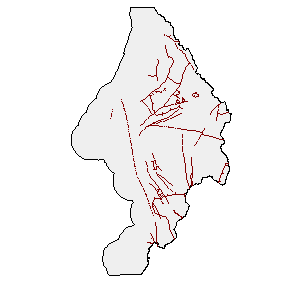
Title: Geologic Faults in the Sixes Watershed, USGS, 1996
Geospatial Data Presentation Form: Map
Publication Information:
Publication Place: Portland, Oregon
Publisher: Oregon Bureau of Land Management
Online Linkage: http://www.or.blm.gov/gis/resources/dataset.asp?cid=63
Description:
Abstract: This theme shows all known geological faults in Oregon
Purpose: Resource Management Planning
Supplemental Information:
BLM (Bureau of Land Management), USGS (United States
Geological Survey) 20040218 For purposes of Oregon Coastal
Atlas project this data was reprojected and clipped to
basin boundaries. Please refer to originators for original
data and further information regarding this data
Time Period of Content:
Time Period Information:
Range of Dates/Times:
Beginning Date: 7/5/1980
Beginning Time: Unknown
Ending Date: Present
Ending Time: Unknown
Currentness Reference: publication date
Status:
Progress: Complete
Maintenance and Update Frequency: Unknown
Spatial Domain:
Bounding Coordinates:
West Bounding Coordinate: -124.703537
East Bounding Coordinate: -124.134727
North Bounding Coordinate: 43.122093
South Bounding Coordinate: 42.415104
Keywords:
Theme:
Theme Keyword Thesaurus: None
Theme Keyword: Minerals
Theme Keyword: Geology
Theme Keyword: Faults
Place:
Place Keyword Thesaurus: None
Place Keyword: Oregon
Place Keyword: Sixes
Access Constraints: None
Use Constraints:
Acknowledgement of the U.S. Geological Survey would be
appreciated in products derived from these data
Point of Contact:
Contact Information:
Contact Organization Primary:
Contact Organization: Bureau of Land Management, OR/WA State Office
Contact Person: Lisa Blackburn
Contact Position: State Records Administrator
Contact Address:
Address Type: mailing and physical address
Address: P. O. Box 2965
City: Portland
State or Province: OR
Postal Code: 97208
Country: USA
Contact Voice Telephone: (503)952-6276
Contact Facsimile Telephone: NA
Contact Electronic Mail Address: lblackbu@or.blm.gov
Hours of Service: NA
Native Data Set Environment: Arc/Info coverage format
Data Quality Information
Section Index
Attribute Accuracy:
Attribute Accuracy Report: Refer to DLG24 metadata
Logical Consistency Report: Refer to DLG24 metadata. This theme is built for line topology.
Completeness Report: Refer to DLG24 metadata. This theme covers all of Oregon.
Positional Accuracy:
Horizontal Positional Accuracy:
Horizontal Positional Accuracy Report: Unknown. Intended scale is 500000
Vertical Positional Accuracy:
Vertical Positional Accuracy Report: NA.
Lineage:
Source Information:
Source Citation:
Citation Information:
Originator: United States Geological Survey
Publication Date: 19800705
Title: Faults
Edition: NA
Geospatial Data Presentation Form: map
Publication Information:
Publication Place: Reston, VA
Publisher: United States Geological Survey
Source Scale Denominator: 500000
Type of Source Media: NA
Source Time Period of Content:
Time Period Information:
Range of Dates/Times:
Beginning Date: 1980
Beginning Time: Unknown
Ending Date: 1996
Ending Time: Unknown
Source Currentness Reference: publication date
Source Citation Abbreviation: Faults
Source Contribution: Fault features
Process Step:
Process Description:
Refer to DLG24 metadata
The Q100 Library was converted from Arc/Info ver. 6.1.2 to
Arc/Info ver. 7.0.3.
Source Used Citation Abbreviation: Faults
Process Date: 19960325
Cloud Cover: 0
Spatial Data Organization Information
Section Index
Direct Spatial Reference Method: Vector
Point and Vector Object Information:
SDTS Terms Description:
SDTS Point and Vector Object Type: Complete Chain
Point and Vector Object Count: 25966
Spatial Reference Information
Section Index
Horizontal Coordinate System Definition:
Planar:
Map Projection:
Map Projection Name: Lambert Conformal Conic
Lambert Conformal Conic:
Standard Parallel: 43
Standard Parallel: 45.5
Longitude of Central Meridian: -120.5
Latitude of Projection Origin: 41.75
False Easting: 400000
False Northing: 0
Planar Coordinate Information:
Planar Coordinate Encoding Method: Coordinate Pair
Coordinate Representation:
Abscissa Resolution: 0.001
Ordinate Resolution: 0.001
Planar Distance Units: international feet
Geodetic Model:
Horizontal Datum Name: North American Datum of 1983
Ellipsoid Name: Geodetic Reference System 80
Semi-major Axis: 6378137
Denominator of Flattening Ratio: 298.257
Entity and Attribute Information
Section Index
Detailed Description:
Entity Type:
Entity Type Label: or_fault.aat
Entity Type Definition: Arc Attribute Table
Entity Type Definition Source: None
Attribute:
Attribute Label: Fnode#
Attribute Definition: From-node identifier of linear feature
Attribute Definition Source: Software generated
Attribute Domain Values:
Unrepresentable Domain: Software computed
Attribute:
Attribute Label: Length
Attribute Definition: Length of line
Attribute Definition Source: Software generated
Attribute Domain Values:
Unrepresentable Domain: Software computed
Attribute:
Attribute Label: Lpoly#
Attribute Definition: Internal number of polygon to left of arc
Attribute Definition Source: Software generated
Attribute Domain Values:
Unrepresentable Domain: Software computed
Attribute:
Attribute Label: Or_fault#
Attribute Definition: Internal feature number
Attribute Definition Source: Software generated
Attribute Domain Values:
Unrepresentable Domain: Software computed
Attribute:
Attribute Label: Or_fault-id
Attribute Definition: Feature identification number
Attribute Definition Source: Software generated
Attribute Domain Values:
Unrepresentable Domain: User Defined
Attribute:
Attribute Label: Rpoly#
Attribute Definition: Internal number of polygon to right of arc
Attribute Definition Source: Software generated
Attribute Domain Values:
Unrepresentable Domain: Software computed
Attribute:
Attribute Label: Tnode#
Attribute Definition: To-node identifier of linear feature
Attribute Definition Source: Software generated
Attribute Domain Values:
Unrepresentable Domain: Software computed
Distribution Information
Section Index
Distributor:
Contact Information:
Contact Organization Primary:
Contact Organization: Bureau of Land Management, OR/WA State Office
Contact Person: Lisa Blackburn
Contact Position: State Records Administrator
Contact Address:
Address Type: mailing and physical address
Address: P. O. Box 2965
City: Portland
State or Province: OR
Postal Code: 97208
Country: USA
Contact Voice Telephone: (503)952-6276
Contact Facsimile Telephone: NA
Contact Electronic Mail Address: lblackbu@or.blm.gov
Hours of Service: NA
Resource Description: Sixes Faults (Line)
Distribution Liability:
No warranty is made by the Bureau of Land Management
as to the accuracy, reliability, or completeness of
these data for individual use or aggregate use with other data.
Ecotrust makes no express or implied warrantees with
respect to the character, fitness, or accuracy of the
information presented, or their appropriateness for any
users purposes
Standard Order Process:
Digital Form:
Digital Transfer Information:
Digital Transfer Option:
Offline Option:
Offline Media: 8 mm cartridge tape
Recording Format: TAR
Compatibility Information: Sun UNIX
Fees:
$8 administrative fee; $18.60 per hour research time (human
time spent to locate the files and make the tape); $0.13
per page copying costs (8.5x11 up to 8.5x14); $7.50 per
paper plot; $16.00 per mylar plot; cost of media
(diskettes, tapes, etc); cost of postage (based on actual
postage, including tubes, padded envelopes,
overnight/express mail, etc)
Ordering Instructions: Contact Distributor
Custom Order Process: Contact Distributor
Available Time Period:
Time Period Information:
Single Date/Time:
Calendar Date: 1/1/1895
Time of Day: Unknown
Metadata Reference Information
Section Index
Metadata Date: 3/21/2003
Metadata Review Date: 3/21/2003
Metadata Future Review Date:
Metadata Contact:
Contact Information:
Contact Organization Primary:
Contact Organization: O.S.U. Geosciences Department
Contact Person: Lisa Reiley
Contact Position: Metadata Intern
Contact Address:
Address Type: Mailing and physical address
Address: 104 Wilkinson Hall, Oregon State University
City: Corvallis
State or Province: OR.
Postal Code: 97330.
Country: U.S.A.
Contact Voice Telephone: (541) 737-1201
Contact Facsimile Telephone: (541) 737-1200
Contact Electronic Mail Address: geo-oss@geo.orst.edu / wrightd@geo.orst.edu
Hours of Service: 8:00 a.m. to 5 p.m., Mon. - Fri.
Metadata Standard Name: F.G.D.C. Content Standard for Digital Geospatial Metadata (C.S.D.G.M.)
Metadata Standard Version: FGDC-STD-001-1998
SMMS Metadata report generated 6/13/2005