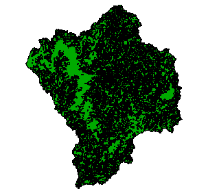
Forest Species & Age in the Coquille Basin, 1993
Identification_Information
Data_Quality_Information
Spatial_Data_Organization_Information
Spatial_Reference_Information
Entity_and_Attribute_Information
Distribution_Information
Metadata_Reference_Information
Identification Information
Section Index
Citation:
Citation Information:
Originator: Oregon Bureau of Land Management
Publication Date: 03012000
Title: Forest Species & Age in the Coquille Basin, 1993
Edition: 2000
Geospatial Data Presentation Form: Map
Publication Information:
Publication Place: Roseburg, Oregon
Publisher: Regional Ecosystem Office, US Forest Service
Other Citation Details:
The Western Oregon Digital Image Project or WODIP is an
attempt to produce a vegetation map of Western Oregon using
satellite data from Landsat Thematic Mapper. Landsat orbits
the earth hundreds of miles up in space, and records energy
reflected or emitted from the earth's surface in various
portions of the electromagnetic spectrum. Different land
covers reflect and absorb different amounts of energy.This
allows the different land covers to be distinguished, and
vegetation maps produced
Online Linkage: http://www.reo.gov
Larger Work Citation:
Citation Information:
Originator: Oregon Bureau of Land Management
Publication Date: 011998
Title: Western Oregon Digital Image Project
Publication Information:
Publication Place: Portland, Oregon
Publisher: Oregon Bureau of Land Management
Online Linkage: http://www.or.blm.gov/gis/docs/guidebook.pdf
Description:
Abstract: This coverage is a vector simplification of the original raster WODIP vegetation map for the area. It depicts all polygons greater than 5 acres of like Tree age and classification.
Purpose:
The purpose of this coverage was to provide a coverage of manageable file size which would give a fair representation
of Forest Species and Age.
Time Period of Content:
Time Period Information:
Range of Dates/Times:
Beginning Date: 1993
Beginning Time: Unknown
Ending Date: 1993
Ending Time: Unknown
Currentness Reference: 1993
Status:
Progress: Complete
Maintenance and Update Frequency: Unknown
Spatial Domain:
Bounding Coordinates:
West Bounding Coordinate: -121.0126
East Bounding Coordinate: -120.2139
North Bounding Coordinate: 43.4103
South Bounding Coordinate: 42.7217
Keywords:
Theme:
Theme Keyword Thesaurus: None
Theme Keyword: Vegetation
Theme Keyword: Land Cover
Theme Keyword: Forest Species
Theme Keyword: Forest Age
Place:
Place Keyword Thesaurus: None
Place Keyword: Oregon
Place Keyword: Coquille
Access Constraints: None
Use Constraints: None
Point of Contact:
Contact Information:
Contact Organization Primary:
Contact Organization: OR/WA State Office, Bureau of Land Management
Contact Person: Jeff Nighbert
Contact Position: Geographer
Contact Address:
Address Type: mailing and physical address
Address: P.O. Box 2965
City: Portland
State or Province: Oregon
Postal Code: 97208
Country: USA
Contact Voice Telephone: 503-952-6399
Native Data Set Environment: Arc/Info coverage format
Data Quality Information
Section Index
Attribute Accuracy:
Attribute Accuracy Report: WODIP Attributes are assumed to be accurate. No extensive tests were performed.
Logical Consistency Report: The data are assumed to be logically consistent. No extensive tests were performed.
Positional Accuracy:
Horizontal Positional Accuracy:
Horizontal Positional Accuracy Report: Unknown
Lineage:
Source Information:
Source Citation:
Citation Information:
Originator: Oregon Bureau of Land Management
Publication Date: 011998
Title: Western Oregon Digital Image Project
Publication Information:
Publication Place: Portland, Oregon
Publisher: Oregon Bureau of Land Management
Online Linkage: http://www.or.blm.gov/gis/docs/guidebook.pdf
Source Time Period of Content:
Time Period Information:
Source Currentness Reference: Ground Condition
Source Citation Abbreviation: Landsat TM/WODIP GRID
Source Contribution: Landsat Data Source provided Spectral Information (25 Meter Pixels). WODIP Data source provided classified integer GRID (25 meter pixels).
Process Step:
Cloud Cover: 0
Spatial Data Organization Information
Section Index
Direct Spatial Reference Method: Vector
Point and Vector Object Information:
SDTS Terms Description:
SDTS Point and Vector Object Type: GT-polygon composed of chains
Point and Vector Object Count: 11908
Spatial Reference Information
Section Index
Horizontal Coordinate System Definition:
Planar:
Map Projection:
Map Projection Name: Lambert Conformal Conic
Lambert Conformal Conic:
Standard Parallel: 43
Standard Parallel: 45.5
Longitude of Central Meridian: -120.5
Latitude of Projection Origin: 41.75
False Easting: 400000
False Northing: 0
Planar Coordinate Information:
Planar Coordinate Encoding Method: Coordinate Pair
Coordinate Representation:
Abscissa Resolution: 0
Ordinate Resolution: 0
Geodetic Model:
Horizontal Datum Name: North American Datum of 1983
Ellipsoid Name: Geodetic Reference System 80
Semi-major Axis: 6378137
Denominator of Flattening Ratio: 298.257
Entity and Attribute Information
Section Index
Detailed Description:
Entity Type:
Entity Type Label: forspec.pat
Entity Type Definition: Polygon Attribute Table
Entity Type Definition Source: None
Attribute:
Attribute Label: Area
Attribute Definition: Area of polygon
Attribute Definition Source: Software generated
Attribute Domain Values:
Unrepresentable Domain: Software computed
Attribute:
Attribute Label: Forspec#
Attribute Definition: Internal feature number
Attribute Definition Source: Software generated
Attribute Domain Values:
Unrepresentable Domain: Software computed
Attribute:
Attribute Label: Forspec-id
Attribute Definition: Feature identification number
Attribute Definition Source: Software generated
Attribute Domain Values:
Unrepresentable Domain: User Defined
Attribute:
Attribute Label: Forspec_
Attribute Definition: Internal feature number
Attribute Definition Source: Software generated
Attribute Domain Values:
Unrepresentable Domain: Software computed
Attribute:
Attribute Label: Forspec_id
Attribute Definition: User assinged Feature ID
Attribute Domain Values:
Range Domain:
Range Domain Minimum: 0
Range Domain Maximum: 18088
Attribute:
Attribute Label: Perimeter
Attribute Definition: Perimeter of polygon
Attribute Definition Source: Software generated
Attribute Domain Values:
Unrepresentable Domain: Software computed
Attribute:
Attribute Label: Species_si
Attribute Definition: Species / Size
Distribution Information
Section Index
Distributor:
Contact Information:
Contact Organization Primary:
Contact Organization:
Oregon Ocean Coastal Management Program - Department of
Land Conservation and Development
Contact Person: Tanya Haddad
Contact Position: DEMIS Coordinator
Contact Address:
Address Type: mailing and physical address
Address: 800 NE Oregon Street #18
City: Portland
State or Province: Oregon
Postal Code: 97232
Country: USA
Contact Voice Telephone: 503-731-4065 x30
Contact Facsimile Telephone: 503-731-4068
Contact Electronic Mail Address: tanya.haddad@state.or.us
Resource Description: Forest Species for the Coquille Basin
Distribution Liability:
THE DATA AND ASSOCIATED DATA FILES ON THIS CD-ROM ARE
PROVIDED ""AS IS,"" WITHOUT WARRANTY TO THEIR PERFORMANCE, MERCHANTABLE STATE, OR FITNESS FOR ANY PARTICULAR PURPOSE. THE ENTIRE RISK ASSOCIATED WITH THE RESULTS AND PERFORMANCES OF THE DATA IS ASSUMED
BY THE USER. THIS DATA IS NOT FOR NAVIGATIONAL OR LEGAL PURPOSES.
Available Time Period:
Metadata Reference Information
Section Index
Metadata Date: 1/1/2000
Metadata Review Date: 1/1/2000
Metadata Future Review Date:
Metadata Contact:
Contact Information:
Contact Organization Primary:
Contact Organization:
Oregon Ocean Coastal Management Program - Department of
Land Conservation and Development
Contact Person: Tanya Haddad
Contact Position: DEMIS Coordinator
Contact Address:
Address Type: mailing and physical address
Address: 800 NE Oregon Street #18
City: Portland
State or Province: Oregon
Postal Code: 97232
Country: USA
Contact Voice Telephone: 503-731-4065 x30
Contact Facsimile Telephone: 503-731-4068
Contact Electronic Mail Address: tanya.haddad@state.or.us
Metadata Standard Name: FGDC CSDGM
Metadata Standard Version: FGDC-STD-001-1998
SMMS Metadata report generated 3/26/2002