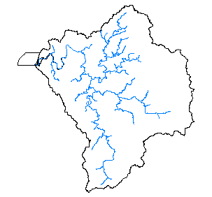
Fall Chinook Salmon Distribution for the Coquille Basin, 1998
Identification_Information
Data_Quality_Information
Spatial_Data_Organization_Information
Spatial_Reference_Information
Entity_and_Attribute_Information
Distribution_Information
Metadata_Reference_Information
Identification Information
Section Index
Citation:
Citation Information:
Originator: Oregon Department of Fish and Wildlife, Keith Hupperts
Publication Date: 1999
Title: Fall Chinook Salmon Distribution for the Coquille Basin, 1998
Edition: 1998
Geospatial Data Presentation Form: Map
Publication Information:
Publication Place: Salem, Oregon
Publisher: Oregon Department of Fish and Wildlife
Online Linkage: http://www.odfw.state.or.us
Larger Work Citation:
Description:
Abstract:
Distribution of Fall Chinook. This is a DYNAMIC dataset in that it represents stream segments that are known to be used by
Fall Chinook. However, these reaches may not be used on an annual basis due to natural variations in run size, water
conditions and other environmental factors.
Purpose: To map known distribution of Fall Chinook salmon.
Supplemental Information:
This data was created through a process where 1:100,000 scale hardcopy maps were plotted by hydrologic unit and then provided to ODFW field staff. Based on survey data, supporting documentation and the best professional judgement of field biologists, the distribution of spawning, rearing and migration use types were then marked on the maps with highlighter pens.This data was then digitized by ODFW GIS staff and stored as event tables in Info file format. For mapping purposes, using the tools of dynamic segmentation, the event tables are combined with the 1:100,000 scale routed streams coverages on a HUC by HUC basis. For the purpose of distributing this data, we have converted the event tables into coverage format with the EVENTARC command.This results in a static version of the "dynamic" data, but in a more common format.
Time Period of Content:
Time Period Information:
Range of Dates/Times:
Beginning Date:
Beginning Time: Unknown
Ending Date: 1998
Ending Time: Unknown
Currentness Reference: Current plans are to update this data every 2 years.
Status:
Progress: In work
Maintenance and Update Frequency: 2 years
Spatial Domain:
Bounding Coordinates:
West Bounding Coordinate: -120.0108
East Bounding Coordinate: -119.3332
North Bounding Coordinate: 43.3965
South Bounding Coordinate: 42.7452
Keywords:
Theme:
Theme Keyword Thesaurus: None
Theme Keyword: Estuary
Theme Keyword: Salmon
Theme Keyword: Chinook
Place:
Place Keyword Thesaurus: None
Place Keyword: Oregon
Place Keyword: Coquille
Place Keyword: Oregon Coast
Access Constraints: None
Use Constraints: Many streams that contain Fall chinook distribution are not found in the 1:100,000 scale streams data.
Point of Contact:
Contact Information:
Contact Organization Primary:
Contact Organization: Oregon Department of Fish and Wildlife
Contact Person: Keith Hupperts
Contact Address:
Address Type: mailing and physical address
Address: 2501 SW Fist Ave, PO Box 59
City: Portland
State or Province: Oregon
Postal Code: 97207
Country: USA
Native Data Set Environment: Arc/Info coverage format
Data Quality Information
Section Index
Attribute Accuracy:
Attribute Accuracy Report: Attribute accuracy is described, where present, with each attribute defined in the Entity and Attribute Section.
Logical Consistency Report: Chain-node topology present.
Completeness Report: All distribution data have been reviewed at least once by the ODFW Field staff (typically District Biologists), however, some of this data may have changed due to its dynamic nature.
Positional Accuracy:
Vertical Positional Accuracy:
Vertical Positional Accuracy Report: NA
Lineage:
Source Information:
Source Citation:
Citation Information:
Originator: Oregon Department of Fish and Wildlife
Publication Date: 1999
Title: Coho Salmon Distribution
Edition: 1998
Geospatial Data Presentation Form: map
Publication Information:
Publication Place: Salem, Oregon
Publisher: Oregon Department of Fish and Wildlife
Online Linkage: http://www.odfw.state.or.us
Larger Work Citation:
Source Time Period of Content:
Time Period Information:
Range of Dates/Times:
Beginning Date:
Beginning Time: Unknown
Ending Date: 1998
Ending Time: Unknown
Source Currentness Reference: Data will be updated every two years
Source Citation Abbreviation: Coho
Source Information:
Source Citation:
Citation Information:
Originator: Oregon Department of Fish and Wildlife
Publication Date: 1999
Title: Fall ChinookSalmon Distribution
Edition: 1996
Geospatial Data Presentation Form: map
Publication Information:
Publication Place: Salem, Oregon
Publisher: Oregon Department of Fish and Wildlife
Online Linkage: http://www.odfw.state.or.us
Larger Work Citation:
Source Time Period of Content:
Time Period Information:
Range of Dates/Times:
Beginning Date:
Beginning Time: Unknown
Ending Date: 1996
Ending Time: Unknown
Source Currentness Reference: Data will be updated every two years
Source Citation Abbreviation: Fall Chinook
Process Step:
Source Used Citation Abbreviation: Fall Chinook
Process Date: 071999
Cloud Cover: 0
Spatial Data Organization Information
Section Index
Direct Spatial Reference Method: Vector
Point and Vector Object Information:
SDTS Terms Description:
SDTS Point and Vector Object Type: Complete Chain
Point and Vector Object Count: 48
Spatial Reference Information
Section Index
Horizontal Coordinate System Definition:
Planar:
Map Projection:
Map Projection Name: Lambert Conformal Conic
Lambert Conformal Conic:
Standard Parallel: 43
Standard Parallel: 45.5
Longitude of Central Meridian: -120.5
Latitude of Projection Origin: 41.75
False Easting: 400000
False Northing: 0
Planar Coordinate Information:
Planar Coordinate Encoding Method: Coordinate Pair
Coordinate Representation:
Abscissa Resolution: 0
Ordinate Resolution: 0
Geodetic Model:
Horizontal Datum Name: North American Datum of 1983
Ellipsoid Name: Geodetic Reference System 80
Semi-major Axis: 6378137
Denominator of Flattening Ratio: 298.257
Entity and Attribute Information
Section Index
Detailed Description:
Entity Type:
Entity Type Label: fallch.aat
Entity Type Definition: Arc Attribute Table
Entity Type Definition Source: None
Attribute:
Attribute Label: Fallch#
Attribute Definition: Internal feature number
Attribute Definition Source: Software generated
Attribute Domain Values:
Unrepresentable Domain: Software computed
Attribute:
Attribute Label: Fallch-id
Attribute Definition: Feature identification number
Attribute Definition Source: Software generated
Attribute Domain Values:
Unrepresentable Domain: User Defined
Attribute:
Attribute Label: Fallch_
Attribute Definition: Internal feature number
Attribute Definition Source: Software generated
Attribute Domain Values:
Unrepresentable Domain: Software computed
Attribute:
Attribute Label: Fallch_id
Attribute Definition: User Assigned Feature number
Attribute Domain Values:
Range Domain:
Range Domain Minimum: 1
Range Domain Maximum: 48
Attribute:
Attribute Label: Fnode#
Attribute Definition: From-node identifier of linear feature
Attribute Definition Source: Software generated
Attribute Domain Values:
Unrepresentable Domain: Software computed
Attribute:
Attribute Label: Fnode_
Attribute Definition: From-node identifier of linear feature
Attribute Definition Source: Software generated
Attribute Domain Values:
Unrepresentable Domain: Software computed
Attribute:
Attribute Label: From
Attribute Definition: Stream Mile Beginning measure for Distribution
Attribute Domain Values:
Range Domain:
Range Domain Minimum: 0
Range Domain Maximum: 6
Attribute:
Attribute Label: Habitat
Attribute Definition: Fish Use Type
Attribute Domain Values:
Enumerated Domain:
Enumerated Domain Value: 1
Enumerated Domain Value Definition:
Spawning and Rearing (defined as areas where eggs are
deposited and fertilized,
where gravel emergence occurs, and where at least some
juvenile development occurs).
Enumerated Domain Value: 2
Enumerated Domain Value Definition:
Rearing and Migration (defined as areas outside primary
spawning habitats where juvenile fish take up residence
during some stage of juvenile development and utilize the
area for feeding, shelter, and growth. Some migration also
occurs as juvenile and adult fish move between the ocean
and spawning areas)
Attribute:
Attribute Label: Length
Attribute Definition: Length of line
Attribute Definition Source: Software generated
Attribute Domain Values:
Unrepresentable Domain: Software computed
Attribute:
Attribute Label: Llid
Attribute Definition: Longitude-Latitude ID Route identifier
Attribute Definition Source: USGS-PSMFC-ODFW
Attribute Domain Values:
Unrepresentable Domain: Character Field
Attribute:
Attribute Label: Lpoly#
Attribute Definition: Internal number of polygon to left of arc
Attribute Definition Source: Software generated
Attribute Domain Values:
Unrepresentable Domain: Software computed
Attribute:
Attribute Label: Lpoly_
Attribute Definition: Internal number of polygon to left of arc
Attribute Definition Source: Software generated
Attribute Domain Values:
Unrepresentable Domain: Software computed
Attribute:
Attribute Label: Name
Attribute Definition: Stream name
Attribute Definition Source: USGS and Oregon Water Resources Department
Attribute Domain Values:
Unrepresentable Domain: Character Field
Attribute:
Attribute Label: Rpoly#
Attribute Definition: Internal number of polygon to right of arc
Attribute Definition Source: Software generated
Attribute Domain Values:
Unrepresentable Domain: Software computed
Attribute:
Attribute Label: Rpoly_
Attribute Definition: Internal number of polygon to right of arc
Attribute Definition Source: Software generated
Attribute Domain Values:
Unrepresentable Domain: Software computed
Attribute:
Attribute Label: Tnode#
Attribute Definition: To-node identifier of linear feature
Attribute Definition Source: Software generated
Attribute Domain Values:
Unrepresentable Domain: Software computed
Attribute:
Attribute Label: Tnode_
Attribute Definition: To-node identifier of linear feature
Attribute Definition Source: Software generated
Attribute Domain Values:
Unrepresentable Domain: Software computed
Attribute:
Attribute Label: To
Attribute Definition: Measure of Upstream River File of Fish Distribution
Attribute Domain Values:
Range Domain:
Range Domain Minimum: 0
Range Domain Maximum: 47
Distribution Information
Section Index
Distributor:
Contact Information:
Contact Organization Primary:
Contact Organization: Oregon Department of Fish and Wildlife
Contact Person: Keith Hupperts
Contact Address:
Address Type: mailing and physical address
Address: 2501 SW Fist Ave, PO Box 59
City: Portland
State or Province: Oregon
Postal Code: 97207
Country: USA
Resource Description: Fall Chinook Salmon Distribution
Distribution Liability:
THE DATA AND ASSOCIATED DATA FILES ON THIS CD-ROM ARE
PROVIDED ""AS IS,"" WITHOUT WARRANTY TO THEIR PERFORMANCE,
MERCHANTABLE STATE, OR FITNESS FOR ANY PARTICULAR PURPOSE. THE ENTIRE
RISK ASSOCIATED WITH THE RESULTS AND PERFORMANCES OF THE DATA IS
ASSUMED BY THE USER. THIS DATA IS NOT FOR NAVIGATIONAL OR LEGAL PURPOSES.
Available Time Period:
Metadata Reference Information
Section Index
Metadata Date: 1/1/2000
Metadata Review Date: 1/1/2000
Metadata Future Review Date:
Metadata Contact:
Contact Information:
Contact Organization Primary:
Contact Organization:
Oregon Ocean Coastal Management Program - Department of
Land Conservation and Development
Contact Person: Tanya Haddad
Contact Position: DEMIS Coordinator
Contact Address:
Address Type: mailing and physical address
Address: 800 NE Oregon Street #18
City: Portland
State or Province: Oregon
Postal Code: 97232
Country: USA
Contact Voice Telephone: 503-731-4065 x30
Contact Facsimile Telephone: 503-731-4068
Contact Electronic Mail Address: tanya.haddad@state.or.us
Metadata Standard Name: FGDC CSDGM
Metadata Standard Version: FGDC-STD-001-1998
SMMS Metadata report generated 3/26/2002