Depth Area Features from Electronic Nautical Charts, NOAA, 2008
Identification_Information
Data_Quality_Information
Spatial_Data_Organization_Information
Spatial_Reference_Information
Entity_and_Attribute_Information
Distribution_Information
Metadata_Reference_Information
Identification Information
Section Index
Citation:
Citation Information:
Originator: Department of Commerce (DOC), National Oceanic and Atmospheric Administration (NOAA), National Ocean Service (NOS), Office of Coast Survey (OCS)
Publication Date: 2001 through present
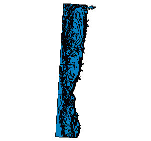
Title: Depth Area Features from Electronic Nautical Charts, NOAA, 2008
Geospatial Data Presentation Form: vector digital data
Publication Information:
Publication Place: Silver Spring, MD
Publisher: NOAA's Ocean Service, Office of Coast Survey (OCS)
Online Linkage: http://ocs-spatial.ncd.noaa.gov/encdirect/viewer.htm
Description:
Abstract:
NOAA's Electronic Navigational Charts (NOAA ENC's) have been developed to support the marine transportation infrastructure and coastal management. The NOAA ENC's are in S-57, a data standard developed by the International Hydrographic Organization (IHO) to be used for the exchange of digital hydrographic data. NOAA ENC's can be used in Geographic Information Systems, (GIS) allowing for broader public access. Many GIS's, however cannot read an ENC's native S-57 format to address this problem. NOAA's ENC Direct to GIS web portal provides comprehensive access to display, query, and download all available large scale NOAA ENC data in a variety of GIS/CAD formats for non-navigational purposes using Internet mapping service technology. Nautical chart features contained within an NOAA ENC provide a detailed representation of the U.S. coastal and marine environment. This data includes coastal topography, bathymetry, landmarks, geographic place names and marine boundaries. Features in an NOAA ENC are limited in that they only represent the geographic region that is depicted in that particular NOAA ENC. By aggregating nautical features from all NOAA ENC's in the creation of GIS data, a contiguous depiction of the U.S coastal and marine environment is achieved.
Purpose:
NOAA ENC® Direct to GIS Internet Mapping Service is designed to allow for the visualization, querying and downloading of NOAA's Electronic Navigational Chart's (NOAA ENC®) data in common Geographic Information System (GIS) formats.
Time Period of Content:
Time Period Information:
Single Date/Time:
Calendar Date: 7/11/2001
Time of Day: Unknown
Currentness Reference: This site up to date with the latest edition enc cells through publication date on site.
Status:
Progress: In work
Maintenance and Update Frequency: As needed
Spatial Domain:
Bounding Coordinates:
West Bounding Coordinate: -125.782203
East Bounding Coordinate: -123.250386
North Bounding Coordinate: 46.393618
South Bounding Coordinate: 41.006902
Keywords:
Theme:
Theme Keyword Thesaurus: Tri - Service Spatial Data Standard
Theme Keyword: Boundaries
Theme Keyword: Environment/Hazard
Theme Keyword: Hydrography
Theme Keyword: Landform
Theme Keyword: Transportation
Theme Keyword: Wildlife/Fisheries
Theme Keyword: Marine Navigation
Theme Keyword: Oceans
Place:
Place Keyword Thesaurus: None
Place Keyword: U.S. Exclusive Economic Zone
Place Keyword: U.S. territories
Place Keyword: U.S. waters
Place Keyword: Oregon
Access Constraints: None
Use Constraints: NOAA ENC® Direct to GIS data is not intended for navigational purposes. This data is provided for use in GIS software packages for coastal planning and research.
Point of Contact:
Contact Information:
Contact Organization Primary:
Contact Organization: NOAA, NOS, Office of Coast Survey
Contact Person: David Myers
Contact Position: ENC Production Manager
Contact Address:
Address Type: mailing address
Address:
1315 East West Highway
N/CS224, Station 7657
City: Silver Spring
State or Province: Maryland
Postal Code: 20910
Country: USA
Contact Voice Telephone: (301) 713-2717x207
Contact Facsimile Telephone: (301) 713-4516
Contact Electronic Mail Address: Dave.Myers@noaa.gov
Hours of Service: 0700-1500 EST
Contact Instructions: E-mail preferred.
Native Data Set Environment: Microsoft Windows XP Version 5.1 (Build 2600) Service Pack 3; ESRI ArcCatalog 9.3.0.1770
Data Quality Information
Section Index
Attribute Accuracy:
Attribute Accuracy Report:
The NOAA ENC® Direct to GIS data is derived from NOAA ENC®'s which conforms to the International Hydrographic Organization Transfer Standard for Digital Hydrographic Data, Special Publication S-57, ENC Product Specification Edition 2.0.
Logical Consistency Report:
The NOAA ENC® Direct data is derived from NOAA ENC®'s which conforms to the International Hydrographic Organization Transfer Standard for Digital Hydrographic Data, Special Publication S-57, ENC Product Specification Edition 2.0. NOAA ENC® Direct to GIS data has added generalized nautical chart symbology to aid in the visualazition of this data.
Completeness Report:
NOAA ENC® Direct to GIS data represents current coverage of all large scale Harbor and Approach (1:150,000 to 1:50,000 or larger) ENC Charts. The NOAA ENC® Chart Suite is not scheduled to be completed until 2007. As new NOAA ENC®s and NOAA ENC editions are created they will be added to the NOAA ENC Direct to GIS data on the first of every month
Positional Accuracy:
Horizontal Positional Accuracy:
Horizontal Positional Accuracy Report:
The NOAA ENC® Direct to GIS data is derived from data that conforms to the International Hydrographic Organization Transfer Standard for Digital Hydrographic Data, Special Publication S-57, ENC Product Specification Edition 2.0.
Vertical Positional Accuracy:
Vertical Positional Accuracy Report:
The NOAA ENC® Direct to GIS data is dereived from data that conforms to the International Hydrographic Organization Transfer Standard for Digital Hydrographic Data, Special Publication S-57, ENC Product Specification Edition 2.0.
Lineage:
Process Step:
Process Description:
The NOAA ENC® database has been built from a combination of charted information as well as original ""source"" information. NOAA has compiled critical features such as channel limits, aids to navigation, and obstructions from the original documents that were used to put the feature on the paper chart. The objective is to use the most accurate information for features that are critical to the safety of navigation. NOAA uses a number of sources in compiling NOAA ENC®S including U.S. Army Corps of Engineers surveys, drawings, and permits, U.S. Coast Guard Local Notices to Mariner, National Imagery and Mapping Agency Notices to Mariners, NOAA hydrographic surveys, and the largest scale paper chart of an area. ENC® Direct to GIS data was created by transforming Approach and Harbor NOAA ENC® version 2 cells to ESRI's shapefile format using Safe Software's Feature Manipulation Engine.
Process Date: 200305 - present
Process Step:
Process Description: Metadata imported.
Process Date: 20081203
Process Time: 11:36:25
Process Step:
Process Description: Dataset copied.
Process Date: 20090130
Process Time: 11:04:29
Cloud Cover: Unknown
Spatial Data Organization Information
Section Index
Direct Spatial Reference Method: Vector
Point and Vector Object Information:
SDTS Terms Description:
SDTS Point and Vector Object Type: G-polygon
Point and Vector Object Count: 556
Spatial Reference Information
Section Index
Horizontal Coordinate System Definition:
Planar:
Map Projection:
Map Projection Name: Lambert Conformal Conic
Lambert Conformal Conic:
Standard Parallel: 43
Standard Parallel: 45.5
Longitude of Central Meridian: -120.5
Latitude of Projection Origin: 41.75
False Easting: 1312335.958005
False Northing: 0
Planar Coordinate Information:
Planar Coordinate Encoding Method: Coordinate Pair
Coordinate Representation:
Abscissa Resolution: 0
Ordinate Resolution: 0
Planar Distance Units: international feet
Geodetic Model:
Horizontal Datum Name: North American Datum of 1983
Ellipsoid Name: Geodetic Reference System 80
Semi-major Axis: 6378137
Denominator of Flattening Ratio: 298.257
Entity and Attribute Information
Section Index
Detailed Description:
Entity Type:
Entity Type Label: DepthAreaFeature_NOAAENC_2008
Attribute:
Attribute Label: DEPTH_TYPE
Attribute:
Attribute:
Attribute:
Attribute Label: FID
Attribute Definition: Internal feature number.
Attribute Definition Source: ESRI
Attribute Domain Values:
Unrepresentable Domain: Sequential unique whole numbers that are automatically generated.
Attribute:
Attribute:
Attribute:
Attribute:
Attribute:
Attribute:
Attribute:
Attribute:
Attribute:
Attribute:
Attribute:
Attribute:
Attribute:
Attribute:
Attribute:
Attribute:
Attribute:
Attribute Label: Shape
Attribute Definition: Feature geometry.
Attribute Definition Source: ESRI
Attribute Domain Values:
Unrepresentable Domain: Coordinates defining the features.
Attribute:
Attribute Label: Shape_Area
Attribute Definition: Area of feature in internal units squared.
Attribute Definition Source: ESRI
Attribute Domain Values:
Unrepresentable Domain: Positive real numbers that are automatically generated.
Attribute:
Attribute Label: Shape_Leng
Attribute:
Attribute:
Attribute:
Attribute:
Attribute:
Attribute:
Overview Description:
Entity and Attribute Overview:
The data provided through the NOAA ENC® Direct to GIS service is derived from elctronic data that conforms to the International Hydrographic Organization Transfer Standard for Digital Hydrographic Data, Special Publication S-57, ENC Product Specification Edition 2.0. The entity and attribute descriptions are contained in the standard. The standard is available from the IHO at <http://www.iho.shom.fr>.
Entity and Attribute Detail Citation: IHO S-57, Edition 3.1
Distribution Information
Section Index
Distributor:
Contact Information:
Contact Organization Primary:
Contact Organization: National Oceanic and Atmospheric Administration (NOAA), National Ocean Service (NOS), Office of Coast Survey (OCS)
Contact Person: ENC GIS Technical
Contact Position: enc.gis@noaa.gov
Contact Address:
Address Type: mailing and physical address
Address: 1315 East West Highway N/CS2
City: Silver Spring
State or Province: Maryland
Postal Code: 20910
Country: USA
Contact Voice Telephone: (301) 713-2645
Contact Facsimile Telephone: (301) 713-4501
Contact Electronic Mail Address: james.hawks@noaa.gov
Hours of Service: 0700-1500 EST
Contact Instructions: Email is preferred.
Distribution Liability: None
Standard Order Process:
Digital Form:
Digital Transfer Information:
Format Name: AutoCAD DWG (R2000), AutoCAD DXF (R2000), Caris NTX, ESRI Arc/Info Coverage, ESRI Arc/Info Export (E00), ESRI Arc/Info Generate, ESRI Shape, MapInfo MID/MIF, MapInfo TAB,
Format Information Content: Data can be downloaded in either North American Datum 1927 or World Geodetic System 1984.
Transfer Size: 3.354
Digital Transfer Option:
Online Option:
Access Instructions: Data can be downloaded in either North American Datum 1927 or World Geodetic System 1984. Available at: http://ocs-spatial.ncd.noaa.gov/encdirect/viewer.htm
Fees: There are no fees for the download of the NOAA ENC Direct to GIS data.
Available Time Period:
Time Period Information:
Single Date/Time:
Calendar Date: 1988
Time of Day: Unknown
Metadata Reference Information
Section Index
Metadata Date: 2/29/2004
Metadata Review Date: 2/29/2004
Metadata Future Review Date:
Metadata Contact:
Contact Information:
Contact Organization Primary:
Contact Organization: National Oceanic and Atmospheric Administration (NOAA), National Ocean Service (NOS), Office of Coast Survey (OCS)
Contact Person: ENC GIS Technical
Contact Position: enc.gis@noaa.gov
Contact Address:
Address Type: mailing and physical address
Address: 1315 East West Highway N/CS2
City: Silver Spring
State or Province: Maryland
Postal Code: 20910
Country: USA
Contact Voice Telephone: (301) 713-2645
Contact Facsimile Telephone: (301) 713-4501
Contact Electronic Mail Address: james.hawks@noaa.gov
Hours of Service: 0700-1500 EST
Contact Instructions: Email is preferred.
Metadata Standard Name: FGDC Content Standards for Digital Geospatial Metadata
Metadata Standard Version: FGDC-STD-001-1998
Metadata Time Convention: local time
Metadata Extensions:
Online Linkage: http://www.esri.com/metadata/esriprof80.html
Profile Name: ESRI Metadata Profile
SMMS Metadata report generated 2/25/2009