Confined Animal Feeding Operations for the Coquille Basin
Identification_Information
Data_Quality_Information
Spatial_Data_Organization_Information
Spatial_Reference_Information
Entity_and_Attribute_Information
Distribution_Information
Metadata_Reference_Information
Identification Information
Section Index
Citation:
Citation Information:
Originator: Oregon Department of Agriculture
Publication Date: 1999
Title: Confined Animal Feeding Operations for the Coquille Basin
Edition: NA
Geospatial Data Presentation Form: Map
Publication Information:
Publication Place: Salem, Oregon
Other Citation Details:
The Southwest Oregon Province GIS data project was funded
by a collaborative group of federal agencies. VESTRA
Resources compiled the GIS and metadata files provided by
project staff into a published CD available from http:\\www.reo.gov.
Larger Work Citation:
Citation Information:
Originator: Regional Ecosystems Office, US Forest Service
Publication Date: 03012000
Title:
Southwest Oregon Province Resource Information - Coos
Coquille Assessment Unit
Publication Information:
Publication Place: Roseburg, Oregon
Publisher: VESTRA Resources (contract)
Online Linkage: http://www.reo.gov/
Description:
Abstract:
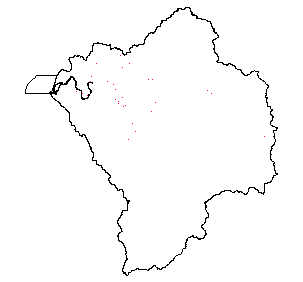
Coverage depicts point locations of Confined Animal Feeding Operations, with relevant address information and number /
type of animals being farmed.
Purpose: Oregon Department of Agriculture tracking purposes.
Time Period of Content:
Time Period Information:
Range of Dates/Times:
Beginning Date:
Beginning Time: Unknown
Ending Date: 1999
Ending Time: Unknown
Currentness Reference: Legacy coverage in 1999, update status unknown.
Status:
Progress: In work
Maintenance and Update Frequency: Unknown
Spatial Domain:
Bounding Coordinates:
West Bounding Coordinate: -119.9186
East Bounding Coordinate: -119.2619
North Bounding Coordinate: 43.2878
South Bounding Coordinate: 43.0705
Keywords:
Theme:
Theme Keyword Thesaurus: None
Theme Keyword: Estuary
Theme Keyword: Water Quality
Theme Keyword: Animal Feeding
Theme Keyword: CAFO
Place:
Place Keyword Thesaurus: None
Place Keyword: Oregon
Place Keyword: Coquille
Place Keyword: Oregon Coast
Access Constraints: None
Use Constraints: ODA requested that the contents of the Business name field be deleted before coverage was redistributed.
Point of Contact:
Contact Information:
Contact Organization Primary:
Contact Organization: Oregon Department of Agriculture
Contact Position: GIS Coordinator
Contact Address:
Address Type: mailing and physical address
Address: 635 NE Capitol St NE
City: Salem
State or Province: Oregon
Postal Code: 97301-2532
Country: USA
Contact Voice Telephone: 503-986-4550
Contact Facsimile Telephone: 503-986-4747
Native Data Set Environment: Arc/Info coverage format
Data Quality Information
Section Index
Attribute Accuracy:
Attribute Accuracy Report: Contents of a single field (business) were deleted at the request of the parent Agency.
Logical Consistency Report: The data are assumed to be logically consistent. No extensive tests were performed.
Positional Accuracy:
Horizontal Positional Accuracy:
Horizontal Positional Accuracy Report: This is a legacy coverage. Scale is thought to be 1:1,200,000 . This value was obtained from within a map-generating AML that accompanied the coverage.
Vertical Positional Accuracy:
Vertical Positional Accuracy Report: NA
Lineage:
Source Information:
Source Citation:
Citation Information:
Originator: Oregon Department of Agriculture
Publication Date: 1999
Title: Confined Animal Feeding Operation
Edition: NA
Geospatial Data Presentation Form: map
Publication Information:
Publication Place: Salem, Oregon
Publisher: Original Dataset never published by ODA.
Other Citation Details:
The Southwest Oregon Province GIS data project was funded by a collaborative group of federal agencies. VESTRA Resources compiled the GIS and metadata files provided by project staff into a published CD available from http:\\www.reo.gov.
Online Linkage: http:\\www.reo.gov
Larger Work Citation:
Citation Information:
Originator: Regional Ecosystems Office, US Forest Service
Publication Date: 03012000
Title:
Southwest Oregon Province Resource Information - Coos
Coquille Assessment Unit
Publication Information:
Publication Place: Roseburg, Oregon
Publisher: VESTRA Resources (contract)
Online Linkage: http://www.reo.gov/
Type of Source Media: Arc Workspace
Source Time Period of Content:
Time Period Information:
Range of Dates/Times:
Beginning Date:
Beginning Time: Unknown
Ending Date: 1999
Ending Time: Unknown
Source Currentness Reference: Unknown
Source Citation Abbreviation: CAFO
Process Step:
Process Description:
Original theme obtained from ODA as an ArcInfo Workspace, in the Oregon Lambert projection. Clipped to the DEMIS
Coquille Basin ""Donut"" coverage in ArcInfo. ODA requested that the contents of the ""business"" attribute field be
deleted before coverage distribution, so these edits to the .pat were done in ArcInfo.
Source Used Citation Abbreviation: CAFO
Process Date: 071999
Cloud Cover: 0
Spatial Data Organization Information
Section Index
Direct Spatial Reference Method: Point
Point and Vector Object Information:
SDTS Terms Description:
SDTS Point and Vector Object Type: Point
Point and Vector Object Count: 28
Spatial Reference Information
Section Index
Horizontal Coordinate System Definition:
Planar:
Map Projection:
Map Projection Name: Lambert Conformal Conic
Lambert Conformal Conic:
Standard Parallel: 43
Standard Parallel: 45.5
Longitude of Central Meridian: -119.5
Latitude of Projection Origin: 41.75
False Easting: 400000
False Northing: 0
Planar Coordinate Information:
Planar Coordinate Encoding Method: Coordinate Pair
Coordinate Representation:
Abscissa Resolution: 0
Ordinate Resolution: 0
Planar Distance Units: international feet
Geodetic Model:
Horizontal Datum Name: North American Datum of 1983
Ellipsoid Name: Geodetic Reference System 80
Semi-major Axis: 6378137
Denominator of Flattening Ratio: 298.257
Entity and Attribute Information
Section Index
Detailed Description:
Entity Type:
Entity Type Label: cafo.pat
Entity Type Definition: Point Attribute Table
Entity Type Definition Source: None
Attribute:
Attribute Label: Area
Attribute Definition: Area of polygon
Attribute Definition Source: Software generated
Attribute Domain Values:
Unrepresentable Domain: Software computed
Attribute:
Attribute Label: Business
Attribute Definition: Business name (contents deleted at the request of ODA)
Attribute Domain Values:
Unrepresentable Domain: Character Field
Attribute:
Attribute Label: Cafo#
Attribute Definition: Internal feature number
Attribute Definition Source: Software generated
Attribute Domain Values:
Unrepresentable Domain: Software computed
Attribute:
Attribute Label: Cafo-id
Attribute Definition: Feature identification number
Attribute Definition Source: Software generated
Attribute Domain Values:
Unrepresentable Domain: User Defined
Attribute:
Attribute Label: Cafo_
Attribute Definition: Internal feature number
Attribute Definition Source: Software generated
Attribute Domain Values:
Unrepresentable Domain: Software computed
Attribute:
Attribute Label: Cafo_id
Attribute Definition: Internal ODA use
Attribute Domain Values:
Range Domain:
Range Domain Minimum: 22
Range Domain Maximum: 567
Attribute:
Attribute Label: City
Attribute Definition: City
Attribute Domain Values:
Unrepresentable Domain: Character Field
Attribute:
Attribute Label: County
Attribute Definition: County
Attribute Domain Values:
Unrepresentable Domain: Character Field
Attribute:
Attribute Label: Facility
Attribute Definition: Internal ODA use
Attribute Domain Values:
Unrepresentable Domain: Character Field
Attribute:
Attribute Label: Firm
Attribute Definition: Internal ODA use
Attribute Domain Values:
Range Domain:
Range Domain Minimum: 19343
Range Domain Maximum: 107967
Attribute:
Attribute Label: Latitude
Attribute Definition: Latitude
Attribute Domain Values:
Range Domain:
Range Domain Minimum: 43.0119
Range Domain Maximum: 43.2276
Attribute:
Attribute Label: Longitude
Attribute Definition: Longitude
Attribute Domain Values:
Range Domain:
Range Domain Minimum: 123.675
Range Domain Maximum: 124.335
Attribute:
Attribute Label: No_anim
Attribute Definition: Number of Animals
Attribute Domain Values:
Range Domain:
Range Domain Minimum: 0
Range Domain Maximum: 450
Attribute:
Attribute Label: Perimeter
Attribute Definition: Perimeter of polygon
Attribute Definition Source: Software generated
Attribute Domain Values:
Unrepresentable Domain: Software computed
Attribute:
Attribute Label: Rsr96
Attribute Definition: Internal ODA use
Attribute Domain Values:
Range Domain:
Range Domain Minimum: 0
Range Domain Maximum: 60
Attribute:
Attribute Label: Type
Attribute Definition: Type of feeding operation
Attribute Domain Values:
Enumerated Domain:
Enumerated Domain Value: Dairy
Enumerated Domain Value Definition: Dairy Cows
Enumerated Domain Value: Swine
Enumerated Domain Value Definition: Swine
Attribute:
Attribute Label: Zip
Attribute Definition: Zip
Attribute Domain Values:
Unrepresentable Domain: Character Field
Distribution Information
Section Index
Distributor:
Contact Information:
Contact Organization Primary:
Contact Organization:
Oregon Ocean Coastal Management Program - Department of
Land Conservation and Development
Contact Person: Tanya Haddad
Contact Position: DEMIS Coordinator
Contact Address:
Address Type: mailing and physical address
Address: 800 NE Oregon Street #18
City: Portland
State or Province: Oregon
Postal Code: 97232
Country: USA
Contact Voice Telephone: 503-731-4065 x30
Contact Facsimile Telephone: 503-731-4068
Contact Electronic Mail Address: tanya.haddad@state.or.us
Resource Description: Confined Animal Feeding Operations in Coquille Basin
Distribution Liability:
THE DATA AND ASSOCIATED DATA FILES ON THIS CD-ROM ARE
PROVIDED ""AS IS,"" WITHOUT WARRANTY TO THEIR PERFORMANCE, MERCHANTABLE
STATE, OR FITNESS FOR ANY PARTICULAR PURPOSE. THE ENTIRE RISK
ASSOCIATED WITH THE RESULTS AND PERFORMANCES OF THE DATA IS ASSUMED
BY THE USER. THIS DATA IS NOT FOR NAVIGATIONAL OR LEGAL PURPOSES.
Available Time Period:
Metadata Reference Information
Section Index
Metadata Date: 1/1/2000
Metadata Review Date: 1/1/2000
Metadata Future Review Date:
Metadata Contact:
Contact Information:
Contact Organization Primary:
Contact Organization:
Oregon Ocean Coastal Management Program - Department of
Land Conservation and Development
Contact Person: Tanya Haddad
Contact Position: DEMIS Coordinator
Contact Address:
Address Type: mailing and physical address
Address: 800 NE Oregon Street #18
City: Portland
State or Province: Oregon
Postal Code: 97232
Country: USA
Contact Voice Telephone: 503-731-4065 x30
Contact Facsimile Telephone: 503-731-4068
Contact Electronic Mail Address: tanya.haddad@state.or.us
Metadata Standard Name: FGDC CSDGM
Metadata Standard Version: FGDC-STD-001-1998
SMMS Metadata report generated 3/26/2002