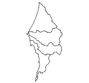
5th Field Hydrologic Units in the Sixes Watershed, 1:24,000, REO, 2002
Identification_Information
Data_Quality_Information
Spatial_Data_Organization_Information
Spatial_Reference_Information
Entity_and_Attribute_Information
Distribution_Information
Metadata_Reference_Information
Identification Information
Section Index
Citation:
Citation Information:
Originator: Regional Ecosystem Office
Publication Date: 2002
Title: 5th Field Hydrologic Units in the Sixes Watershed, 1:24,000, REO, 2002
Geospatial Data Presentation Form: vector digital data
Online Linkage: http://www.reo.gov/gis/projects/watersheds/
Description:
Abstract:
5th Field Watershed separated from hydro_units coverage for use in the Oregon Coastal Atlas Project.
This geospatial dataset is a hydrologic unit boundary layer that is at the Subwatershed (12-digit) level. The dataset was enveloped by delineating the boundary lines on 1:24,000 base maps and digitizing the delineated lines. Digital Elevation data may have been used in part of the process to establish preliminary boundaries.
This data set consists of geo-referenced digital map data and associated attributes. The hydrologic unit code attached to each delineated polygon is linked to the attribute data, which can contain information on area in acres, in-contributing area, state(s) the HU falls within, name for 5th and 6th level HU, 5th and 6th level code for downstream hydrologic unit, and hydrologic unit modifications. Each line has attributes that describe the HU level (1-6), originating source for that line and a metadata ID number that links the line to its associated metadata file.
Purpose:
The watershed and subwatershed hydrologic unit boundaries provide a uniquely identified and uniform method of subdividing large drainage areas. These smaller sized hydrologic units (up to 250,000 acres) are useful in many programs supported by the REO and others.
This data set is intended as a tool for water-resource management and planning activities, particularly for site-specific and localized studies, which require the amount of detail provided by a large-scale map.
Supplemental Information:
The following procedures were used to produce this data set:
Hydrologic units were incorporated into this dataset from an aggregate of pre-existing HUs. Some new HU boundaries were delineated using flow lines and basins computed from 10- and 30-meter horizontal resolution Digital Elevation based on flow derived from the elevation grid to determine potential pour points. The DEM data is derived from hypsography represented on 1:24000 USGS topographic quadrangles. Additional hydrography data was used as a template to control pourpoint locations for the delineated HUs. This version of the data set (housed at the Oregon Geospatial Data Clearinghouse) was projected into the Oregon Lambert projection and reselected to contain only HUC's that are partially or entirely in Oregon. The acres field was widened and recomputed to allow for the width of larger HUCs. Shapefiles of the complete HUC theme and 4th-6th field HUCS were created by the Oregon Geospatial
Data Clearinghouse (OGDC) using ArcView. They represent data in the original layer.
20040226 For purposes of Oregon Coastal Atlas project this data was reprojected and clipped to basin boundaries. Please refer to originators for original data and further information regarding this data.
Time Period of Content:
Time Period Information:
Single Date/Time:
Calendar Date: 2002
Time of Day: Unknown
Currentness Reference: publication date
Status:
Progress: Complete
Maintenance and Update Frequency: As needed
Spatial Domain:
Bounding Coordinates:
West Bounding Coordinate: -124.703537
East Bounding Coordinate: -124.134727
North Bounding Coordinate: 43.122093
South Bounding Coordinate: 42.415104
Keywords:
Theme:
Theme Keyword Thesaurus: None
Theme Keyword: Hydrologic units
Theme Keyword: Watershed Boundaries
Theme Keyword: 5th field watershed
Place:
Place Keyword Thesaurus: None
Place Keyword: Western Oregon
Access Constraints: None
Use Constraints:
The Regional Ecosystem Office should be acknowledged as the data source in products derived from
these data. These data should not be used at scales greater than 1:24,000.
This is public information and may be interpreted by organizations, agencies, units of government, or
others based on needs; however they are responsible for the appropriate application of the data.
Federal, state, or local regulatory bodies are not to reassign to the Regional Ecosystem Office any
authority for the decisions they make. The Regional Ecosystem Office will not perform any evaluations of
these maps or purposes related solely to State or local regulatory programs. Photographic or digital
enlargement of these maps to scales greater than that at which they were originally delineated can cause
misrepresentation of the data. If enlarged, the maps will not include the fine detail that would be
appropriate for mapping at the small scale. Digital data files are periodically updated. Files are dated,
and users are responsible for obtaining the latest version of the data.
Native Data Set Environment: Microsoft Windows 2000 Version 5.0 (Build 2195) Service Pack 4; ESRI ArcCatalog 8.3.0.800
Data Quality Information
Section Index
Attribute Accuracy:
Attribute Accuracy Report:
Polygon identifiers are manually checked with the original base map using the attribute file. Verification on
polygon identification continuity on each side of a neatline is done visually on the screen as adjacent
quad representations are assembled into larger area data layers.
Logical Consistency Report:
Certain node/geometry and topology (GT) polygon/chain relationships are
collected or generated to satisfy topological requirements. (The GT-polygon corresponds to a hydrologic
unit or a portion of a hydrologic unit at the edge of a Quadrangle sheet.) Some of these requirements
include: chains must begin and end at nodes, left and right GT-polygons are defined for each chain
element and are consistent throughout, and the chains representing the limits of the file (neatline) are free
of gaps. The tests of logical consistency are performed using vendor software. The neatline is generated
by connecting the explicitly entered four corners of the digital file. All data outside the enclosed region are
ignored and all data crossing geographically straight lines are clipped at the neatline. Neatline
straightening aligns the digitized edges of the digital data with the generated neatline (i.e., with the
longitude/latitude lines in geographic coordinates). All internal polygons are tested for closure with vendor
software and are checked on hard copy plots. All data are checked for common boundary lines (i.e.,
adjacent polygons with the same label). Quadrangles are edge matched within the Sub-basin area and
edge locations generally do not deviate from centerline more than 0.01 inches.
Completeness Report: complete
Positional Accuracy:
Horizontal Positional Accuracy:
Horizontal Positional Accuracy Report:
The accuracy of these maps is generally based on the contour information or DEM data available for the base maps. Such data
may be supplemented with site visits to locate ridge lines for hydrologic unit boundaries in flat terrain
areas, changes in drainage patterns due to man's activities. The differences in positional accuracy
between the hydrologic unit boundaries and their digitized map locations is unknown.
Hydrologic unit boundaries generally were digitized within 0.01 inches of their locations on the digitizing
source. The digital map elements are edge matched against the data for the adjacent Quadrangle. Edge
match locations generally do not deviate from centerline to centerline by more than 0.01 inches.
Lineage:
Source Information:
Source Citation:
Citation Information:
Originator: Unknown
Publication Date: 2002
Title: The Forest of Oregon
Source Scale Denominator: 24000
Type of Source Media: paper
Source Time Period of Content:
Time Period Information:
Range of Dates/Times:
Beginning Date: 2000
Beginning Time: Unknown
Ending Date: 2002
Ending Time: Unknown
Source Currentness Reference: publication date
Source Citation Abbreviation: NRCS
Source Contribution: map delineation Hydrologic units redelineated
Process Step:
Cloud Cover: 0
Spatial Data Organization Information
Section Index
Indirect Spatial Reference: None
Direct Spatial Reference Method: Vector
Point and Vector Object Information:
SDTS Terms Description:
SDTS Point and Vector Object Type: Complete chain
Point and Vector Object Count: 2750
SDTS Terms Description:
SDTS Point and Vector Object Type: Label point
Point and Vector Object Count: 655
SDTS Terms Description:
SDTS Point and Vector Object Type: GT-polygon composed of chains
Point and Vector Object Count: 655
Spatial Reference Information
Section Index
Horizontal Coordinate System Definition:
Planar:
Map Projection:
Map Projection Name: Lambert Conformal Conic
Lambert Conformal Conic:
Standard Parallel: 43
Standard Parallel: 45.5
Longitude of Central Meridian: -120.5
Latitude of Projection Origin: 41.75
False Easting: 400000
False Northing: 0
Planar Coordinate Information:
Planar Coordinate Encoding Method: Coordinate Pair
Coordinate Representation:
Abscissa Resolution: 0.002331
Ordinate Resolution: 0.002331
Planar Distance Units: international feet
Geodetic Model:
Horizontal Datum Name: North American Datum of 1983
Ellipsoid Name: Geodetic Reference System 80
Semi-major Axis: 6378137
Denominator of Flattening Ratio: 298.257
Entity and Attribute Information
Section Index
Detailed Description:
Entity Type:
Entity Type Label: huc5.aat
Entity Type Definition: arc attribute table
Entity Type Definition Source: ESRI
Attribute:
Attribute Label: BASIN
Attribute Definition: 3rd Field Hydrologic Unit Code
Attribute Definition Source: Based on data from HUC_NUM item
Attribute Domain Values:
Unrepresentable Domain: txt
Attribute:
Attribute Label: CATCHMENT
Attribute Definition: 7th Field Hydrologic Unit Code
Attribute Definition Source: Based on data from HUC_NUM item
Attribute Domain Values:
Unrepresentable Domain: txt
Attribute:
Attribute Label: COMMENT
Attribute Definition: Any additional information that pertains to the hydrologic unit's history or general characteristics that cannot be adequately described in previous items.
Attribute Definition Source: Various
Attribute Domain Values:
Unrepresentable Domain: free text
Attribute:
Attribute Label: FID
Attribute Definition: Internal feature number.
Attribute Definition Source: ESRI
Attribute Domain Values:
Unrepresentable Domain: Sequential unique whole numbers that are automatically generated.
Attribute:
Attribute Label: FIFTH_FIELD
Attribute Definition: 2-digit identifier
Attribute Definition Source: Based on data from HUC_NUM item
Attribute Domain Values:
Unrepresentable Domain: txt
Attribute:
Attribute Label: FIRST_FIELD
Attribute Definition: 2-digit identifier
Attribute Definition Source: Based on data from HUC_NUM item
Attribute Domain Values:
Unrepresentable Domain: txt
Attribute:
Attribute Label: FNODE#
Attribute Definition: Internal node number for the beginning of an arc (from-node).
Attribute Definition Source: ESRI
Attribute Domain Values:
Unrepresentable Domain: Whole numbers that are automatically generated.
Attribute:
Attribute Label: FOURTH_FIELD
Attribute Definition: 2-digit identifier
Attribute Definition Source: Based on data from HUC_NUM item Attribute_Domain_Values:
Attribute Domain Values:
Unrepresentable Domain: txt
Attribute:
Attribute Label: HUC_LEVEL
Attribute Definition: This item is used to identify the hydrologic unit groupings a given line segment belongs to.
Attribute Definition Source: NRCS
Attribute Domain Values:
Enumerated Domain:
Enumerated Domain Value: 1
Enumerated Domain Value Definition: 1st Level Unit Boundary
Enumerated Domain Value Definition Source: BLM
Enumerated Domain:
Enumerated Domain Value: 2
Enumerated Domain Value Definition: 2nd Level Unit Boundary, NOT Shared with a 1st Level Unit Boundary
Enumerated Domain Value Definition Source: BLM
Enumerated Domain:
Enumerated Domain Value: 3
Enumerated Domain Value Definition: 3rd Level Unit Boundary, NOT Shared with 1st or 2nd Level Unit Boundary
Enumerated Domain Value Definition Source: BLM
Enumerated Domain:
Enumerated Domain Value: 4
Enumerated Domain Value Definition: 4th Level Unit Boundary, NOT Shared with 1st - 3rd Level Unit Boundary
Enumerated Domain Value Definition Source: BLM
Enumerated Domain:
Enumerated Domain Value: 5
Enumerated Domain Value Definition: 5th Level Unit Boundary, NOT Shared with 1st - 4th Level Unit Boundary
Enumerated Domain Value Definition Source: BLM
Enumerated Domain:
Enumerated Domain Value: 6
Enumerated Domain Value Definition: 6th Level Unit Boundary, NOT Shared with 1st - 5th Level Unit Boundary
Enumerated Domain Value Definition Source: BLM
Enumerated Domain:
Enumerated Domain Value: 7
Enumerated Domain Value Definition: 7th Level Unit Boundary, NOT Shared with 1st - 6th Level Unit Boundary
Enumerated Domain Value Definition Source: BLM
Enumerated Domain:
Enumerated Domain Value: 8
Enumerated Domain Value Definition: 8th Level Unit Boundary, NOT Shared with 1st - 7th Level Unit Boundary
Enumerated Domain Value Definition Source: BLM
Attribute:
Attribute Label: HUC_MOD
Attribute Definition:
Hydrologic Unit Modifications- This item should contain information about hydrologic unit modifications to natural overland flow (that affect boundary) unique to the 5th or 6th field level unit delineated in an area of interest. This may include information on the type of structure, date of construction or other features that may influence surface water flow. In the attribute field, identify from most significant to least significant modification(s).
Attribute Definition Source: NRCS
Attribute Domain Values:
Enumerated Domain:
Enumerated Domain Value: SC
Enumerated Domain Value Definition: Stormwater Canal
Enumerated Domain Value Definition Source: BLM
Enumerated Domain:
Enumerated Domain Value: BC
Enumerated Domain Value Definition: Barge Canal
Enumerated Domain Value Definition Source: BLM
Enumerated Domain:
Enumerated Domain Value: PD
Enumerated Domain Value Definition: Pipe Diversion
Enumerated Domain Value Definition Source: BLM
Enumerated Domain:
Enumerated Domain Value: KA
Enumerated Domain Value Definition: Karst
Enumerated Domain Value Definition Source: BLM
Enumerated Domain:
Enumerated Domain Value: OC
Enumerated Domain Value Definition: Overflow Channel
Enumerated Domain Value Definition Source: BLM
Enumerated Domain:
Enumerated Domain Value: ID
Enumerated Domain Value Definition: Irrigation Ditch
Enumerated Domain Value Definition Source: BLM
Enumerated Domain:
Enumerated Domain Value: SD
Enumerated Domain Value Definition: Stormwater Ditch
Enumerated Domain Value Definition Source: BLM
Enumerated Domain:
Enumerated Domain Value: CD
Enumerated Domain Value Definition: Channel Diversion
Enumerated Domain Value Definition Source: BLM
Enumerated Domain:
Enumerated Domain Value: LE
Enumerated Domain Value Definition: Levee
Enumerated Domain Value Definition Source: BLM
Enumerated Domain:
Enumerated Domain Value: OT
Enumerated Domain Value Definition: Other
Enumerated Domain Value Definition Source: BLM
Enumerated Domain:
Enumerated Domain Value: IT
Enumerated Domain Value Definition: Interbasin Transfer
Enumerated Domain Value Definition Source: BLM
Enumerated Domain:
Enumerated Domain Value: CB
Enumerated Domain Value Definition: Closed Basin
Enumerated Domain Value Definition Source: BLM
Enumerated Domain:
Enumerated Domain Value: NC
Enumerated Domain Value Definition: Non-Contributing
Enumerated Domain Value Definition Source: BLM
Enumerated Domain:
Enumerated Domain Value: NM
Enumerated Domain Value Definition: No Modifications
Enumerated Domain Value Definition Source: BLM
Attribute:
Attribute Label: HUC5#
Attribute Definition: Internal feature number.
Attribute Definition Source: ESRI
Attribute Domain Values:
Unrepresentable Domain: Sequential unique whole numbers that are automatically generated.
Attribute:
Attribute Label: HUC5-ID
Attribute Definition: User-defined feature number.
Attribute Definition Source: ESRI
Attribute Domain Values:
Unrepresentable Domain: User-defined feature number
Attribute:
Attribute Label: LENGTH
Attribute Definition: Length of feature in internal units.
Attribute Definition Source: ESRI
Attribute Domain Values:
Unrepresentable Domain: Positive real numbers that are automatically generated.
Attribute:
Attribute Label: LINEDATE
Attribute Definition: Date that the last line edit was performed.
Attribute Definition Source: Various
Attribute Domain Values:
Unrepresentable Domain: Date
Attribute:
Attribute Label: LINEORG
Attribute Definition: The organization who performed the last spatial edit to a given line segment.
Attribute Definition Source: various
Attribute Domain Values:
Enumerated Domain:
Enumerated Domain Value: CLAMS
Enumerated Domain Value Definition: Coastal Landscape Analysis and Modeling Study
Enumerated Domain Value Definition Source: BLM
Enumerated Domain:
Enumerated Domain Value: IRICC
Enumerated Domain Value Definition: Intergovernmental Resource Information Coordinating Council
Enumerated Domain Value Definition Source: BLM
Enumerated Domain:
Enumerated Domain Value: LVWFBR
Enumerated Domain Value Definition: Longview Fiber Company
Enumerated Domain Value Definition Source: BLM
Enumerated Domain:
Enumerated Domain Value: NMFS
Enumerated Domain Value Definition: National Marine Fisheries Service
Enumerated Domain Value Definition Source: BLM
Enumerated Domain:
Enumerated Domain Value: NRCS
Enumerated Domain Value Definition: Natural Resources Conservation Service
Enumerated Domain Value Definition Source: BLM
Enumerated Domain:
Enumerated Domain Value: NWIFC
Enumerated Domain Value Definition: Northwest Indian Fisheries Commission
Enumerated Domain Value Definition Source: BLM
Enumerated Domain:
Enumerated Domain Value: ODEQ
Enumerated Domain Value Definition: OR Dept. of Environmental Quality
Enumerated Domain Value Definition Source: BLM
Enumerated Domain:
Enumerated Domain Value: ODF
Enumerated Domain Value Definition: OR Dept. of Forestry
Enumerated Domain Value Definition Source: BLM
Enumerated Domain:
Enumerated Domain Value: REO
Enumerated Domain Value Definition: REO (Regional Ecosystem Office). These are lines that were created from REO coverage last updated October 1998.
Enumerated Domain Value Definition Source: BLM
Enumerated Domain:
Enumerated Domain Value: SNPSN
Enumerated Domain Value Definition: Simpson Timber Company
Enumerated Domain Value Definition Source: BLM
Enumerated Domain:
Enumerated Domain Value: UNKNOWN
Enumerated Domain Value Definition: Unknown input organization
Enumerated Domain Value Definition Source: BLM
Enumerated Domain:
Enumerated Domain Value: USACE
Enumerated Domain Value Definition: U.S. Army Corps of Engineers
Enumerated Domain Value Definition Source: BLM
Enumerated Domain:
Enumerated Domain Value: USBLM-BUR
Enumerated Domain Value Definition: U.S. Bureau of Land Management - BURNS
Enumerated Domain Value Definition Source: BLM
Enumerated Domain:
Enumerated Domain Value: USBLM-CSB
Enumerated Domain Value Definition: U.S. Bureau of Land Management - COOS_BAY
Enumerated Domain Value Definition Source: BLM
Enumerated Domain:
Enumerated Domain Value: USBLM-EUG
Enumerated Domain Value Definition: U.S. Bureau of Land Management - EUGENE
Enumerated Domain Value Definition Source: BLM
Enumerated Domain:
Enumerated Domain Value: USBLM-LKE
Enumerated Domain Value Definition: U.S. Bureau of Land Management - LAKEVIEW
Enumerated Domain Value Definition Source: BLM
Enumerated Domain:
Enumerated Domain Value: USBLM-MED
Enumerated Domain Value Definition: U.S. Bureau of Land Management - MEDFORD
Enumerated Domain Value Definition Source: BLM
Enumerated Domain:
Enumerated Domain Value: USBLM-OSO
Enumerated Domain Value Definition: U.S. Bureau of Land Management - OREGON STATE OFFICE
Enumerated Domain Value Definition Source: BLM
Enumerated Domain:
Enumerated Domain Value: USBLM-PNV
Enumerated Domain Value Definition: U.S. Bureau of Land Management - PRINEVILLE
Enumerated Domain Value Definition Source: BLM
Enumerated Domain:
Enumerated Domain Value: USBLM-RSB
Enumerated Domain Value Definition: U.S. Bureau of Land Management - ROSEBURG
Enumerated Domain Value Definition Source: BLM
Enumerated Domain:
Enumerated Domain Value: USBLM-SLM
Enumerated Domain Value Definition: U.S. Bureau of Land Management - SALEM
Enumerated Domain Value Definition Source: BLM
Enumerated Domain:
Enumerated Domain Value: USBLM-VAL
Enumerated Domain Value Definition: U.S. Bureau of Land Management - VALE
Enumerated Domain Value Definition Source: BLM
Enumerated Domain:
Enumerated Domain Value: USBR
Enumerated Domain Value Definition: U.S. Bureau of Reclamation
Enumerated Domain Value Definition Source: BLM
Enumerated Domain:
Enumerated Domain Value: Domain Value: USBPA
Enumerated Domain Value Definition: U.S. Bonneville Power Administration
Enumerated Domain Value Definition Source: BLM
Enumerated Domain:
Enumerated Domain Value: USEPA-R10
Enumerated Domain Value Definition: U.S. Environmental Protection Agency - Region 10
Enumerated Domain Value Definition Source: BLM
Enumerated Domain:
Enumerated Domain Value: USFS-DES
Enumerated Domain Value Definition: U.S. Forest Service - DESCHUTES
Enumerated Domain Value Definition Source: BLM
Enumerated Domain:
Enumerated Domain Value: USFS-FRE
Enumerated Domain Value Definition: U.S. Forest Service - FREMONT
Enumerated Domain Value Definition Source: BLM
Enumerated Domain:
Enumerated Domain Value: USFS-KAL
Enumerated Domain Value Definition: U.S. Forest Service - KALMATH
Enumerated Domain Value Definition Source: BLM
Enumerated Domain:
Enumerated Domain Value: USFS-MAL
Enumerated Domain Value Definition: U.S. Forest Service - MALHEUR
Enumerated Domain Value Definition Source: BLM
Enumerated Domain:
Enumerated Domain Value: USFS-MTH
Enumerated Domain Value Definition: U.S. Forest Service - MT HOOD
Enumerated Domain Value Definition Source: BLM
Enumerated Domain:
Enumerated Domain Value: USFS-OCH
Enumerated Domain Value Definition: U.S. Forest Service - OCHOCO
Enumerated Domain Value Definition Source: BLM
Enumerated Domain:
Enumerated Domain Value: USFS-ROG
Enumerated Domain Value Definition: U.S. Forest Service - ROGUE RIVER
Enumerated Domain Value Definition Source: BLM
Enumerated Domain:
Enumerated Domain Value: USFS-R6
Enumerated Domain Value Definition: U.S. Forest Service - REGION SIX SUPERVISORS OFFICE
Enumerated Domain Value Definition Source: BLM
Enumerated Domain:
Enumerated Domain Value: USFS-SIS
Enumerated Domain Value Definition: U.S. Forest Service - SISKIYOU
Enumerated Domain Value Definition Source: BLM
Enumerated Domain:
Enumerated Domain Value: USFS-SIU
Enumerated Domain Value Definition: U.S. Forest Service - SIUSLAW
Enumerated Domain Value Definition Source: BLM
Enumerated Domain:
Enumerated Domain Value: USFS-SIX
Enumerated Domain Value Definition: U.S. Forest Service - SIX RIVERS
Enumerated Domain Value Definition Source: BLM
Enumerated Domain:
Enumerated Domain Value: USFS-UMA
Enumerated Domain Value Definition: U.S. Forest Service - UMATILLA
Enumerated Domain Value Definition Source: BLM
Enumerated Domain:
Enumerated Domain Value: USFS-UMP
Enumerated Domain Value Definition: U.S. Forest Service - UMPQUA
Enumerated Domain Value Definition Source: BLM
Enumerated Domain:
Enumerated Domain Value: USFS-WAL
Enumerated Domain Value Definition: U.S. Forest Service - WALLOWA WHITMAN
Enumerated Domain Value Definition Source: BLM
Enumerated Domain:
Enumerated Domain Value: USFS-WIL
Enumerated Domain Value Definition: U.S. Forest Service - WILLAMETTE
Enumerated Domain Value Definition Source: BLM
Enumerated Domain:
Enumerated Domain Value: USFS-WIN
Enumerated Domain Value Definition: U.S. Forest Service - WINEMA
Enumerated Domain Value Definition Source: BLM
Enumerated Domain:
Enumerated Domain Value: USFWS
Enumerated Domain Value Definition: U.S. Fish and Wildlife Service
Enumerated Domain Value Definition Source: BLM
Enumerated Domain:
Enumerated Domain Value: USGS
Enumerated Domain Value Definition: U.S. Geological Survey
Enumerated Domain Value Definition Source: BLM
Enumerated Domain:
Enumerated Domain Value: USGS-NMD
Enumerated Domain Value Definition: U.S. Geological Survey - National Mapping Division
Enumerated Domain Value Definition Source: BLM
Enumerated Domain:
Enumerated Domain Value: USNPS
Enumerated Domain Value Definition: U.S. National Park Service
Enumerated Domain Value Definition Source: BLM
Enumerated Domain:
Enumerated Domain Value: WEYHSR
Enumerated Domain Value Definition: Weyerhaeuser Company
Enumerated Domain Value Definition Source: BLM
Attribute:
Attribute Label: LINESOURCE
Attribute Definition: Information related to the original spatial data source from which the boundary line was derived.
Attribute Definition Source: NRCS
Attribute Domain Values:
Enumerated Domain:
Enumerated Domain Value: DRG24
Enumerated Domain Value Definition: USGS 1:24,000 Digital Raster Graphics (DRG)
Enumerated Domain Value Definition Source: BLM
Enumerated Domain:
Enumerated Domain Value: TVC23
Enumerated Domain Value Definition: USGS 1:24,000 Tagged Vector Contours (TVC)
Enumerated Domain Value Definition Source: BLM
Enumerated Domain:
Enumerated Domain Value: DEM10
Enumerated Domain Value Definition: Derived from 10 Meter Digital Elevation Model (Surface modeling)
Enumerated Domain Value Definition Source: BLM
Enumerated Domain:
Enumerated Domain Value: DEM30
Enumerated Domain Value Definition: Derived from 30 Meter Digital Elevation Model (Surface modeling)
Enumerated Domain Value Definition Source: BLM
Enumerated Domain:
Enumerated Domain Value: DLG
Enumerated Domain Value Definition: USGS Digital Line Graph
Enumerated Domain Value Definition Source: BLM
Enumerated Domain:
Enumerated Domain Value: UNK
Enumerated Domain Value Definition: Unknown
Enumerated Domain Value Definition Source: BLM
Attribute:
Attribute Label: LINEVER
Attribute Definition:
Line Edit Verification- Indicates which level in a series of quality control checks the hydrologic boundary has undergone prior to being accepted as part of the finalized dataset. * Only verification levels of 4 and 5 will be included in the regional dataset.
Attribute Definition Source: BLM
Attribute Domain Values:
Enumerated Domain:
Enumerated Domain Value: 1
Enumerated Domain Value Definition: Initial Draft Line
Enumerated Domain Value Definition Source: BLM
Enumerated Domain:
Enumerated Domain Value: 2
Enumerated Domain Value Definition: Line accuracy certified by local hydrologist
Enumerated Domain Value Definition Source: BLM
Enumerated Domain:
Enumerated Domain Value: 3
Enumerated Domain Value Definition: Line accuracy certified by ALL local participating organizations
Enumerated Domain Value Definition Source: BLM
Enumerated Domain:
Enumerated Domain Value: 4
Enumerated Domain Value Definition: Line accuracy certified by Pacific Northwest stewards
Enumerated Domain Value Definition Source: BLM
Enumerated Domain:
Enumerated Domain Value: 5
Enumerated Domain Value Definition: Line accuracy certified by National stewards
Enumerated Domain Value Definition Source: BLM
Attribute:
Attribute Label: LPOLY#
Attribute Definition: Internal node number for the left polygon.
Attribute Definition Source: ESRI
Attribute Domain Values:
Unrepresentable Domain: Whole numbers that are automatically generated.
Attribute:
Attribute Label: METADATA_ID
Attribute Definition: Metadata ID is a code that identifies which metadata file applies to the arc.
Attribute Definition Source: NRCS
Attribute Domain Values:
Unrepresentable Domain: ID
Attribute:
Attribute Label: REGION
Attribute Definition: 1st Field Hydrologic Unit Code
Attribute Definition Source: Based on data from HUC_NUM item
Attribute Domain Values:
Unrepresentable Domain: txt
Attribute:
Attribute Label: RPOLY#
Attribute Definition: Internal node number for the right polygon.
Attribute Definition Source: ESRI
Attribute Domain Values:
Unrepresentable Domain: Whole numbers that are automatically generated.
Attribute:
Attribute Label: SECOND_FIELD
Attribute Definition: 2-digit identifier
Attribute Definition Source: Based on data from HUC_NUM item
Attribute Domain Values:
Unrepresentable Domain: txt
Attribute:
Attribute Label: Shape
Attribute Definition: Feature geometry.
Attribute Definition Source: ESRI
Attribute Domain Values:
Unrepresentable Domain: Coordinates defining the features.
Attribute:
Attribute Label: SUBBASIN
Attribute Definition: 4th Field Hydrologic Unit Code
Attribute Definition Source: Based on data from HUC_NUM item
Attribute Domain Values:
Unrepresentable Domain: txt
Attribute:
Attribute Label: SUBCATCH
Attribute Definition: 8th Field Hydrologic Unit Code
Attribute Definition Source: Based on data from HUC_NUM item
Attribute Domain Values:
Unrepresentable Domain: txt
Attribute:
Attribute Label: SUBREGION
Attribute Definition: 2nd Field Hydrologic Unit Code
Attribute Definition Source: Based on data from HUC_NUM item
Attribute Domain Values:
Unrepresentable Domain: txt
Attribute:
Attribute Label: SUBWAT
Attribute Definition: 6th Field Hydrologic Unit Code
Attribute Definition Source: Based on data from HUC_NUM item
Attribute Domain Values:
Unrepresentable Domain: txt
Attribute:
Attribute Label: THIRD_FIELD
Attribute Definition: 2-digit identifier
Attribute Definition Source: Based on data from HUC_NUM item
Attribute Domain Values:
Unrepresentable Domain: txt
Attribute:
Attribute Label: TNODE#
Attribute Definition: Internal node number for the end of an arc (to-node).
Attribute Definition Source: ESRI
Attribute Domain Values:
Unrepresentable Domain: Whole numbers that are automatically generated.
Attribute:
Attribute Label: WATERSHED
Attribute Definition: 5th Field Hydrologic Unit Code
Attribute Definition Source: Based on data from HUC_NUM item
Attribute Domain Values:
Unrepresentable Domain: txt
Detailed Description:
Entity Type:
Entity Type Label: huc5.pat
Entity Type Definition: 12-digit hydrologic unit codes
Entity Type Definition Source: NRCS
Attribute:
Attribute Label: ACRES
Attribute Definition: Area of polygon in GIS acres
Attribute Definition Source: Computed
Attribute Domain Values:
Unrepresentable Domain: acres
Attribute:
Attribute Label: AREA
Attribute Definition: Area of feature in internal units squared.
Attribute Definition Source: ESRI
Attribute Domain Values:
Unrepresentable Domain: Positive real numbers that are automatically generated.
Attribute:
Attribute Label: BASIN
Attribute Definition: 3rd Field Hydrologic Unit Code
Attribute Definition Source: Based on data from HUC_NUM item
Attribute Domain Values:
Unrepresentable Domain: txt
Attribute:
Attribute Label: BASIN_NAME
Attribute Definition: 3rd Field Hydrologic Unit Naming Protocol
Attribute Definition Source: NRCS
Attribute Domain Values:
Unrepresentable Domain: Name
Attribute:
Attribute Label: COMMENT
Attribute Definition: This item may include any additional information that pertains to the hydrologic units boundary line's history or general characteristics that cannot be adequately described in previous items.
Attribute Definition Source: Various
Attribute Domain Values:
Unrepresentable Domain: FREE TEXT
Attribute:
Attribute Label: DS_HUC5
Attribute Definition:
Fifth Level Downstream HUC- This item represents the hydrologic unit code of the 5th level hydrologic unit receiving the majority of the downstream flow. Outlets created by ditching or other artificial drainage are not to be considered.
Attribute Definition Source: NRCS
Attribute Domain Values:
Unrepresentable Domain: HUC
Attribute:
Attribute Label: FID
Attribute Definition: Internal feature number.
Attribute Definition Source: ESRI
Attribute Domain Values:
Unrepresentable Domain: Sequential unique whole numbers that are automatically generated.
Attribute:
Attribute Label: FIFTH_FIELD
Attribute Definition: 2-digit identifier
Attribute Definition Source: Based on data from HUC_NUM item
Attribute Domain Values:
Unrepresentable Domain: txt
Attribute:
Attribute Label: FIRST_FIELD
Attribute Definition: 2-digit identifier
Attribute Definition Source: Based on data from HUC_NUM item
Attribute Domain Values:
Unrepresentable Domain: txt
Attribute:
Attribute Label: FOURTH_FIELD
Attribute Definition: 2-digit identifier
Attribute Definition Source: Based on data from HUC_NUM item Attribute_Domain_Values:
Attribute Domain Values:
Unrepresentable Domain: txt
Attribute:
Attribute Label: HUC_MOD
Attribute Definition:
Hydrologic Unit Modifications- This item should contain information about hydrologic unit modifications to natural overland flow (that affect boundary) unique to the 5th or 6th field level unit delineated in an area of interest. This may include information on the type of structure, date of construction or other features that may influence surface water flow. In the attribute field, identify from most significant to least significant modification(s).
Attribute Definition Source: NRCS
Attribute Domain Values:
Enumerated Domain:
Enumerated Domain Value: SC
Enumerated Domain Value Definition: Stormwater Canal
Enumerated Domain Value Definition Source: NRCS
Enumerated Domain:
Enumerated Domain Value: BC
Enumerated Domain Value Definition: Barge Canal
Enumerated Domain Value Definition Source: NRCS
Enumerated Domain:
Enumerated Domain Value: PD
Enumerated Domain Value Definition: Pipe Diversion
Enumerated Domain Value Definition Source: NRCS
Enumerated Domain:
Enumerated Domain Value: KA
Enumerated Domain Value Definition: Karst
Enumerated Domain Value Definition Source: NRCS
Enumerated Domain:
Enumerated Domain Value: OC
Enumerated Domain Value Definition: Overflow Channel
Enumerated Domain Value Definition Source: NRCS
Enumerated Domain:
Enumerated Domain Value: ID
Enumerated Domain Value Definition: Irrigation Ditch
Enumerated Domain Value Definition Source: NRCS
Enumerated Domain:
Enumerated Domain Value: SD
Enumerated Domain Value Definition: Stormwater Ditch
Enumerated Domain Value Definition Source: NRCS
Enumerated Domain:
Enumerated Domain Value: CD
Enumerated Domain Value Definition: Channel Diversion
Enumerated Domain Value Definition Source: NRCS
Enumerated Domain:
Enumerated Domain Value: LE
Enumerated Domain Value Definition: Levee
Enumerated Domain Value Definition Source: NRCS
Enumerated Domain:
Enumerated Domain Value: OT
Enumerated Domain Value Definition: Other
Enumerated Domain Value Definition Source: NRCS
Enumerated Domain:
Enumerated Domain Value: IT
Enumerated Domain Value Definition: Interbasin Transfer
Enumerated Domain Value Definition Source: NRCS
Enumerated Domain:
Enumerated Domain Value: CB
Enumerated Domain Value Definition: Closed Basin
Enumerated Domain Value Definition Source: NRCS
Enumerated Domain:
Enumerated Domain Value: NC
Enumerated Domain Value Definition: Non-Contributing
Enumerated Domain Value Definition Source: NRCS
Enumerated Domain:
Enumerated Domain Value: NM
Enumerated Domain Value Definition: No Modifications
Enumerated Domain Value Definition Source: NRCS
Attribute:
Attribute Label: HUC_NUM
Attribute Definition:
Hydrologic Unit Field Code- In order to identify an area, be it 1st through Nth Levels, each is assigned the combination of Levels which comprise it. Starting at the uppermost end of the drainage, the first 7th level hydrologic unit would be assigned the code 01 for the 13th and 14th digits. When combined with the 6th level code, the full Hydrologic Unit Code in the above example would be 17100203020901XX.
Attribute Definition Source: BLM
Attribute Domain Values:
Unrepresentable Domain: HUC code
Attribute:
Attribute Label: HUC_TYPE
Attribute Definition:
Hydrologic Unit Types-This item allows users to query hydrologic units based on composition type. Information is presented as a running string where each individual character of the string represents the composition type of a particular unit (e.g.- character number 1 represents the composition type of a 1st level unit, character number 2 represents the composition type of a 2nd level unit, etc). Where a hydrologic unit level has not been delineated or the type has yet to be classified, an X will serve as a placeholder. This is an optional item that may be populated for 1st through 8th level units where deemed necessary.
Attribute Definition Source: NRCS
Attribute Domain Values:
Enumerated Domain:
Enumerated Domain Value: T
Enumerated Domain Value Definition: True, pure, or ""classic"" hydrologic units are land areas having all the surface drainage within its boundary converging at a single point.
Enumerated Domain Value Definition Source: BLM
Enumerated Domain:
Enumerated Domain Value: C
Enumerated Domain Value Definition:
Composite hydrologic units, or remnant areas are drainage areas typically formed as the residual areas after delineation of classic watersheds. The most common example of a remnant area is the small triangular wedge between the boundaries of adjacent hydrologic units flowing into the same side of another stream.
Enumerated Domain Value Definition Source: BLM
Enumerated Domain:
Enumerated Domain Value: F
Enumerated Domain Value Definition: Frontal hydrologic units are areas that include multiple, non-convergent rivers. Frontal units would most likely be related to hydrologic units feeding into the Pacific Ocean or Columbia River.
Enumerated Domain Value Definition Source: BLM
Enumerated Domain:
Enumerated Domain Value: X
Enumerated Domain Value Definition: Unclassified hydrologic units
Enumerated Domain Value Definition Source: BLM
Enumerated Domain:
Enumerated Domain Value: S
Enumerated Domain Value Definition: Unknown type (type undocumented in BLM metadata)
Enumerated Domain Value Definition Source: BLM
Enumerated Domain:
Enumerated Domain Value: R
Enumerated Domain Value Definition: Unknown type (type undocumented in BLM metadata)
Enumerated Domain Value Definition Source: BLM
Attribute:
Attribute Label: HUC5#
Attribute Definition: Internal feature number.
Attribute Definition Source: ESRI
Attribute Domain Values:
Unrepresentable Domain: Sequential unique whole numbers that are automatically generated.
Attribute:
Attribute Label: HUC5-ID
Attribute Definition: User-defined feature number.
Attribute Definition Source: ESRI
Attribute Domain Values:
Unrepresentable Domain: Positive real numbers
Attribute:
Attribute Label: NCONTRIB_DA
Attribute Definition:
Drainage areas that do not flow towards the outlet are considered non-contributing. Such areas may be due to glaciated plains (potholes), enclosed basins, karst topography, playas, cirques, depression lakes, dry lakebeds, or similar landforms.
Attribute Definition Source: This item is based on the national interagency protocol.
Attribute Domain Values:
Unrepresentable Domain: TXT
Attribute:
Attribute Label: PERIMETER
Attribute Definition: Perimeter of feature in internal units.
Attribute Definition Source: ESRI
Attribute Domain Values:
Unrepresentable Domain: Positive real numbers that are automatically generated.
Attribute:
Attribute Label: POLY#
Attribute Definition: Comment
Attribute Definition Source: BLM
Attribute Domain Values:
Unrepresentable Domain: Positive real numbers
Attribute:
Attribute Label: REGION
Attribute Definition: 1st Field Hydrologic Unit Code
Attribute Definition Source: Based on data from HUC_NUM item
Attribute Domain Values:
Unrepresentable Domain: txt
Attribute:
Attribute Label: REGION_NAME
Attribute Definition: 1st Field Hydrologic Unit Naming Protocol
Attribute Definition Source: NRCS
Attribute Domain Values:
Unrepresentable Domain: Name
Attribute:
Attribute Label: SECOND_FIELD
Attribute Definition: 2-digit identifier
Attribute Definition Source: Based on data from HUC_NUM item
Attribute Domain Values:
Unrepresentable Domain: txt
Attribute:
Attribute Label: Shape
Attribute Definition: Feature geometry.
Attribute Definition Source: ESRI
Attribute Domain Values:
Unrepresentable Domain: Coordinates defining the features.
Attribute:
Attribute Label: STATES
Attribute Definition: This item should include the names of all states that a hydrologic unit falls within. A 2-digit postal code abbreviation with a coma separating each state is used.
Attribute Definition Source: NRCS
Attribute Domain Values:
Enumerated Domain:
Enumerated Domain Value: OR
Enumerated Domain Value Definition: Oregon
Enumerated Domain Value Definition Source: NRCS
Enumerated Domain:
Enumerated Domain Value: CA
Enumerated Domain Value Definition: California
Enumerated Domain Value Definition Source: NRCS
Enumerated Domain:
Enumerated Domain Value: NV
Enumerated Domain Value Definition: Nevada
Enumerated Domain Value Definition Source: NRCS
Enumerated Domain:
Enumerated Domain Value: ID
Enumerated Domain Value Definition: Idaho
Enumerated Domain Value Definition Source: NRCS
Enumerated Domain:
Enumerated Domain Value: WA
Enumerated Domain Value Definition: Washington
Enumerated Domain Value Definition Source: NRCS
Attribute:
Attribute Label: SUBBASIN
Attribute Definition: 4th Field Hydrologic Unit Code
Attribute Definition Source: Based on data from HUC_NUM item
Attribute Domain Values:
Unrepresentable Domain: txt
Attribute:
Attribute Label: SUBBASIN_NAME
Attribute Definition: 4th Field Hydrologic Unit Naming Protocol
Attribute Definition Source: NRCS
Attribute Domain Values:
Unrepresentable Domain: Name
Attribute:
Attribute Label: SUBREGION
Attribute Definition: 2nd Field Hydrologic Unit Code
Attribute Definition Source: Based on data from HUC_NUM item
Attribute Domain Values:
Unrepresentable Domain: txt
Attribute:
Attribute Label: SUBREGION_NAME
Attribute Definition: 2nd Field Hydrologic Unit Naming Protocol
Attribute Definition Source: NRCS
Attribute Domain Values:
Unrepresentable Domain: Name
Attribute:
Attribute Label: THIRD_FIELD
Attribute Definition: 2-digit identifier
Attribute Definition Source: Based on data from HUC_NUM item
Attribute Domain Values:
Unrepresentable Domain: txt
Attribute:
Attribute Label: WATERSHED
Attribute Definition: 5th Field Hydrologic Unit Code
Attribute Definition Source: Based on data from HUC_NUM item
Attribute Domain Values:
Unrepresentable Domain: txt
Attribute:
Attribute Label: WATERSHED_NAME
Attribute Definition: 5th Field Hydrologic Unit Naming Protocol
Attribute Definition Source: NRCS
Attribute Domain Values:
Unrepresentable Domain: Name
Overview Description:
Entity and Attribute Overview:
Hydrologic Unit delineations are closed polygons that encompass all
area draining toward the lowest point (called pour point) in the polygon. Because of nominal sizes for the
different hydrologic unit level: Watershed (40,000 to 250,000 acres) and Subwatershed (generally 10,000
to 40,000 acres), some polygons do not include all areas up to the drainage divide but all areas to one or
more other upstream hydrologic units. A unique hydrologic unit code is used to identify each hydrologic
unit. The hydrologic unit codes start with the 8-digit Sub-basin (sub-basin) number that contains the
Watershed. Likewise the Subwatershed hydrologic unit codes start with the 10-digit Watershed number
that contains the Subwatershed. Attributes associated with a hydrologic unit code includes: ACRES,
HUC_NUM, HUC_TYPE, REGION_NAME, SUBREGION_NAME, BASIN_NAME, SUBBASIN_NAME,
WATERSHED_NAME, SUBWAT_NAME, CATCHMENT_NAME, SUBCATCH_NAME, OLD_HUCNUM,
STATES, NCONTRIB_DA, DS_HUC5, DS_HUC6, HUC_MOD, COMMENT, REGION, SUBREGION,
BASIN, SUBBASIN, WATERSHED, SUBWAT, CATCHMENT, SUBCATCH, FIRST_FIELD, SECOND_FIELD, THIRD_FIELD, FOURTH_FIELD, FIFTH_FIELD, SIXTH_FIELD, SEVENTH_FIELD,
EIGHTH_FIELD, HUC_LEVEL, LINESOURCE, LINEVER, LINEDATE, LINEORG, METADATA_ID,
COMMENT
Entity and Attribute Detail Citation: Pacific Northwest Regional Hydrologic Unit Boundary Database Attribute Standards
Distribution Information
Section Index
Distributor:
Contact Information:
Contact Organization Primary:
Contact Organization: Regional Ecosystem Office
Contact Address:
Address Type: mailing address
Address: 333 SW First Avenue, P. O. Box 3623
City: Portland
State or Province: OR
Postal Code: 97208-3623
Country: USA
Contact Voice Telephone: (503) 808-2165
Contact Facsimile Telephone: (503) 808-2163
Contact Electronic Mail Address: jredmonds@fs.fed.us
Resource Description: Downloadable Data
Distribution Liability:
Ecotrust makes no express or implied warrantees with respect to
the character, fitness, or accuracy of the information presented,
or their appropriateness for any users purposes.
Standard Order Process:
Digital Form:
Digital Transfer Information:
Format Name: ARC EXPORT
Format Version Date: 2002
Format Specification:
Optional
Format Content Information: spatial and attribute
File Decompression Technique: No compression applied
Transfer Size: 9.197
Digital Transfer Option:
Online Option:
Computer Contact Information:
Network Address:
Network Resource Name: http://www.reo.gov/gis/projects/watersheds/
Network Resource Name: Network_Resource_
Access Instructions: Local area network
Fees: none
Ordering Instructions: Call or write.
Turnaround: 10 working days
Available Time Period:
Time Period Information:
Single Date/Time:
Calendar Date: 2002
Time of Day: Unknown
Metadata Reference Information
Section Index
Metadata Date: 3/2/2004
Metadata Review Date:
Metadata Future Review Date:
Metadata Contact:
Contact Information:
Contact Person Primary:
Contact Person: Michele Dailey
Contact Organization: Ecotrust
Contact Position: GIS Analyst
Contact Address:
Address Type: mailing and physical address
Address: 721 NW 9th Ave, Suite 200
City: Portland
State or Province: OR
Postal Code: 97209
Country: USA
Contact Electronic Mail Address: michele@ecotrust.org
Metadata Standard Name: FGDC Content Standards for Digital Geospatial Metadata
Metadata Standard Version: FGDC-STD-001-1998
SMMS Metadata report generated 3/31/2005