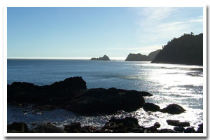
About the Nellie's & Tichenor Cove Rocky Shore Area
Description
The Port Orford rocky shore cell consists of one mile of rocky coastline that encompasses an area from the north at Port Orford Heads to Battle Rock on the south end in Port Orford, in Curry County, Oregon. |
|
Designation
The beaches and rocky shores of Oregon are part of Oregon’s Ocean Shore Recreation Area and the offshore rocks and islands are part of the Oregon Islands National Wildlife Refuge. |
| |
|
|
Key Resources
Abundant nearshore subtidal habitat and kelp beds, limited accessible intertidal habitat, with some use by harbor seals and seabirds on the adjacent rocks and associated cliffs including pigeon guillemots, western gulls, pelagic cormorants, and black oystercatchers. |
|
What can you do here?
Whalewatching, sightseeing, historic interpretive activities, surfing, SCUBA diving, rock fishing, hiking, dog walking, and beachcombing are some of the activities that occur within this cell. |
Educational Opportunities
Both Port Orford Heads State Park and Battle Rock Historical Park offer historical information about the area. The Lifeboat Station Museum and Interpretive Center at Port Orford Heads (and boathouse) along with a visitor’s center at Battle Rock highlight the history of the area.
Getting to the Rocky shore at Nellie's & Tichenor Cove
The most accessible sites include the rocky areas surrounding Battle Rock, and a portion of Tichenor Cove near Graveyard Point. Spectacular visual access to this section of coastline is possible from various overlooks within Port Orford Heads State Park, which is located in Port Orford in Curry County, Oregon.
 Public Access Option 1 for Nellie's & Tichenor Cove Rocky Shore Public Access Option 1 for Nellie's & Tichenor Cove Rocky Shore
 Public Access Option 2 for Nellie's & Tichenor Cove Rocky Shore Public Access Option 2 for Nellie's & Tichenor Cove Rocky Shore
 Public Access Option 3 for Nellie's & Tichenor Cove Rocky Shore Public Access Option 3 for Nellie's & Tichenor Cove Rocky Shore
Who Owns this Site?
Submerged and submersible rocks: Division of State Lands; offshore rocks above Mean High Water: U.S. Fish and Wildlife Service. A good part of the upland is owned by Oregon Parks and Recreation Department (Port Orford Heads State Park) with the remainder in private ownership, except for Battle Rock, which is owned by the city of Port Orford and maintained as a historic park. |
|
Who Manages this Site?
Port Orford Heads State Park is part of Oregon Parks and Recreation Department Area 4 and the Cape Blanco Management Unit. The city of Port Orford manages Battle Rock as a city park. Oregon Parks and Recreation Department manages the ocean shore recreation area. |
|
Data for the Nellie's & Tichenor Cove Rocky Shore
[1 Records Listed]
Nellie's & Tichenor Cove Rocky Shore GIS Data |
Data Layer |
Source |
Scale |
Year |
Download |
|
ODOT |
6,000 |
1967 |
|
[1 Records Listed]
Information compiled by Laurel Hillmann, NOAA Coastal Management Fellow, OPRD |


