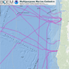
 This data viewer provides the baseline information needed for ocean planning efforts, particularly those that involve finding the best location for renewable energy projects. The Multipurpose Marine Cadastre (MMC) is also a helpful tool in the permit review process. Users pick the ocean geography of their choosing and quickly see the applicable jurisdictional boundaries, restricted areas, laws, critical habitat locations, and other important features.
With the MMC, potential conflicts can be identified and avoided early in the planning process.
Click here to launch the Multipurpose Marine Cadastre
Features
- Allows users to visually analyze and explore geospatial data for marine spatial planning activities
- Provides direct access to authoritative marine cadastral data from federal and state sources
For more information about MMC, please visit MarineCadastre.gov.